A territorial atlas · A.D. 192–700
Rome: the provinces
held and lost
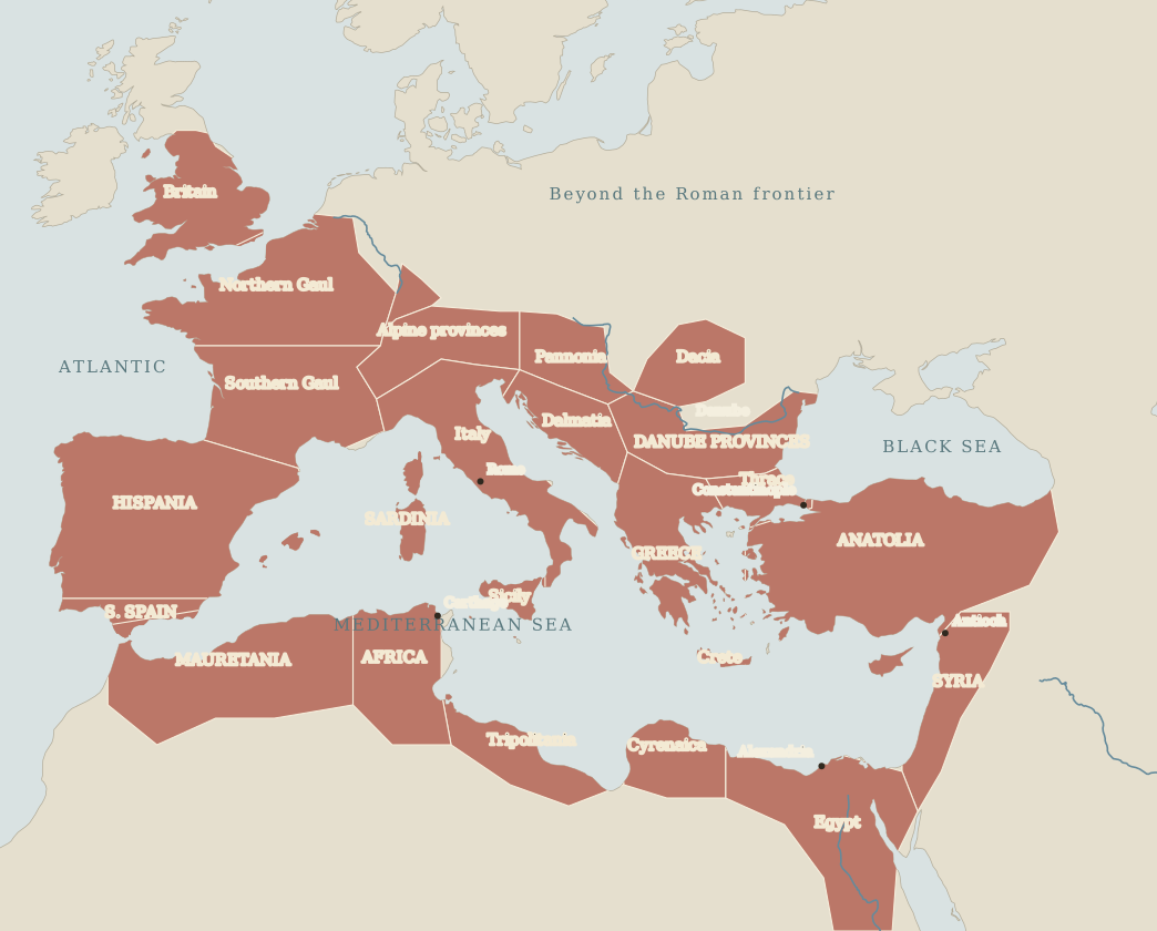
From Commodus’s death to the loss of Carthage.
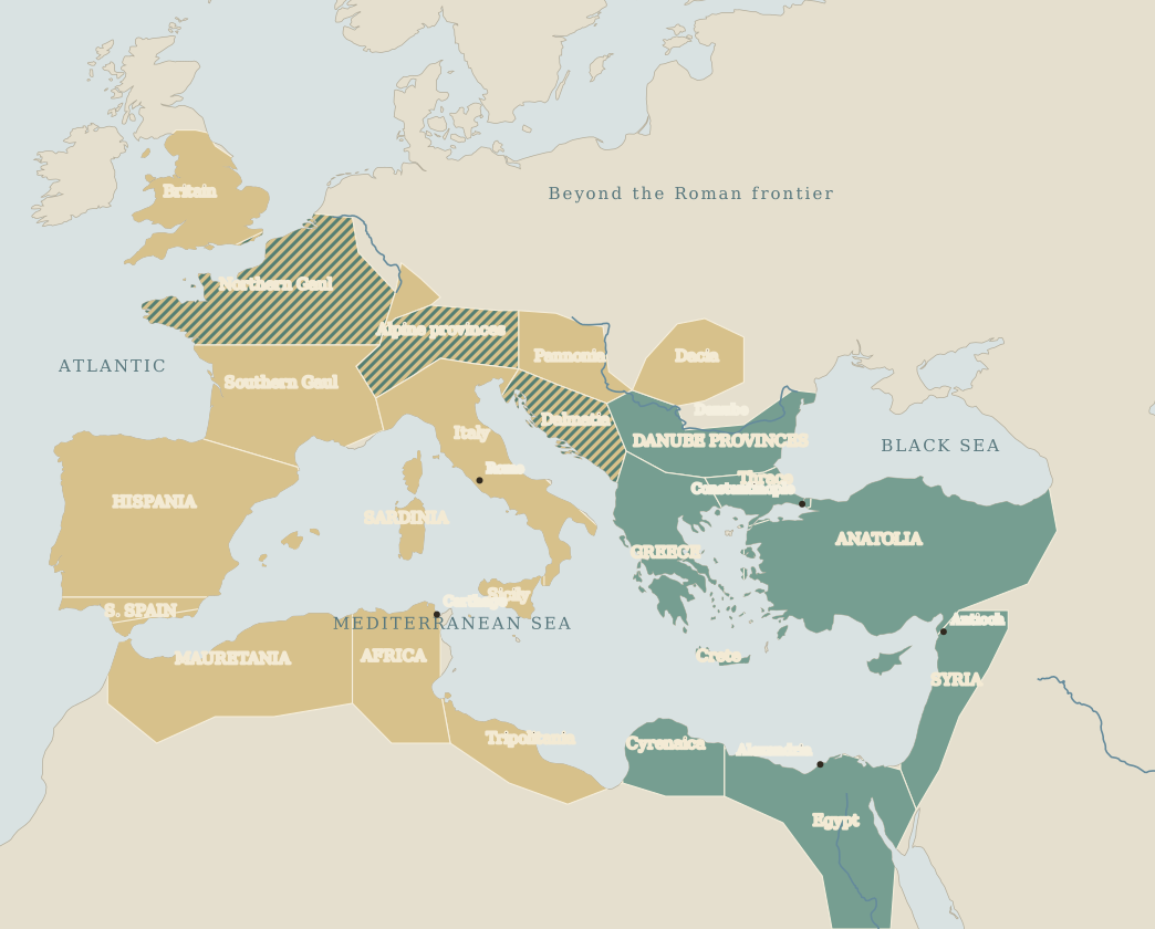
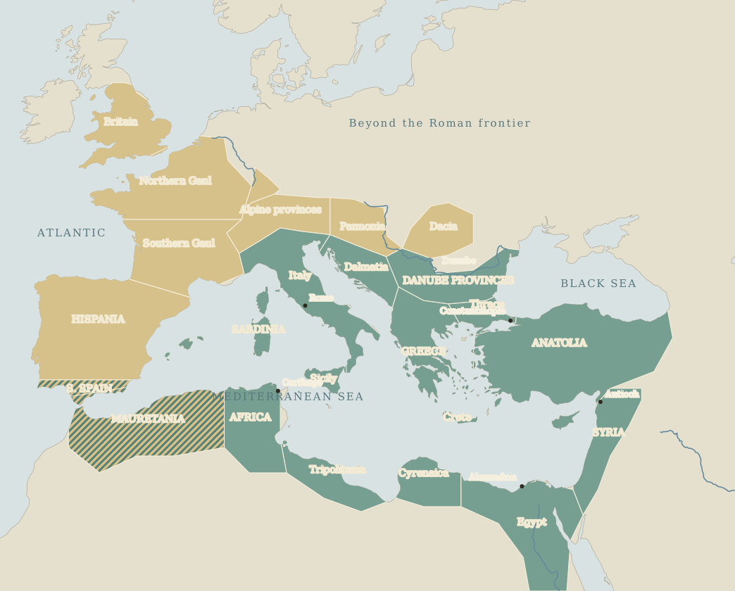
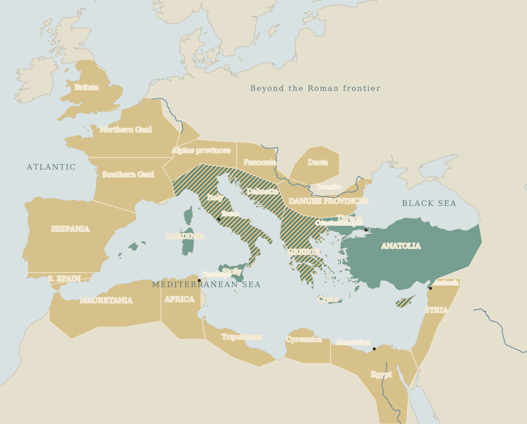
Follow the colour of the land, from the Atlantic to Syria.
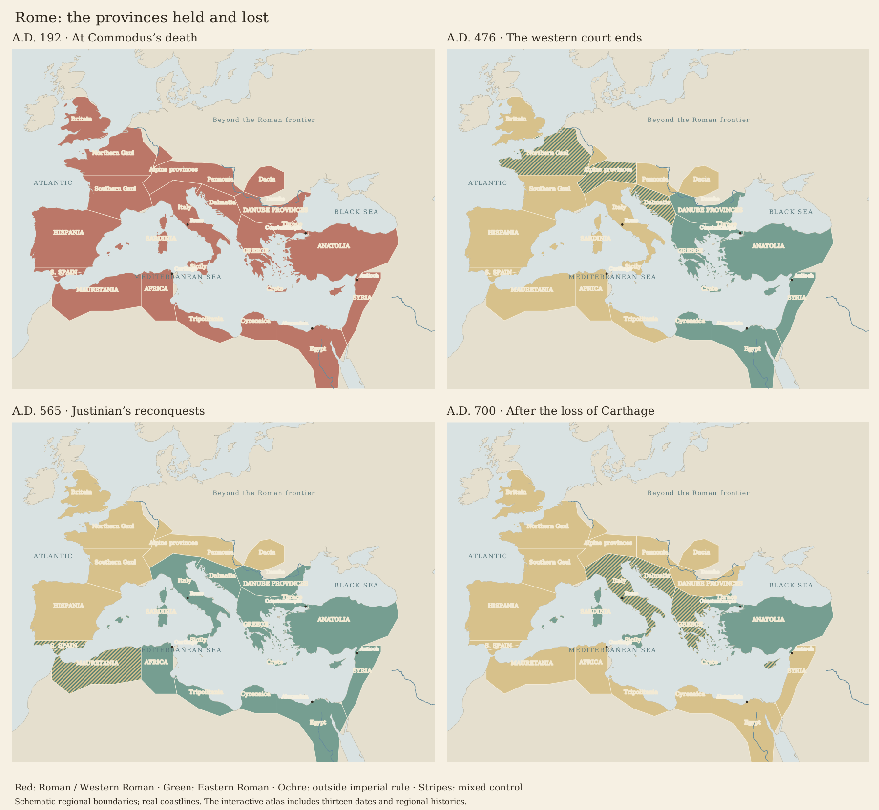
Approximate regional extents, not exact provincial boundaries. Uncoloured land is outside the regions followed here. Hatching does not show the precise location or proportion of each ruler’s territory.
How to read the losses
Ochre means that a region is outside the emperor’s government at the selected date. It does not mean its inhabitants ceased to be Roman. Green remains Roman: the eastern empire continued long after the western court ended in A.D. 476.
The dates follow turning points rather than equal intervals. A fifty-year sequence would hide the loss and recovery of Syria and Egypt between A.D. 625 and 650. Compare with 192 keeps the original territory available as a reference.
Sources and the limits of this map
Large regions group several ancient provinces. Their inland edges are editorial approximations clipped to Natural Earth coastlines; they are not surveyed or independently sourced ancient boundary polygons. Narrow frontier changes, small enclaves, Mesopotamian acquisitions after 192 and most campaigning are omitted. The map follows the large regions held in 192, not every later imperial acquisition. The northern edge of the frame omits the far north of Europe.
Southern Spain, later Italy, Mauretania and the Balkan interior use hatching where a single owner would mislead. The A.D. 439 African colour groups the capture of Carthage with the wider settlement of 442. Dacia’s withdrawal is grouped at 275. Cyprus is hatched after the Arab attacks and later shared arrangement.