 Dynamic
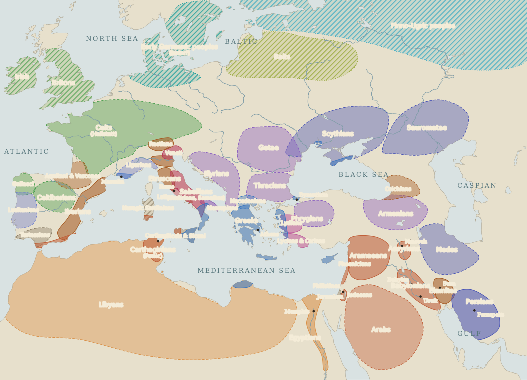
Peoples and Tongues, c. 3300 B.C.–A.D. 476
Who lived where, and what they probably spoke, from Uruk to the fall of the West.
Campaigns and restored plates
Four map collections, each in historical order.
Open a dynamic map to follow its changes step by step. Open a data map for a single question answered on one sheet. Open a processed Shepherd plate, or a Cambridge Ancient History sheet, to study the cleaned historical map used in the published chapters.
44 dynamic maps · 3 data maps · 18 processed Shepherd plates · 80 Cambridge Ancient History plates
145 maps
Scroll-driven campaigns and changing territorial maps.
DynamicWho lived where, and what they probably spoke, from Uruk to the fall of the West.
 Dynamic
Ancient migrations, the Babylonian deportation axis, and the Mediterranean financial network that carried the Temple gold to Jerusalem.
 Dynamic
From the first trading post in Italy to Darius on the Danube: the Greek cities spread round two seas, and the Persian empire reaches them.
 Dynamic
From a city-state on the lower Tiber to the head of an Italian confederacy, south of the Arno and the Rubicon.
 Dynamic
The Persian Wars, the Athenian empire that grew out of them, and the war with Sparta that ended it.
 Dynamic
Scroll to follow the ten thousand from Sardis to the disaster at Cunaxa, and out again to the sea.
 Dynamic
Three leading powers in seventy years, the King of Persia holding the balance, and a Macedonian king at the end.
 Dynamic
Scroll to follow Alexander the Great as he marches across 20,000 miles, overthrows the Achaemenid Empire, and reaches India.
 Dynamic
Scroll to follow the campaigns of King Pyrrhus of Epirus from Tarentum and Heraclea to Asculum, Sicily, and the final standoff at Beneventum.
 Dynamic
From the first crossing to Sicily to the destruction of Carthage and Corinth: the first provinces, and the kings Rome broke without annexing.
 Dynamic
Scroll to follow the march from Spain to the Trebia, stage by stage.
 Dynamic
The first map brought him to the Trebia. Scroll to follow the fifteen years that followed — Trasimene, Cannae, the revolt of the south, and the slow closing of the trap.
 Dynamic
Scroll to follow Publius Cornelius Scipio Africanus as he storms New Carthage, evicts Punic power from Spain at Ilipa, and defeats Hannibal at Zama.
 Dynamic
Scroll through the three wars, a generation apart, that ended the kingdoms of Alexander’s heirs.
 Dynamic
Scroll the chapter's ten years and watch what Rome governed — and what it lost.
 Dynamic
Scroll to see the allies rise, the war turn town by town, and the ballot end it.
 Dynamic
Scroll to follow the First Mithridatic War, from the loss of Asia to the Peace of Dardanus.
 Dynamic
Scroll to follow Quintus Sertorius as he crosses from Africa, unites the Spanish tribes, outgenerals Metellus and Pompey, and establishes an alternative Republic in the Iberian mountains.
 Dynamic
From Sulla's retirement to the death of Cleopatra: Pompey's East, Caesar's Gaul, and Egypt.
 Dynamic
Scroll to follow the campaign that won every battle and lost the war — the one the lex Manilia handed to Pompey.
 Dynamic
Scroll to see what Rome already held, Pompey’s campaign, and the provinces he made of it.
 Dynamic
Two centuries of military pacification: from Pompey's assault through the Galilean campaigns of Vespasian to Titus' siege of Jerusalem and the fall of Masada.
 Dynamic
From Pompey's 63 B.C. boundary lines through the Herodian kingdom to direct Roman equestrian annexation (A.D. 6–66).
 Dynamic
Scroll to follow the eight seasons of the war, from the Helvetii to Alesia.
 Dynamic
Every season of the war: who stood with Rome, who submitted, who rose — and where Caesar marched and wintered.
 Dynamic
One army besieging a town while besieged itself: the works, the relief army, the last attack, the surrender.
 Dynamic
Scroll to follow Julius Caesar as he crosses the Rubicon, disarms Spain at Ilerda, triumphs at Pharsalus, relieves Alexandria, and crushes senatorial resistance at Thapsus and Munda.
 Dynamic
The frontier pushed to the Danube, won and lost beyond the Rhine, and carried into Britain.
 Dynamic
Scroll to follow the one Roman army that ever marched on the incense kingdoms — and stopped two days short of them.
 Dynamic
Scotland won and lost twice, Dacia taken, Mesopotamia held for three years, and the Danube defended.
 Dynamic
Scroll to follow two invasions, a winter counterattack, the bridge that fixed Rome north of the Danube, and the fall of a mountain kingdom.
 Dynamic
Civil wars and breakaway empires, a new Persia, a second capital in the East, and the western provinces lost to the kingdoms.
 Dynamic
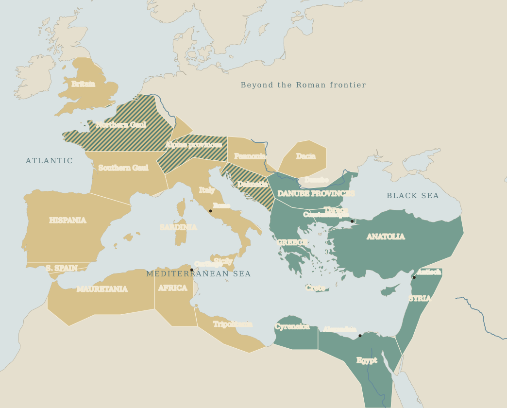
Follow shaded provinces through the losses, reconquests, and survival of the eastern empire.
 Dynamic
Scroll to follow Aurelian’s reconquest of the breakaway Gallic and Palmyrene empires and the reunification of Rome.
 Dynamic
How did imperial power move from Diocletian’s shared rule to Constantine’s new centre on the Bosporus? Scroll through six turning points.
 Dynamic
Scroll to follow the collapse of the frontiers, the sack of Rome, and the emergence of the barbarian kingdoms.
 Dynamic
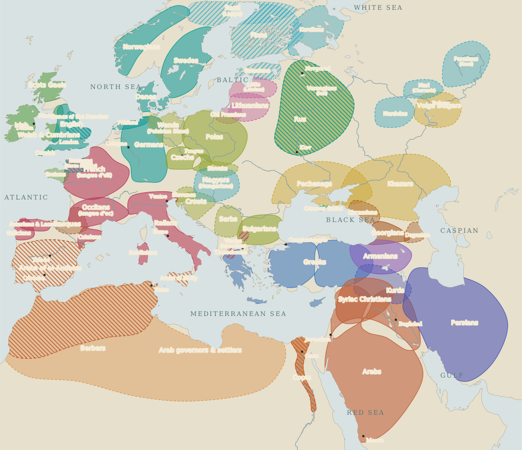
Who lived where, and what they had come to speak, from the last western emperor to the nation-states.
 Dynamic
Scroll to follow Flavius Belisarius as he destroys the Vandal kingdom in Africa, defends Rome against Witiges, and captures Ravenna.
 Dynamic
Scroll to follow Charles the Great as he conquers the Lombards, fights the Saxon wars, storms the Avar Ring, and is crowned Emperor in Rome.
 Dynamic
Scroll to follow Subutai and Batu Khan as they sack the Rus' principalities, crush European armies at Legnica and Mohi, and reach the Adriatic Sea.
 Dynamic
Scroll to follow Vasco da Gama as he navigates the South Atlantic gyre, doubles the Cape of Good Hope, and crosses the Arabian Sea to unlock the direct maritime route to the Indies.
 Dynamic
Scroll to follow the war as it spreads outward from Prague — through Denmark, Sweden, and finally Catholic France — until the Peace of Westphalia remakes Europe.
 Dynamic
Scroll to follow the Grande Armée as it wheels from the English Channel to encircle an Austrian army at Ulm and shatter the Third Coalition at Austerlitz.
 Dynamic
Scroll to follow the collapse of Poland and France, the clash before Moscow, the turning points at Stalingrad and El Alamein, the two-front vise of D-Day and Bagration, and the link-up on the Elbe.
One question, one date, one sheet — drawn from Natural Earth, Pleiades and AWMC data.
 Data map
How far did Carthage reach?
 Data map
The war crosses the sea. Defeat on the Himeras drove Agathocles into Syracuse; his breakout carried the army to Cape Bon and then against the towns surrounding Carthage.
 Data map
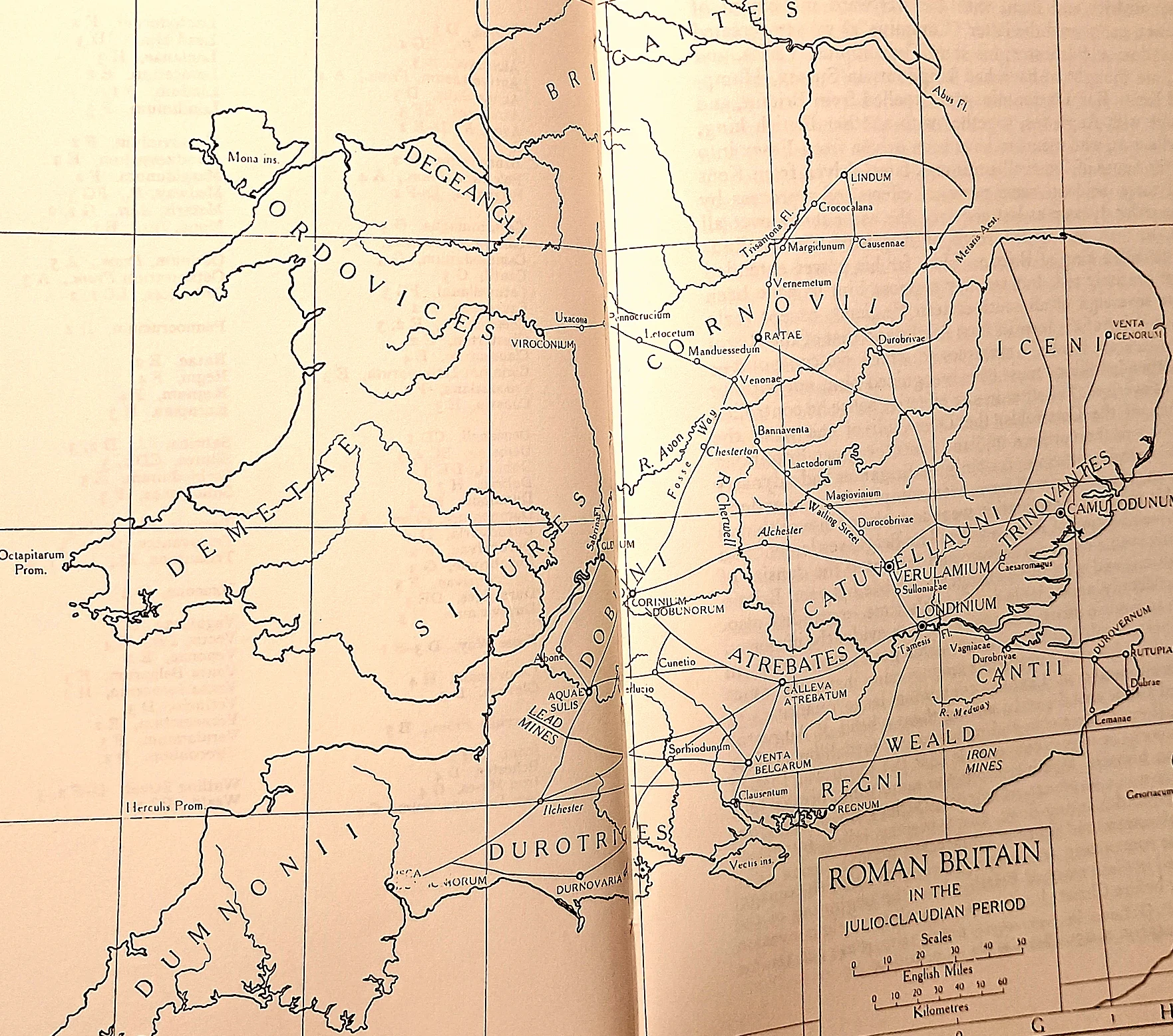
The frontier war in Britannia: The rebellion exposed the structural vulnerability of the early province.
Only the cleaned plates already integrated into the published chapters.
 Processed Shepherd
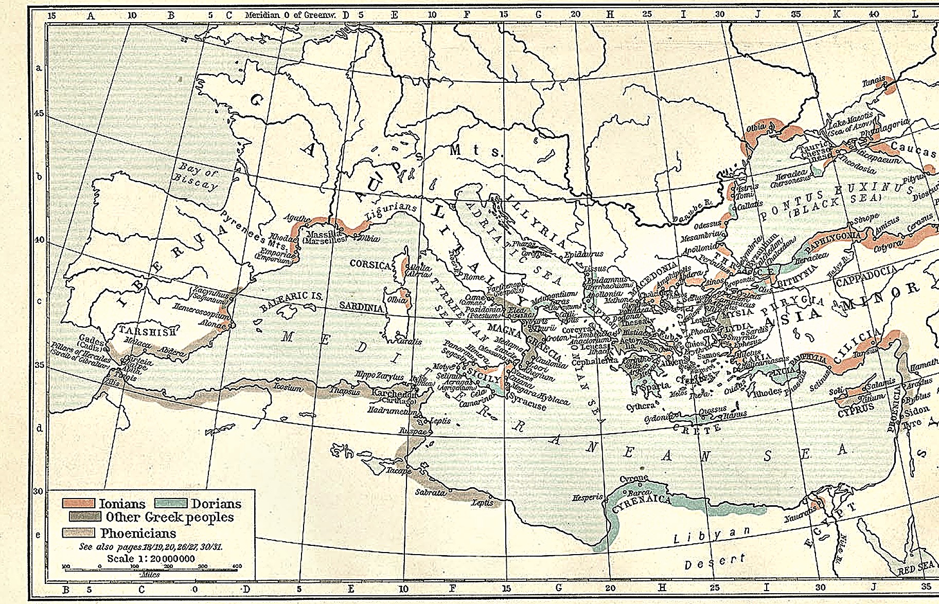
Greek and Phoenician settlements, c. 550 B.C. The plate separates Ionian, Dorian, and other Greek settlements from the Phoenician network. Its colours mark peoples and settlements, not a united Greek state.
 Processed Shepherd
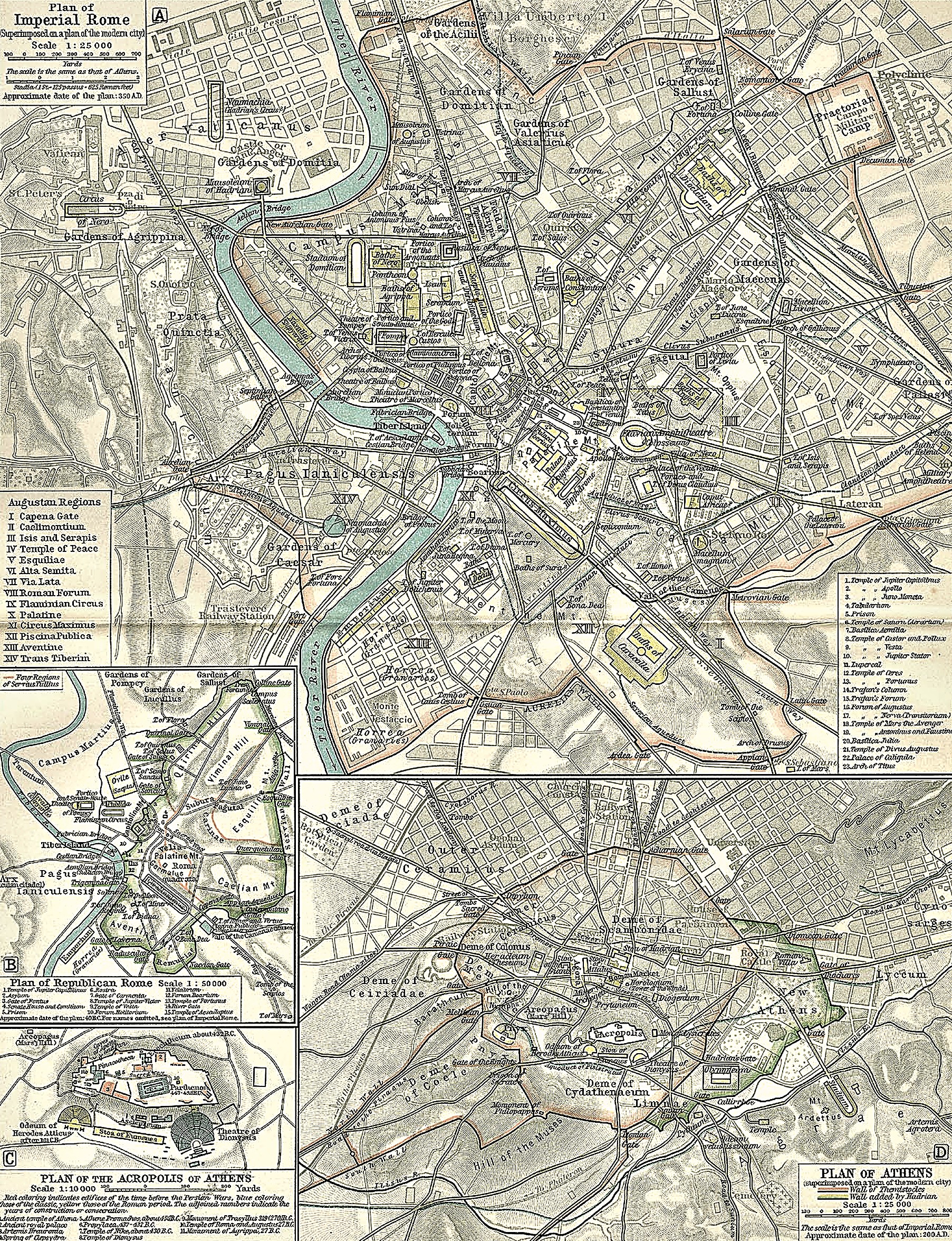
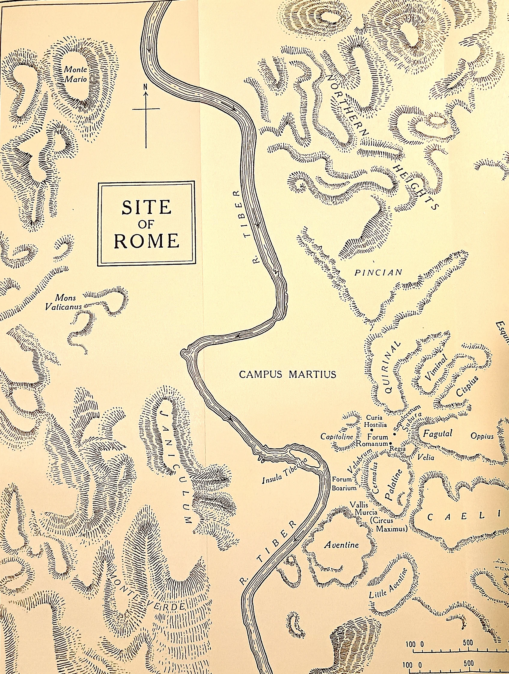
A small city with large arguments. Fifth-century Rome was not yet the mistress of Italy — it was a walled town on the Tiber, its politics small enough that a single family feud, a single father's grief, or a single board of ten men could shake the whole state. Everything in this chapter happens inside, or just outside, this plan.
 Processed Shepherd
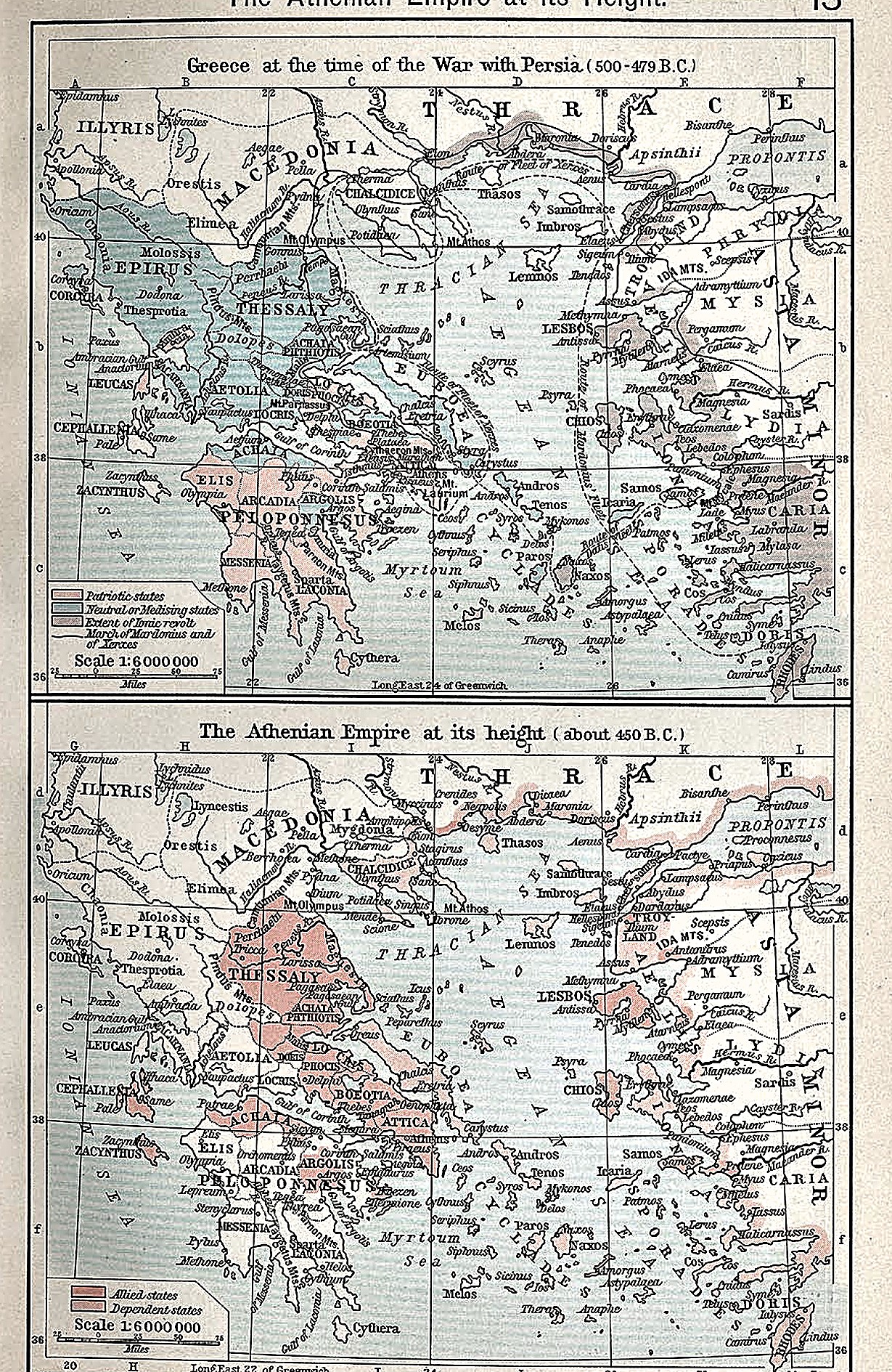
Greece during the Persian Wars; the Athenian empire at its height. The upper map fixes the theatre of 500–479 B.C.; the lower shows the Delian League after Athens had turned it into an empire.
 Processed Shepherd
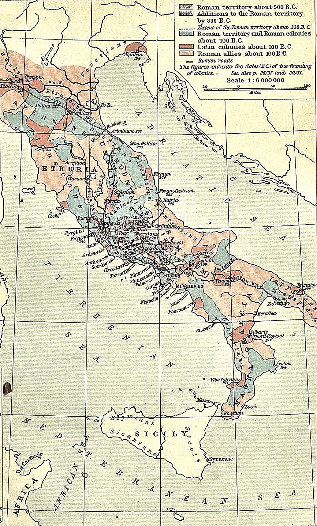
The whole chapter on one sheet. This map layers three centuries of expansion: the small patch of Roman territory in 500 B.C., what the recovery after the Gallic sack had added by 396 B.C., the far larger area under Roman control by 338 B.C. at the end of the Latin War, and the network of colonies and roads — Luceria, Beneventum, Venusia, the Via Appia toward Tarentum — through which Rome held Samnium and the south after this chapter's wars were won.
 Processed Shepherd
Ten miles of river. Veii and Rome sat close enough to watch each other's smoke. The Cremera was a minor stream on this frontier — its name remembered only because of what happened there.
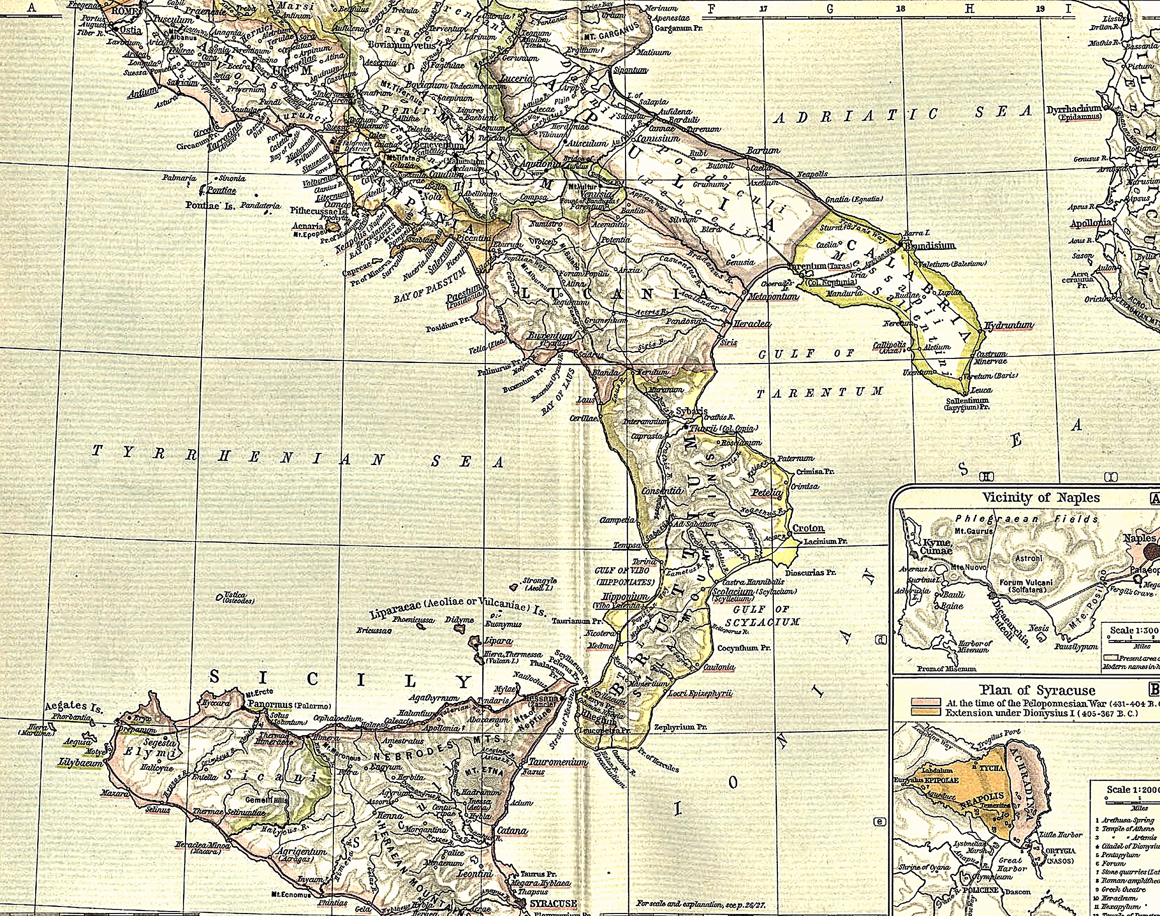 Processed Shepherd
A war fought every summer. Mount Algidus lay in the Alban hills, within the belt of country contested season after season by Rome, the Aequi and the Volsci — a frontier close enough that a dictator raised at dawn could reach the fighting within days.
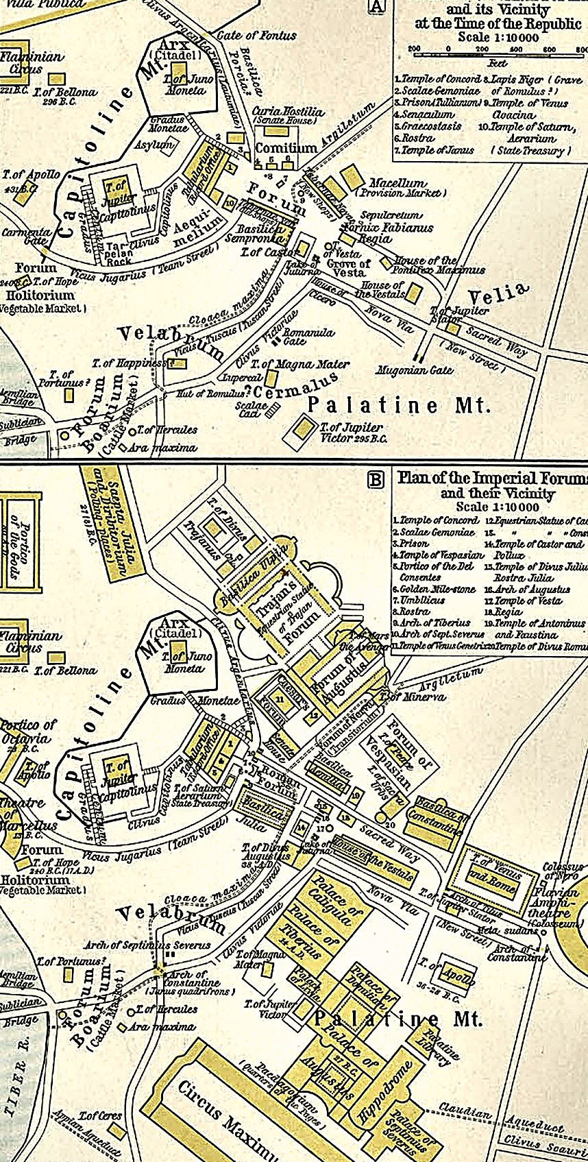 Processed Shepherd
The Comitium and Forum. The decemvirs' tablets stood here, in the Republic's most public space.
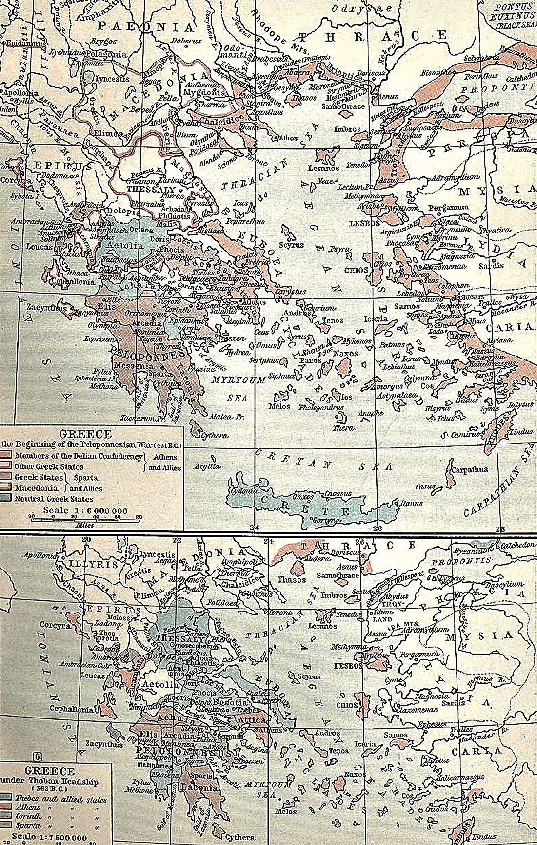 Processed Shepherd
Greece in 431 and 362 B.C. The upper map divides the alliances at the opening of the Peloponnesian War; the lower records the brief Theban hegemony after Leuctra.
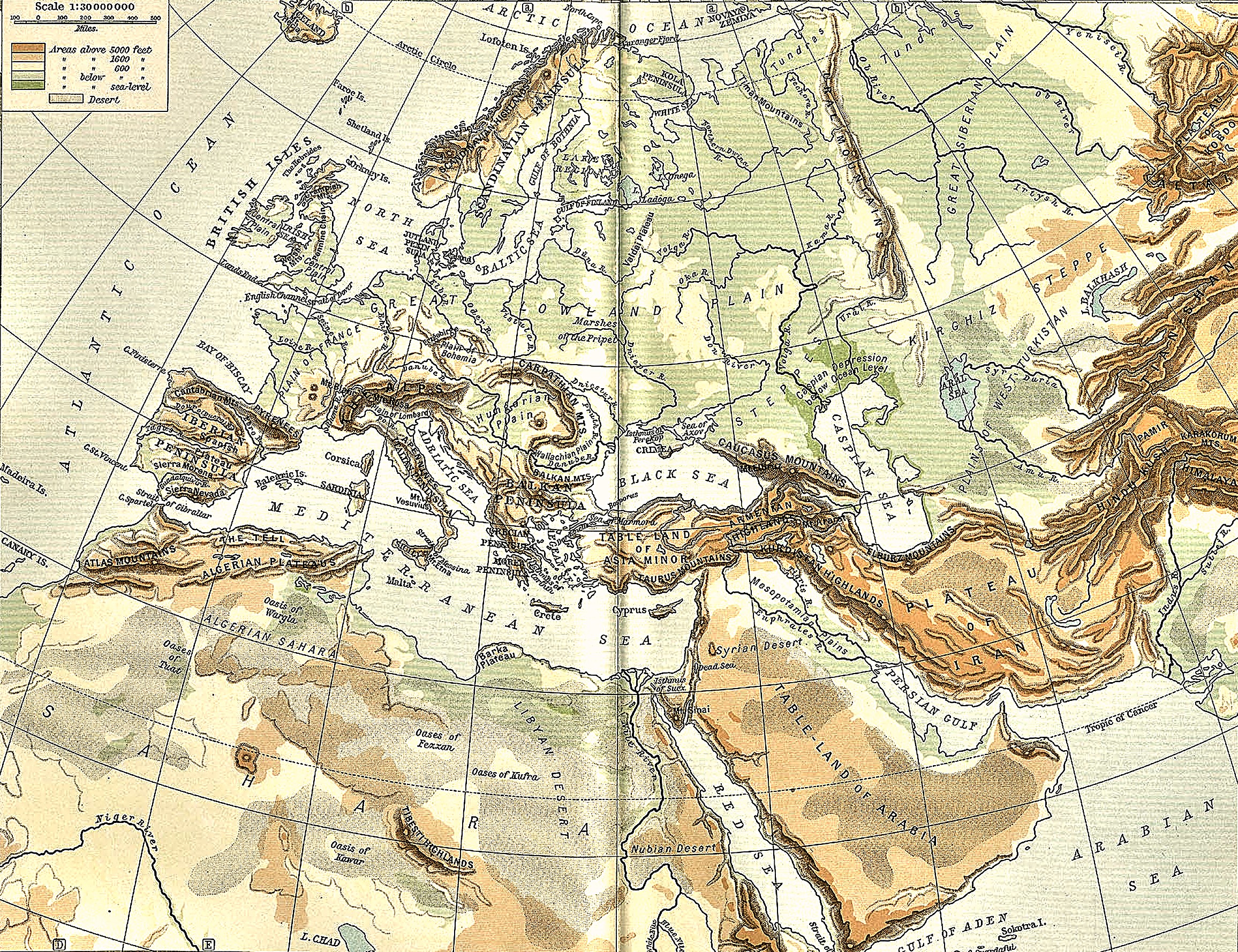 Processed Shepherd
Rome was a small target on a large map. The Senones were one wave among Celtic peoples moving into northern Italy in this period; Rome's sack was, from their side, a raid at the far edge of a much longer migration.
 Processed Shepherd
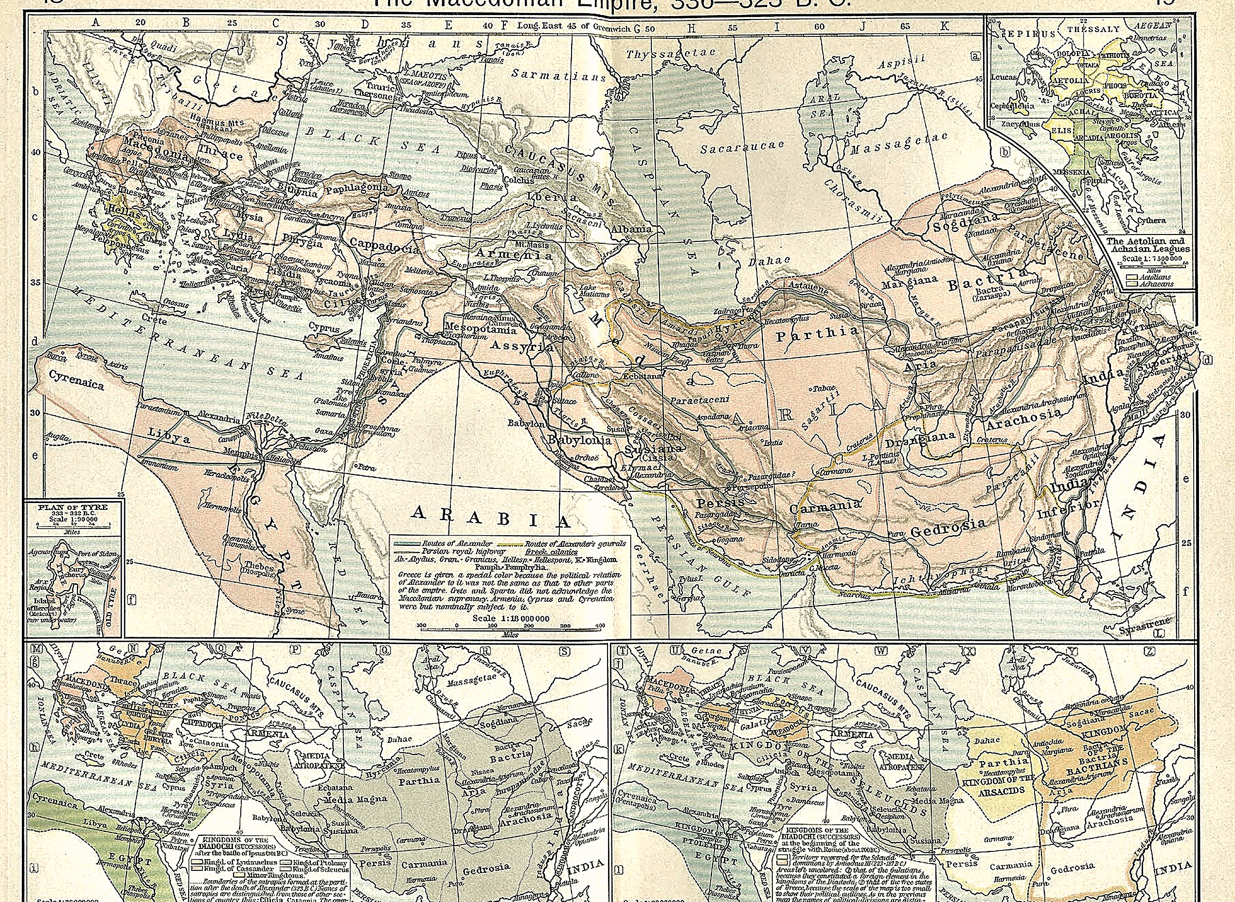
The Macedonian Empire, 336–323 B.C. Shepherd traces Alexander's march from the Hellespont through Egypt, Persia, Bactria, and India. The lower insets show how his generals divided the conquests after his death.
 Processed Shepherd
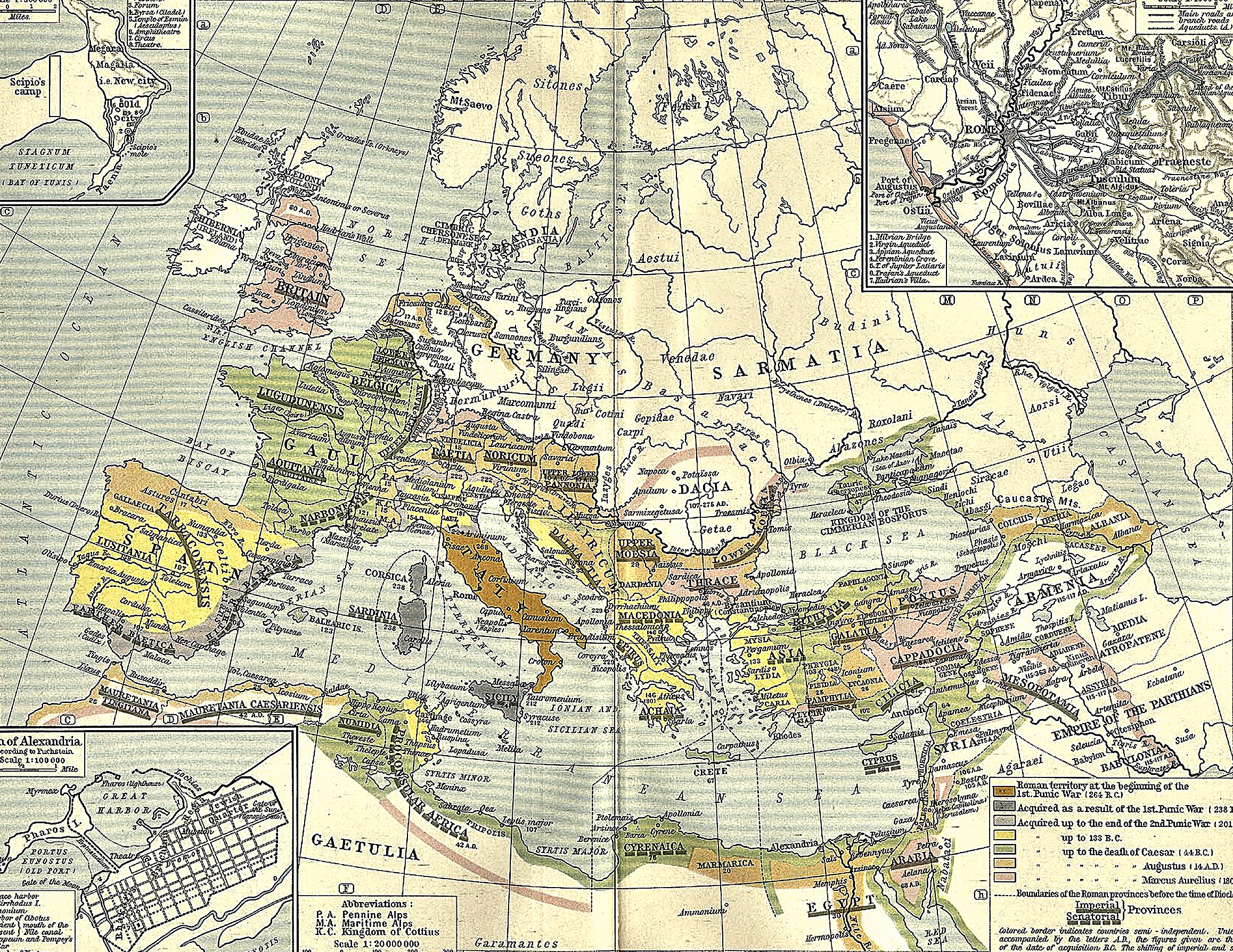
What the Punic Wars made possible. Successive colours distinguish Rome's acquisitions after the First and Second Punic Wars and the eastern settlements that followed. The plate carries the sequence to 133 B.C., thirteen years beyond Carthage's destruction.
 Processed Shepherd
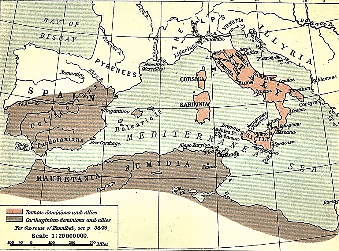
The next board is already set. Every color on this map that is not Roman orange is Carthaginian territory or sphere of influence — Spain, North Africa, and a long-standing hold on western Sicily. Rome, unified master of Italy, and Carthage, mistress of the western sea, now faced each other across a single island.
 Processed Shepherd
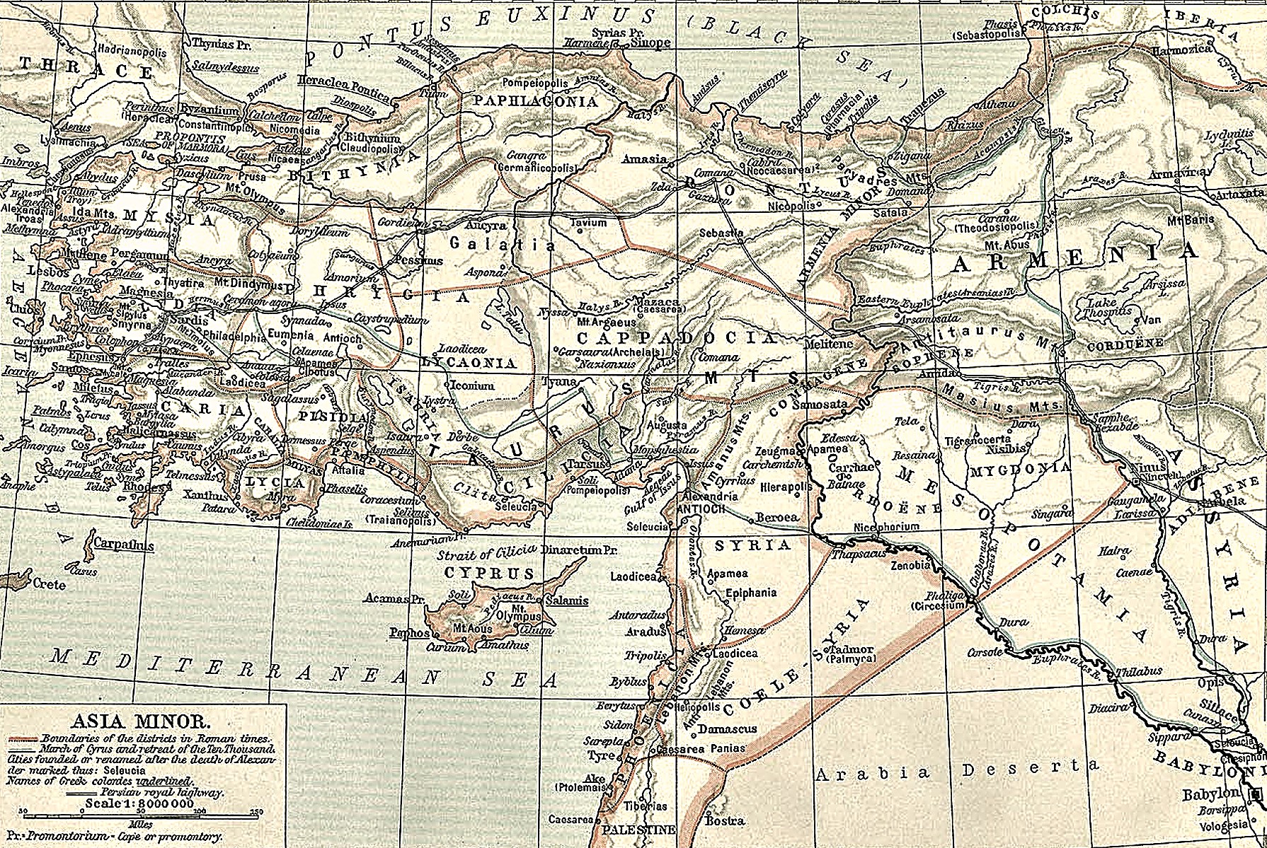
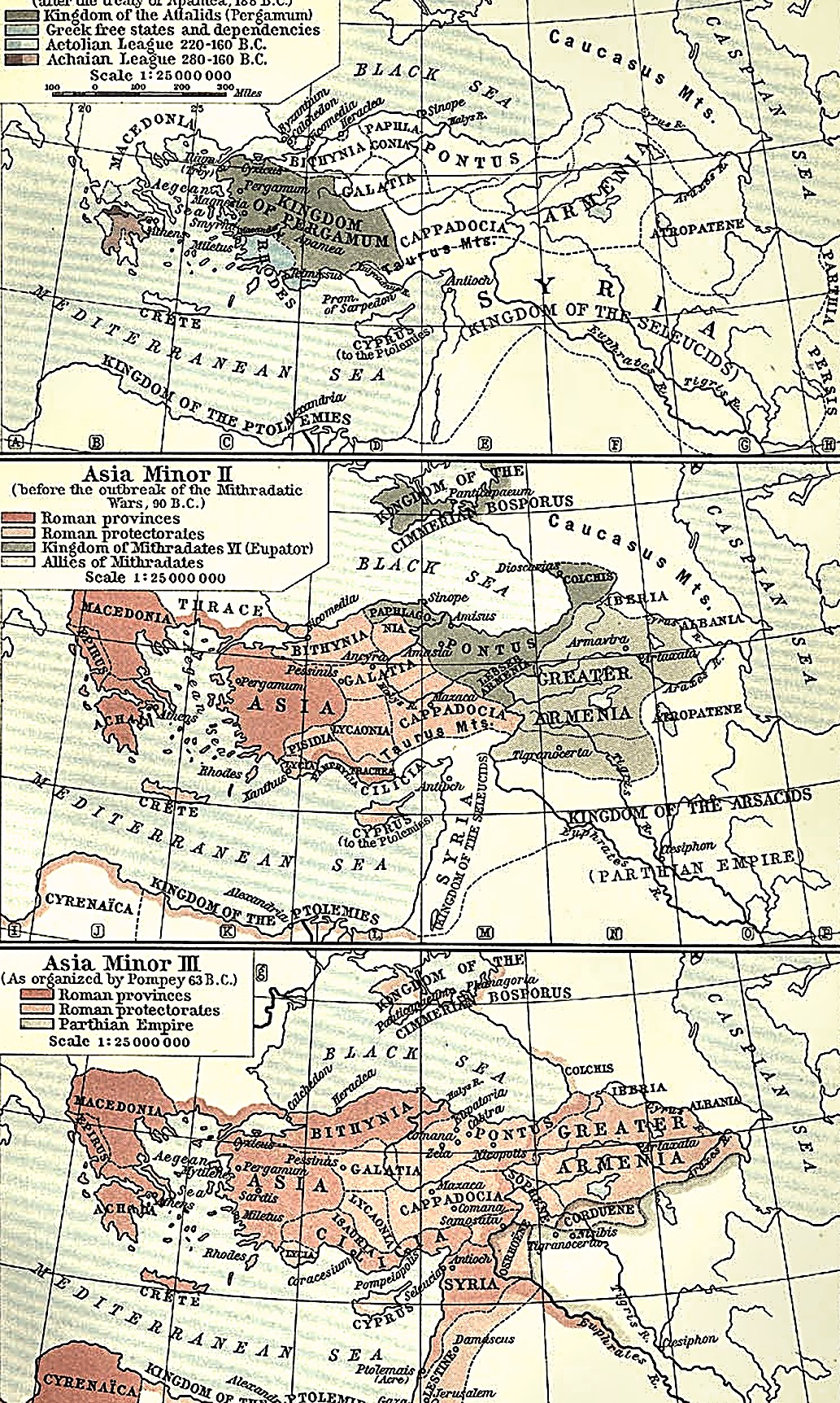
The ground Apamea redrew. The Treaty of Apamea (188 B.C.) pushed Seleucid power out of Asia Minor entirely, north and west of the Taurus range shown here — territory that Rome did not keep for itself but handed to its allies Pergamon and Rhodes, preferring loyal client states to the cost and exposure of direct rule.
 Processed Shepherd
The East remade. Pompey’s settlement reorganized Bithynia, Pontus, Cilicia, and the new province of Syria, ringed by client kingdoms bound to Rome — and to Pompey personally. The wealth and patronage of half the Mediterranean now answered to a single senator.
 Processed Shepherd
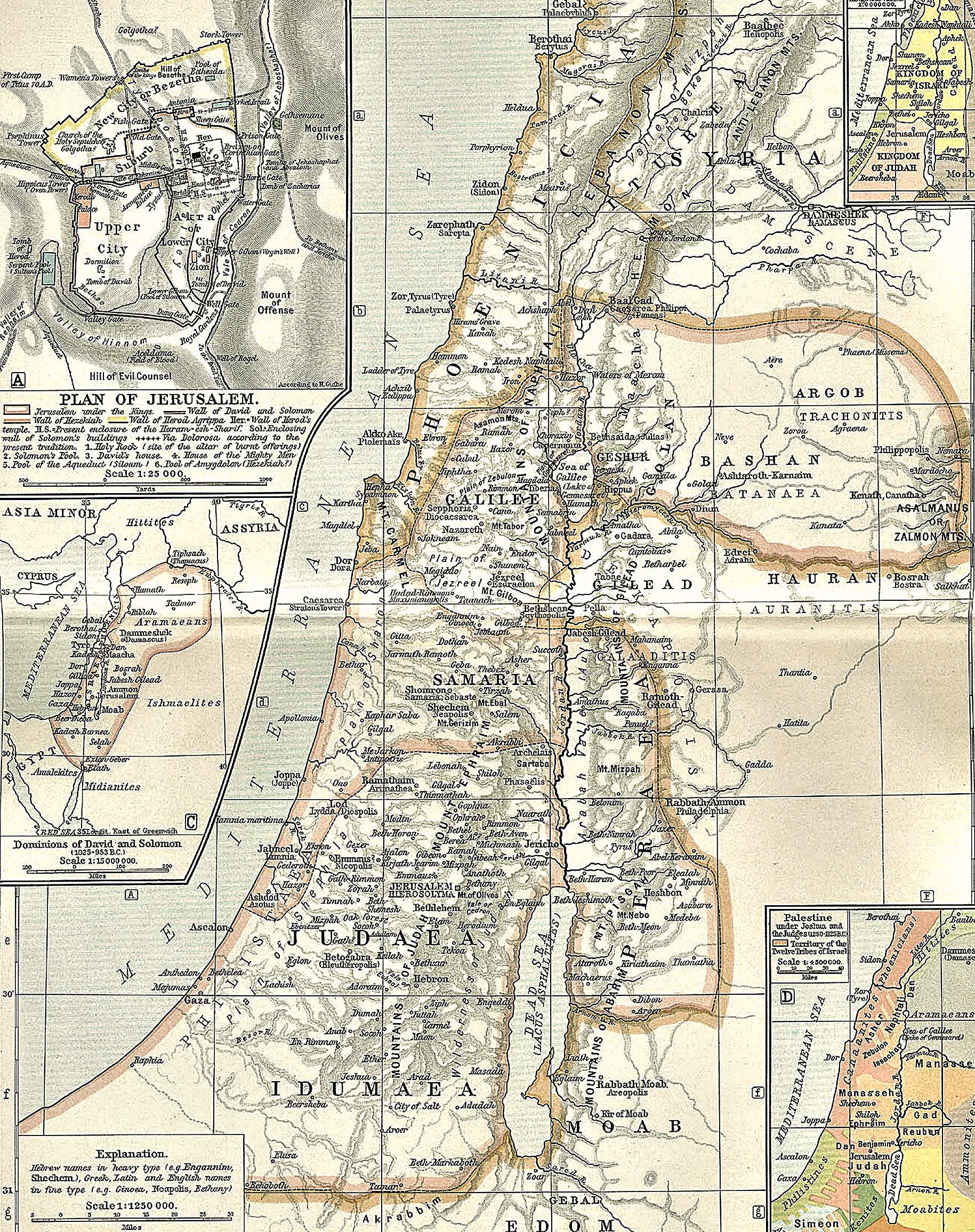
The land Pompey entered: Judaea, Samaria, and Galilee run down the hill country between the coastal plain and the Jordan, with Idumaea and the Dead Sea ( Lacus Asphaltites ) to the south. The insets trace the region's older political geography—the twelve tribes under Joshua and the Judges, the united monarchy of David and Solomon, the divided Kingdoms of Israel and Judah, and a plan of Jerusalem under the Israelite kings—the same walled city Pompey's legions breached in 63 B.C.
 Processed Shepherd
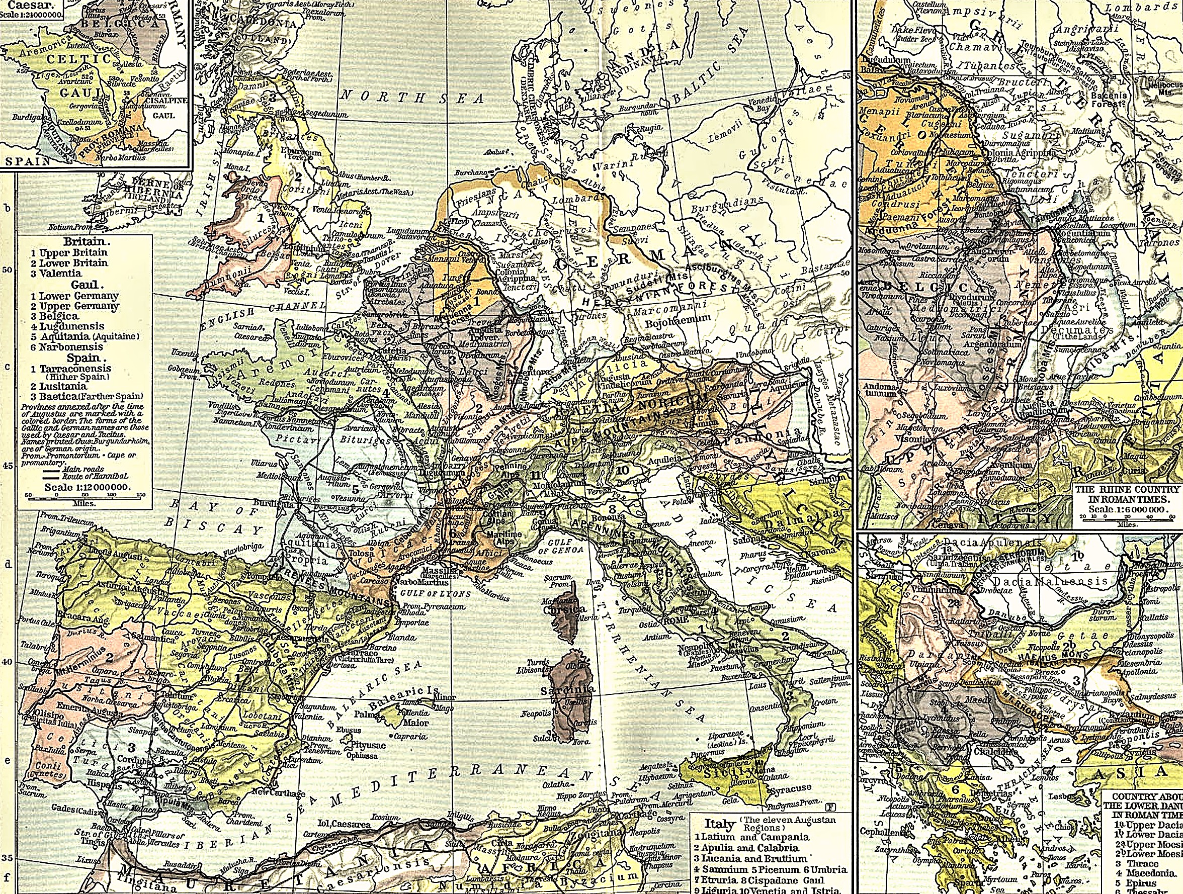
The consolidation of the European frontier: Augustus established twenty-eight permanent standing legions, stationed in fixed fortress camps along the Rhine, Danube, and Euphrates frontiers. To support this professional army of one hundred and fifty thousand citizens and an equal number of auxiliaries, Augustus established the aerarium militare in A.D. 6, funded by inheritance taxes and sales duties.
 Processed Shepherd
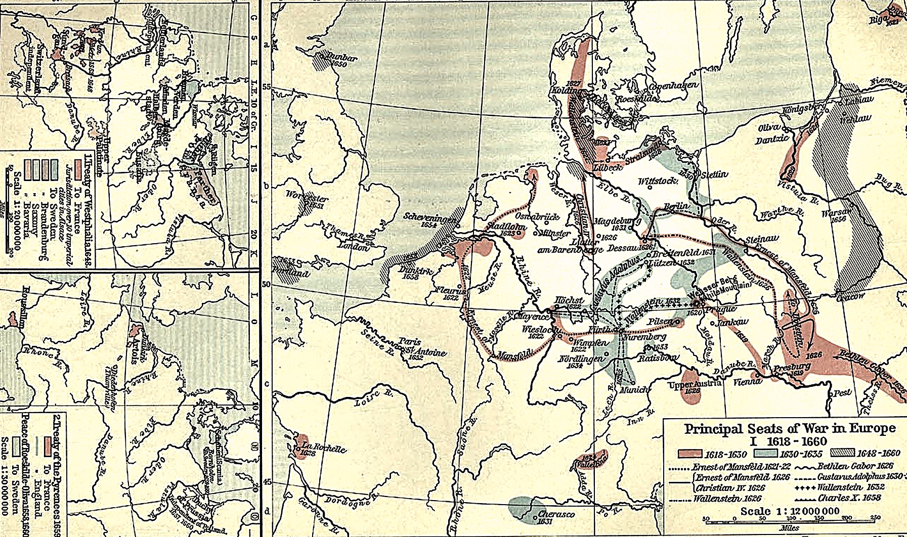
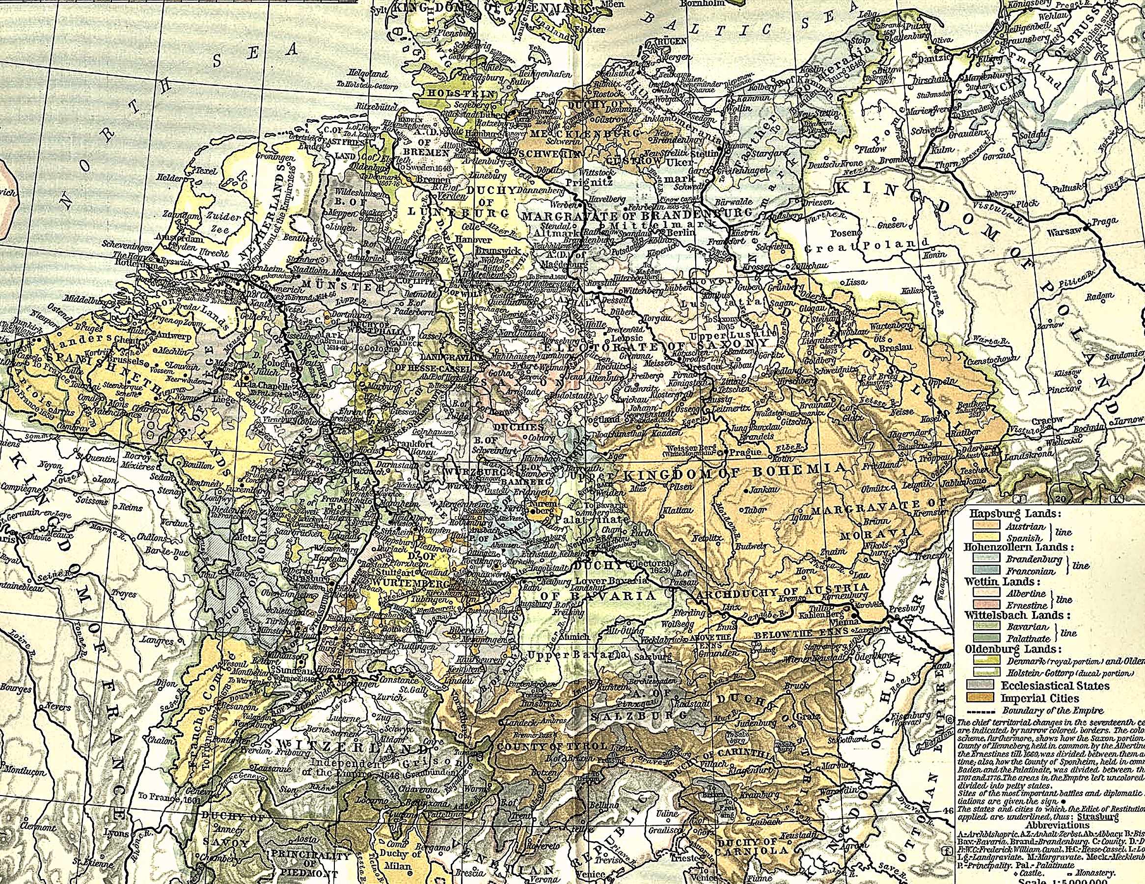
The Strategic Geography of the War — Over thirty years, Germany was crisscrossed by four successive waves of military intervention: the initial Bohemian–Palatine struggle along the Upper Danube and Rhine (1618–1623); the Danish intervention across Lower Saxony to the Baltic (1625–1629); the Swedish lightning advance from Usedom down the Oder and Elbe to Munich (1630–1634); and the grinding, multi-front French and Swedish war of attrition against the Austrian and Spanish Habsburgs (1635–1648).
 Processed Shepherd
The Re-mapping of Central Europe (1648) — The treaties of Münster and Osnabrück permanently reorganized the map of Europe. France obtained the bishoprics of Metz, Toul, and Verdun, and full sovereign rights over Upper and Lower Alsace, anchoring its eastern frontier on the Rhine. Sweden acquired Western Pomerania with Stettin, Wismar, and the secularized bishoprics of Bremen and Verden, making the Swedish crown an Imperial Estate and master of the mouths of the Oder, Elbe, and Weser. Brandenburg-Prussia was compensated with Eastern Pomerania, Halberstadt, Minden, and the reversion of Magdeburg. The Dutch Republic and the Swiss Confederation were officially declared independent states outside the Empire.
Fold-out map sheets from the first edition, photographed and cleaned, in the reading order of the chapters that use them.
 CAH plate
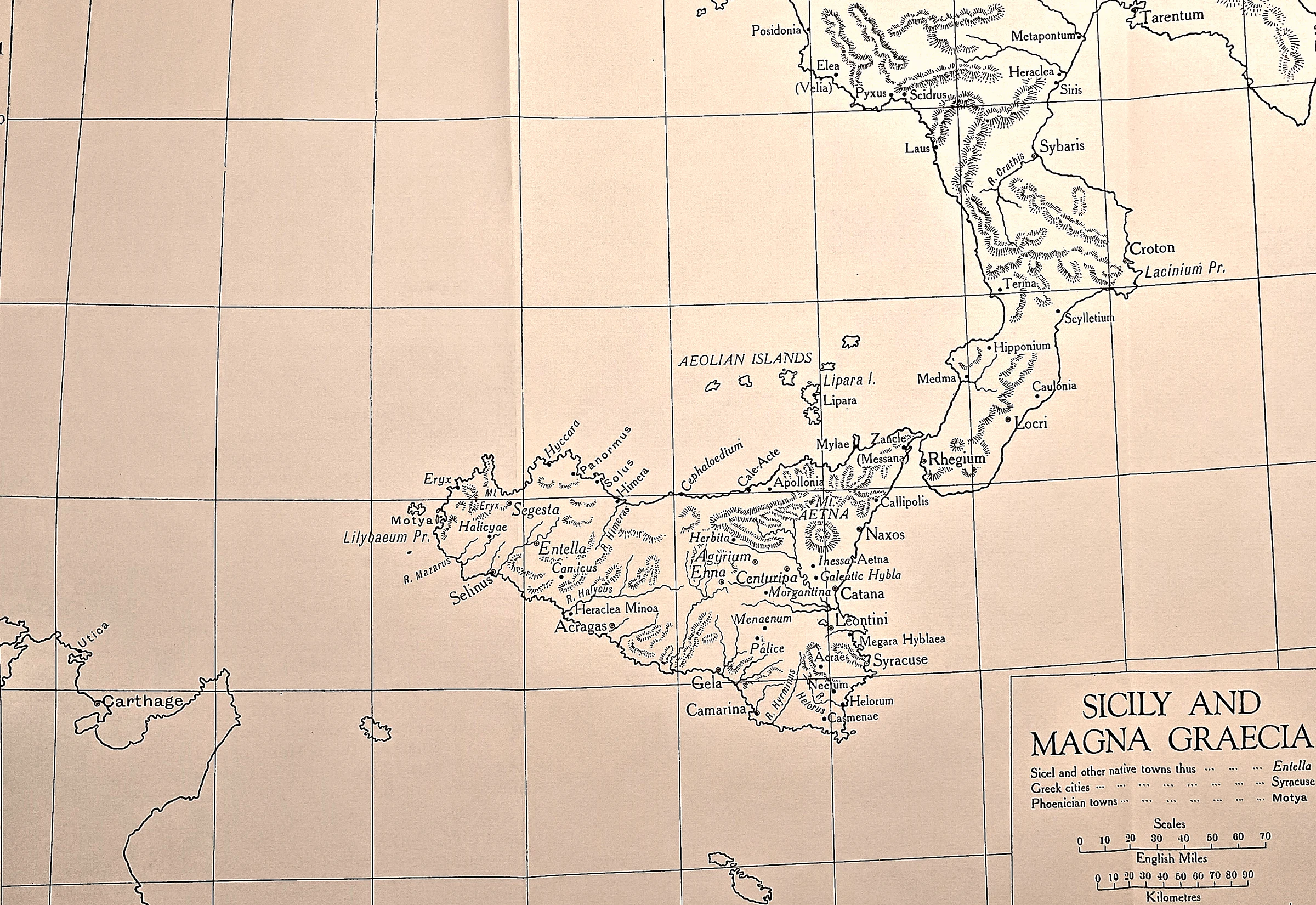
Three alphabets on one island.
 CAH plate
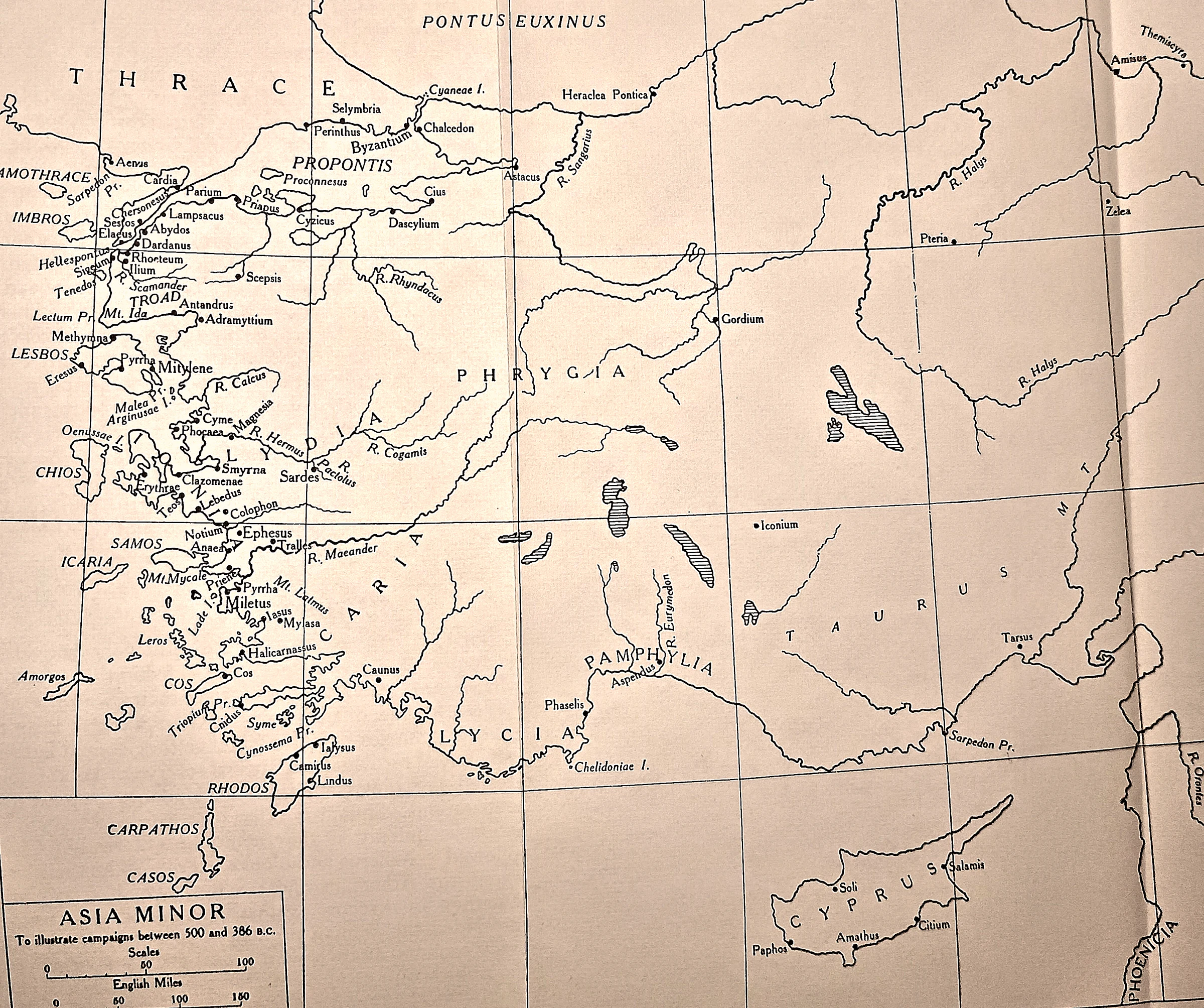
The ground of the revolt. The plate’s own title gives its span: the campaigns between 500 and 386 B.C., from this revolt to the King’s Peace.
 CAH plate
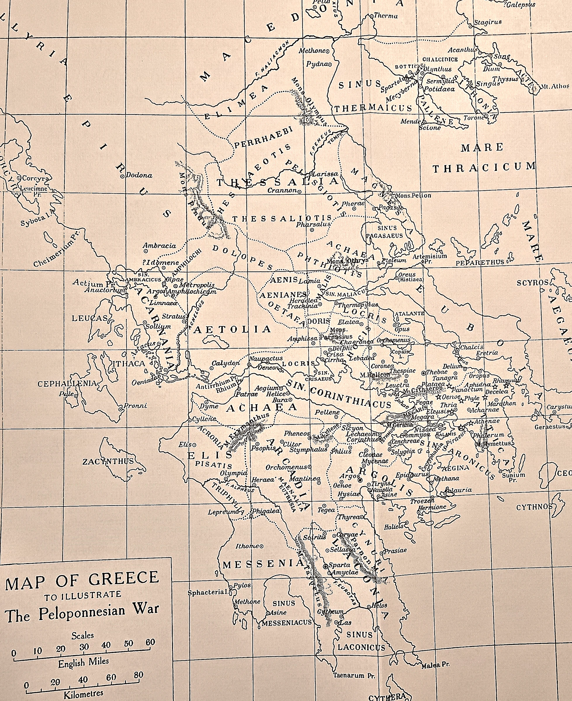
The board the war was played on. Worth a long look before the narrative starts, because almost every place named in this chapter is on it.
 CAH plate
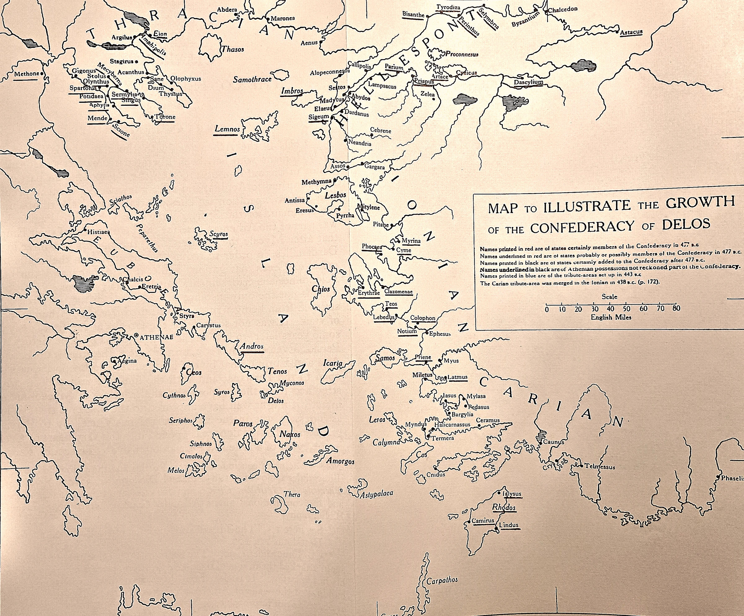
An alliance turning into an empire. This is the league as a cartographer can show it. The printed key distinguishes the states certainly in the Confederacy in 477 B.C.
 CAH plate
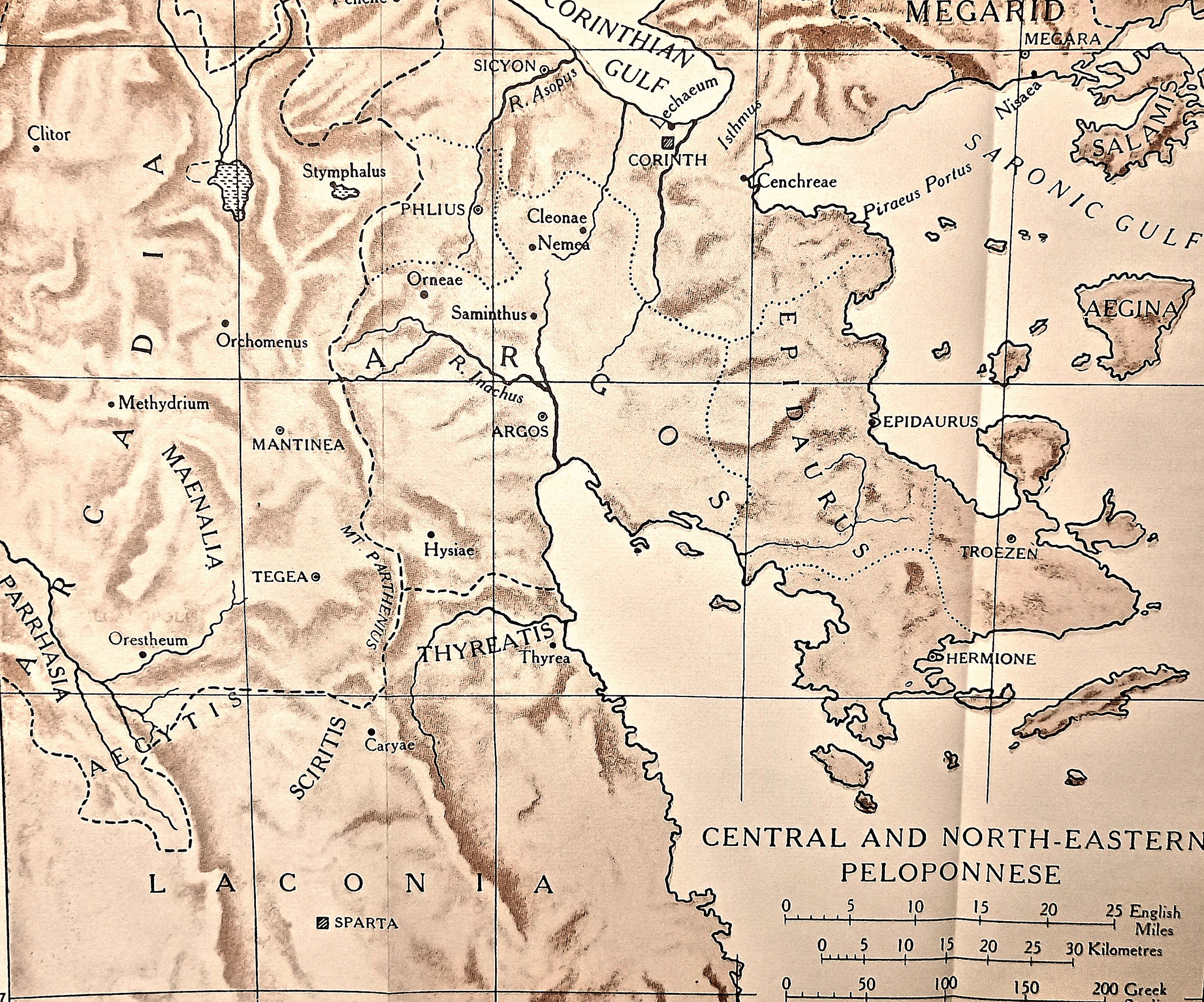
Why the quarrel was worth a war. A relief sheet of the corner where the causes lay.
 CAH plate
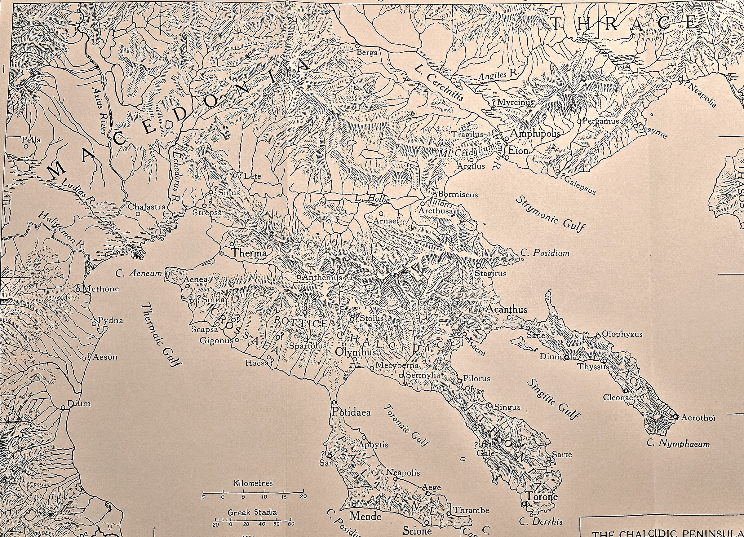
The north, where the war was decided. The three prongs of Chalcidice — Pallene, Sithonia and Acte, the last ending at Mount Athos — hang off the Macedonian coast between the Thermaic and Strymonic Gulfs.
 CAH plate
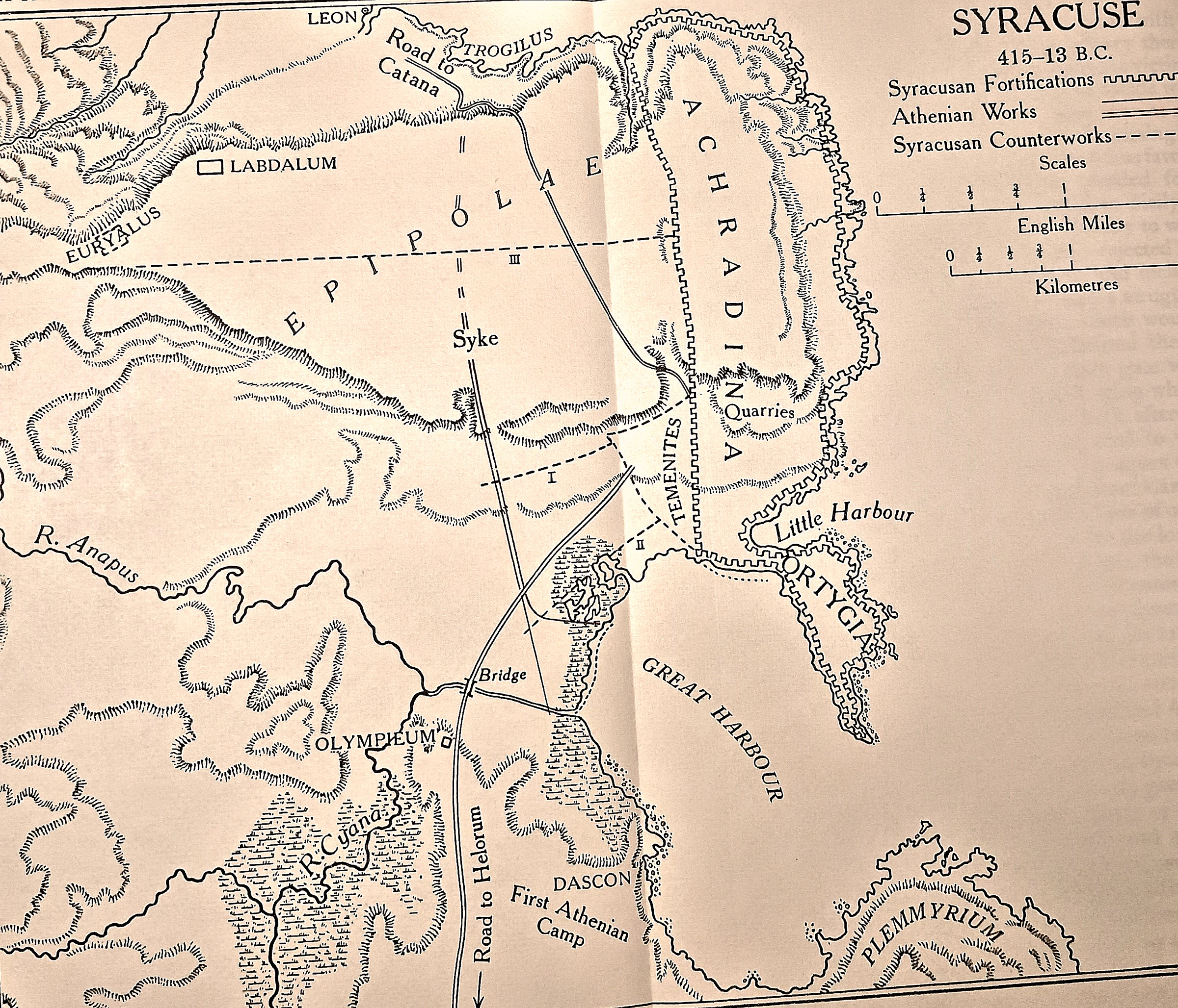
The siege that failed, wall by wall. The plan keys three kinds of line: Syracusan fortifications, Athenian works, and Syracusan counter-works.
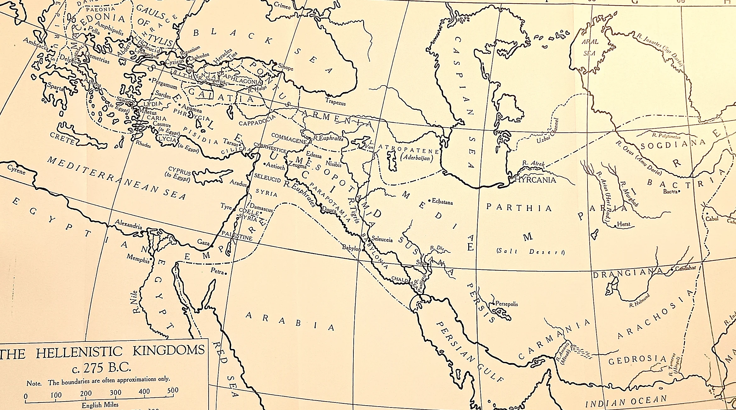 CAH plate
The settled partition. Antigonid Macedon at the top left, the Seleucid empire running from the Aegean to Bactria, Ptolemaic Egypt with Cyprus and the Levantine coast, Pergamum and the Galatian settlements between them.
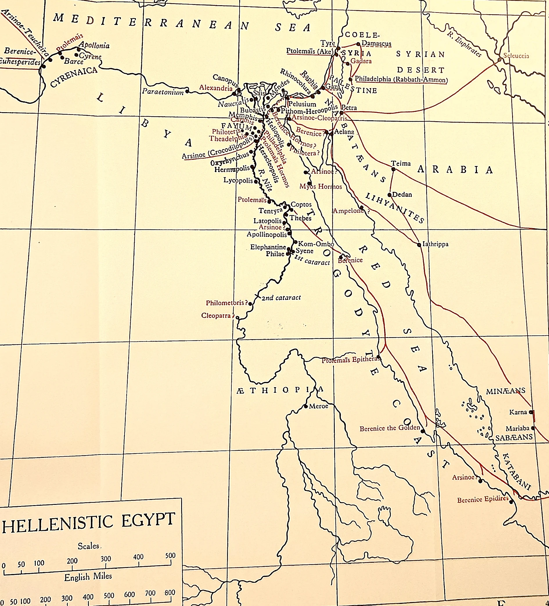 CAH plate
A kingdom run as an estate.
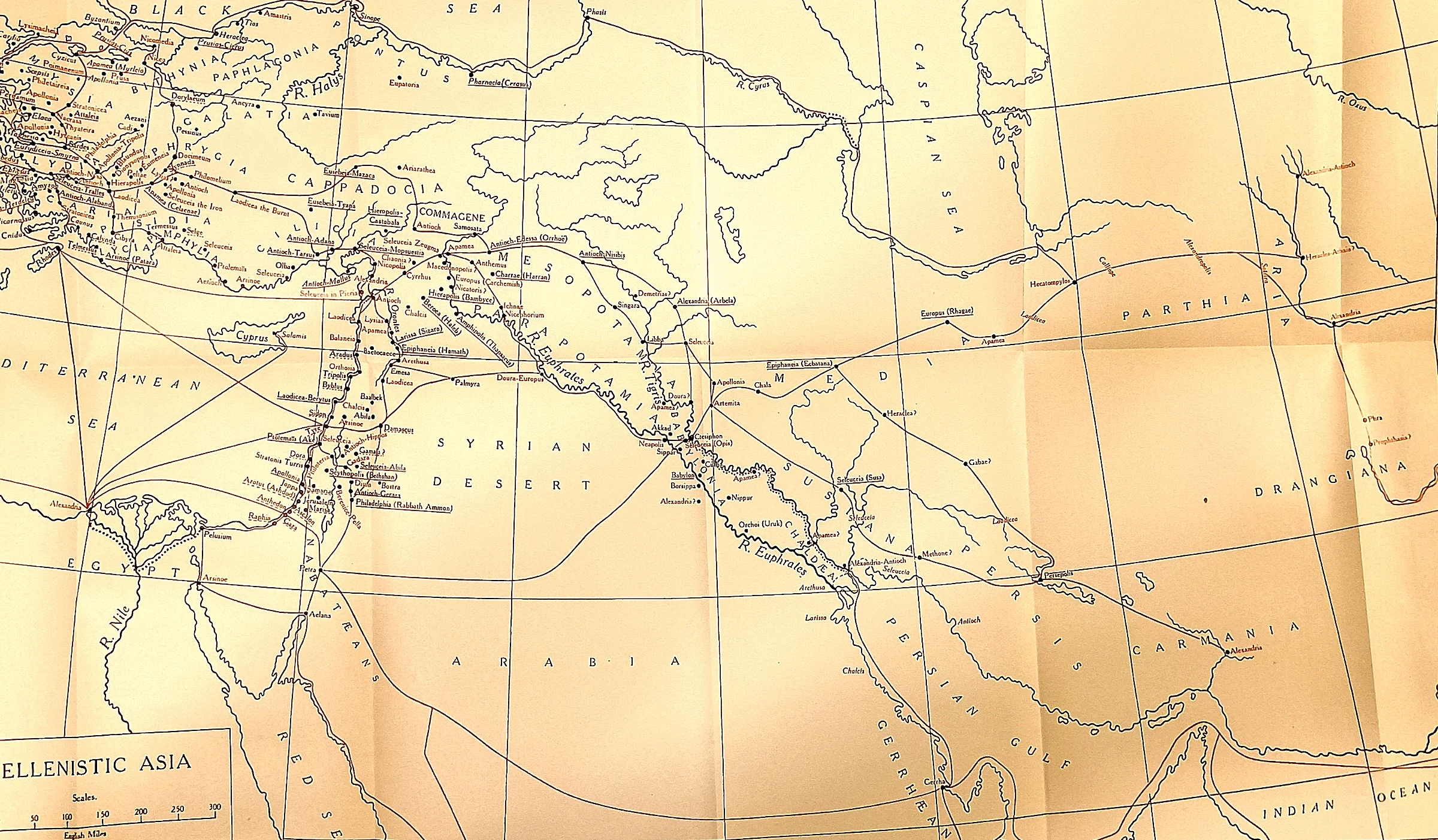 CAH plate
Greek cities strung along a road.
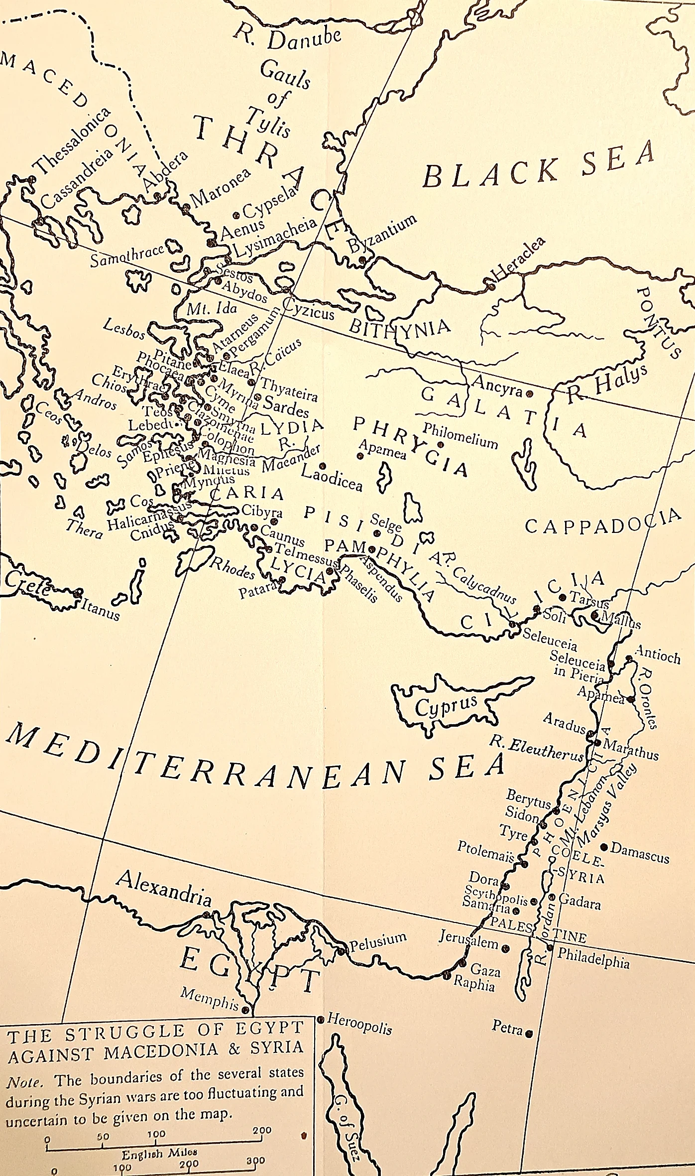 CAH plate
What the kings actually fought over. Not territory in bulk but coastline: the Aegean islands, the harbours of Ionia and Caria, Cyprus, and Coele-Syria between Egypt and Antioch, which changed hands in six Syrian Wars.
 CAH plate
The city the kings left behind.
 CAH plate
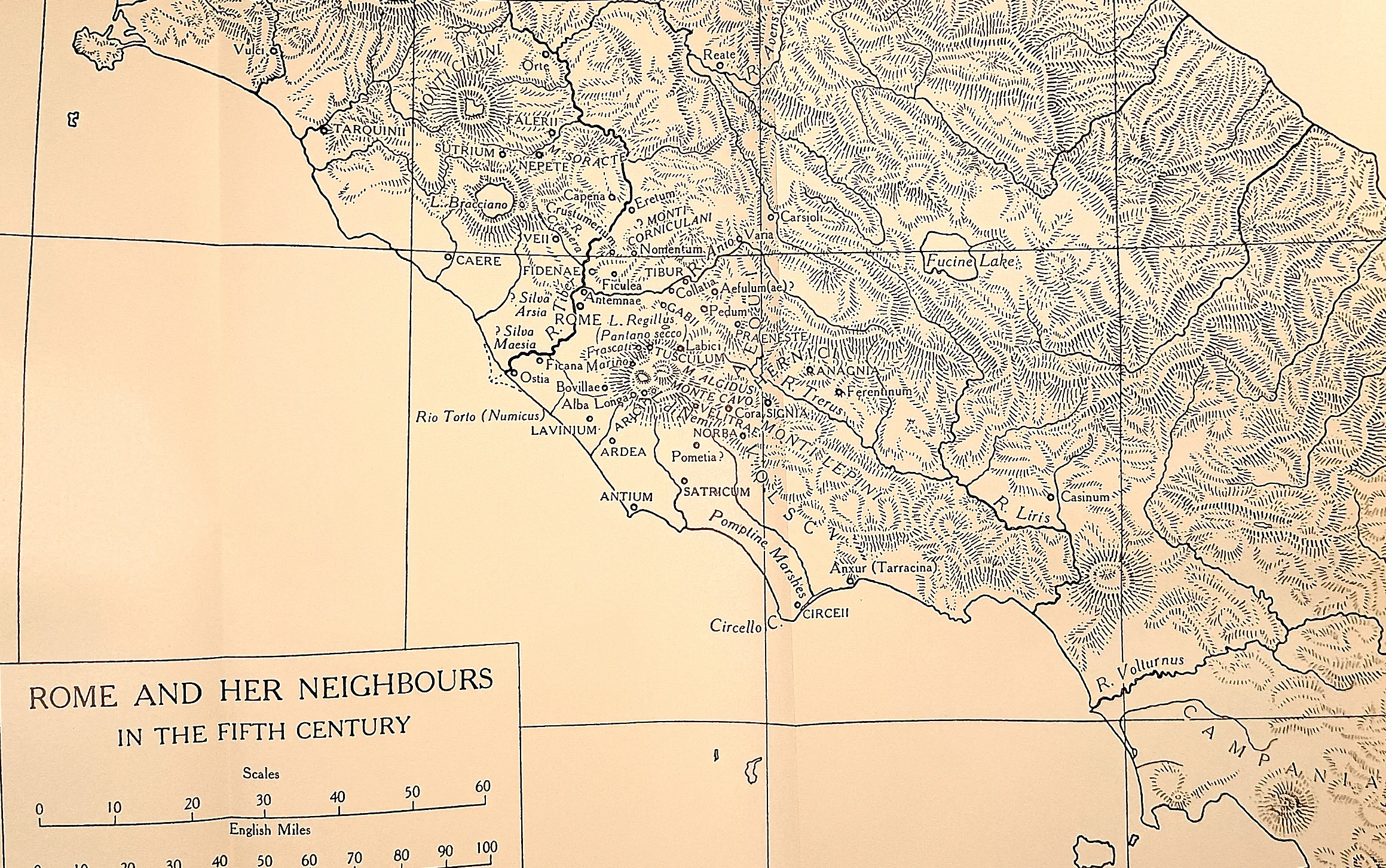
How small the quarrel was. Veii lies about ten miles north of Rome; Fidenae, Antemnae and Crustumerium are inside a morning’s march. The Aequi and Volsci hold the hills that close the Latin plain from the east and south.
 CAH plate
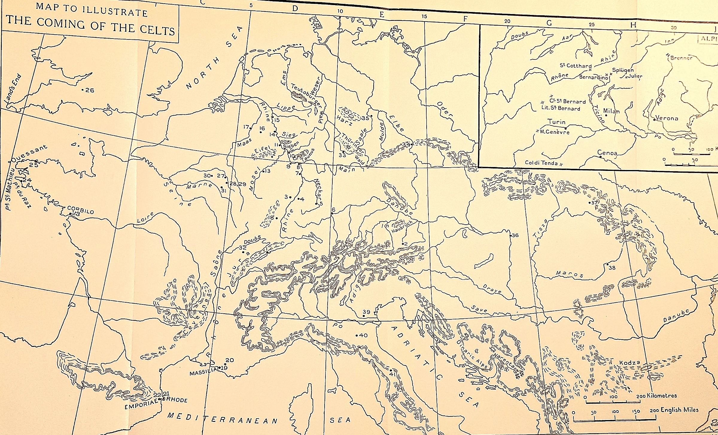
Where Brennus came from. The Senones who burned Rome in 390 B.C.
 CAH plate
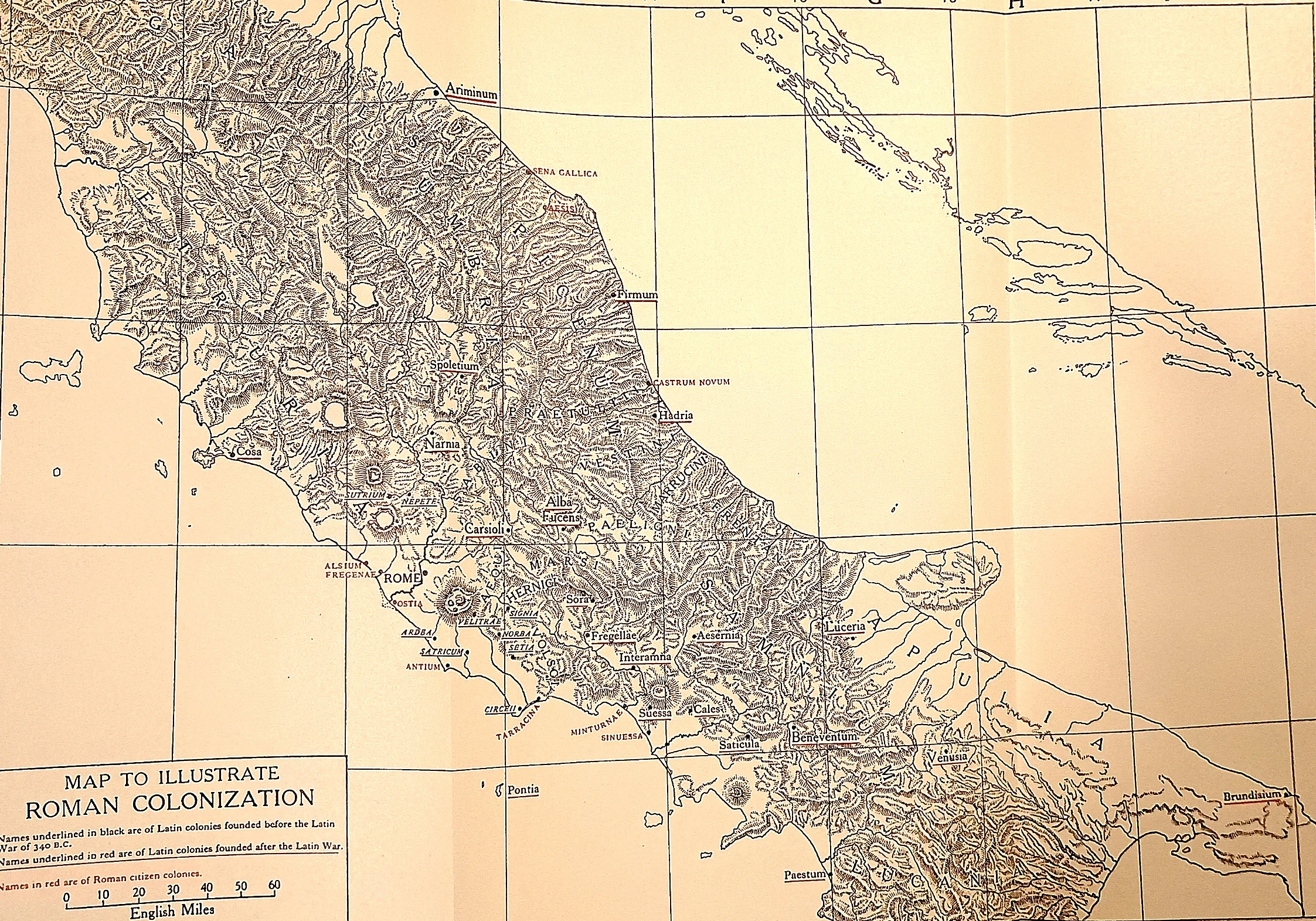
The settlement, drawn. The plate separates the Latin colonies founded before the Latin War from those planted after it, and marks the citizen colonies in a third hand.
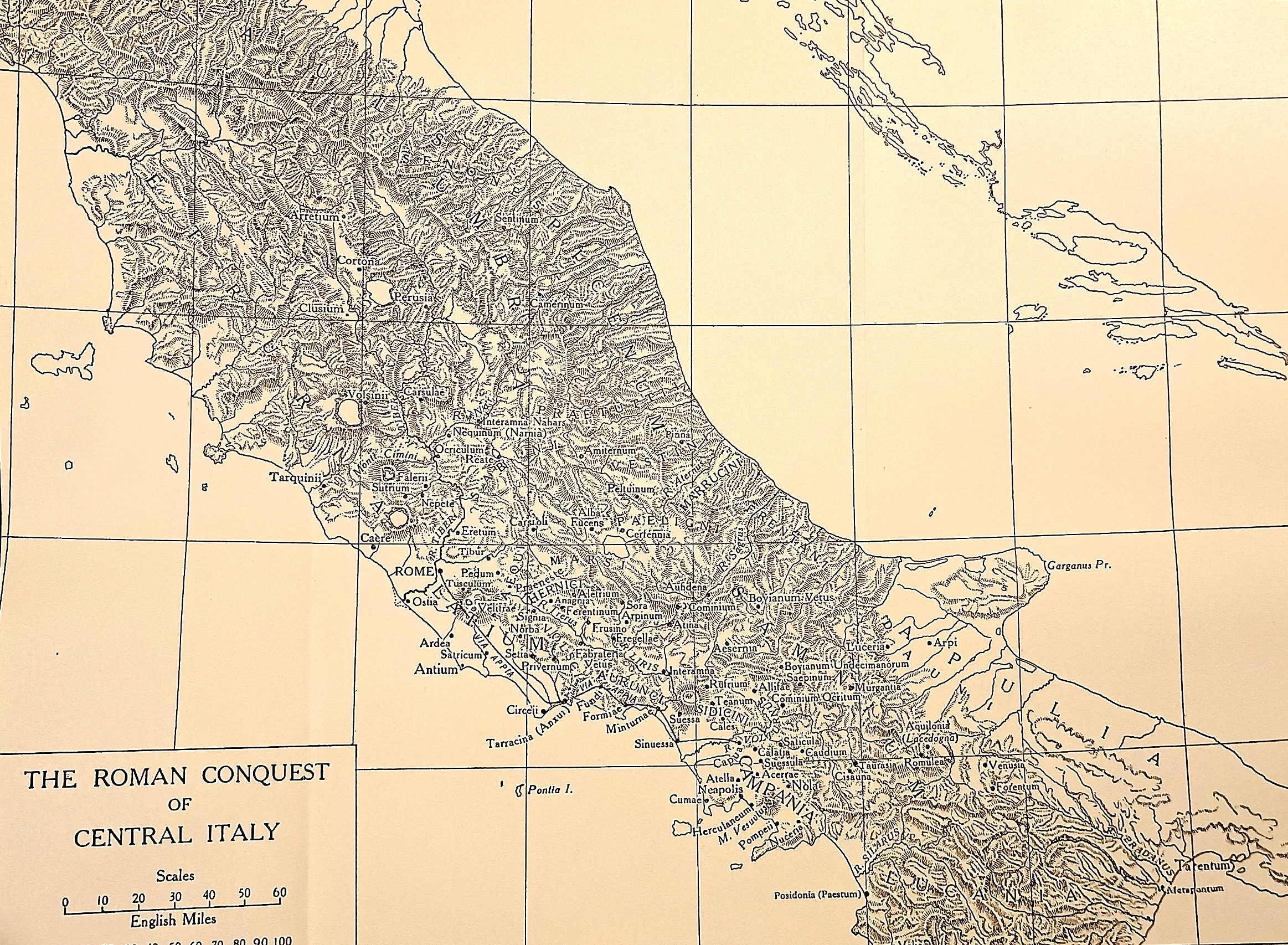 CAH plate
Fifty years of war on one sheet.
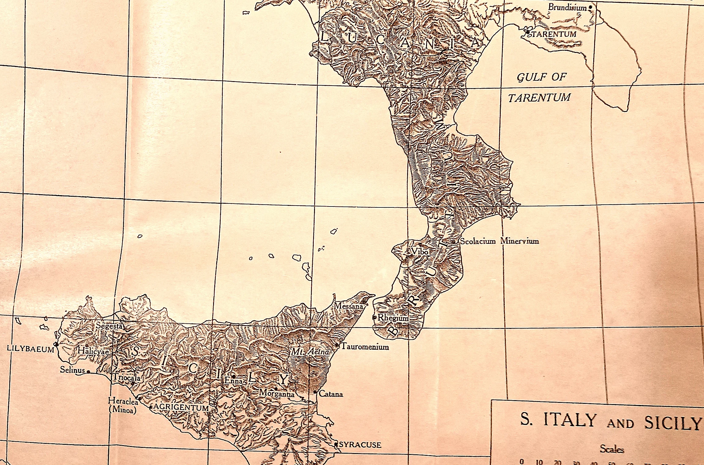 CAH plate
The Greek south, in relief. Tarentum at the top of the gulf, the mountain spine running down to Rhegium, and across the strait the Sicily of Syracuse and Agrigentum.
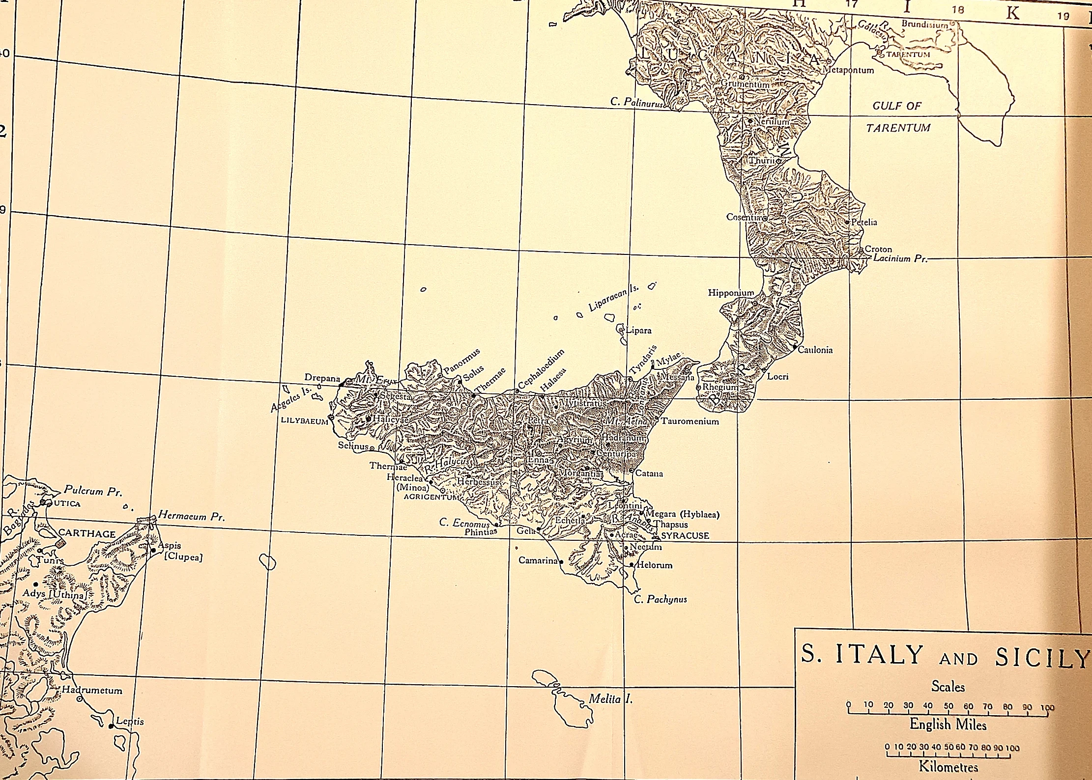 CAH plate
The board of the first war.
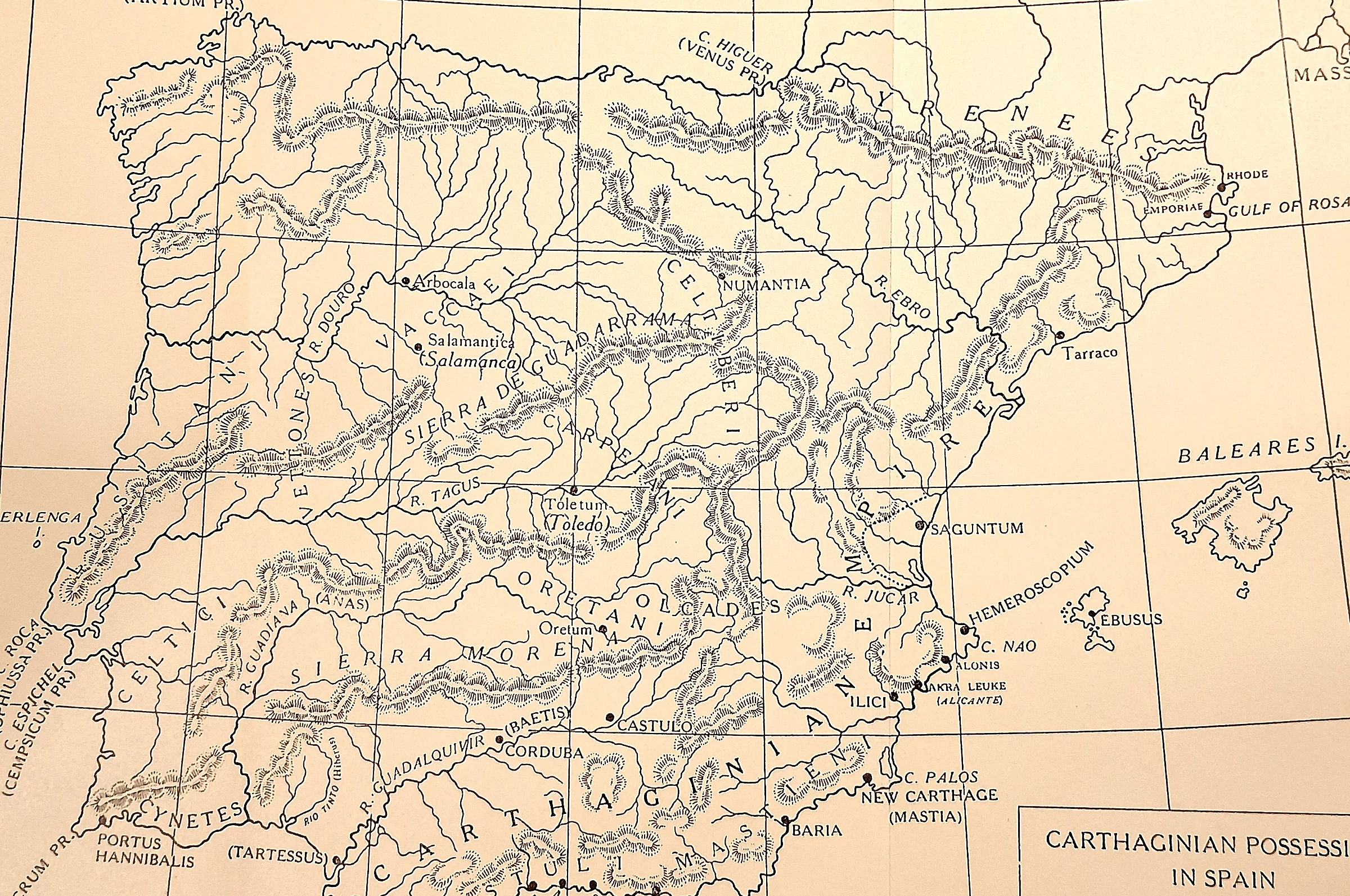 CAH plate
The empire Hamilcar built to replace Sicily. New Carthage on its harbour, the silver of the Sierra Morena behind it, and northward the Ebro — the line Hasdrubal agreed with Rome — with Saguntum awkwardly south of it.
 CAH plate
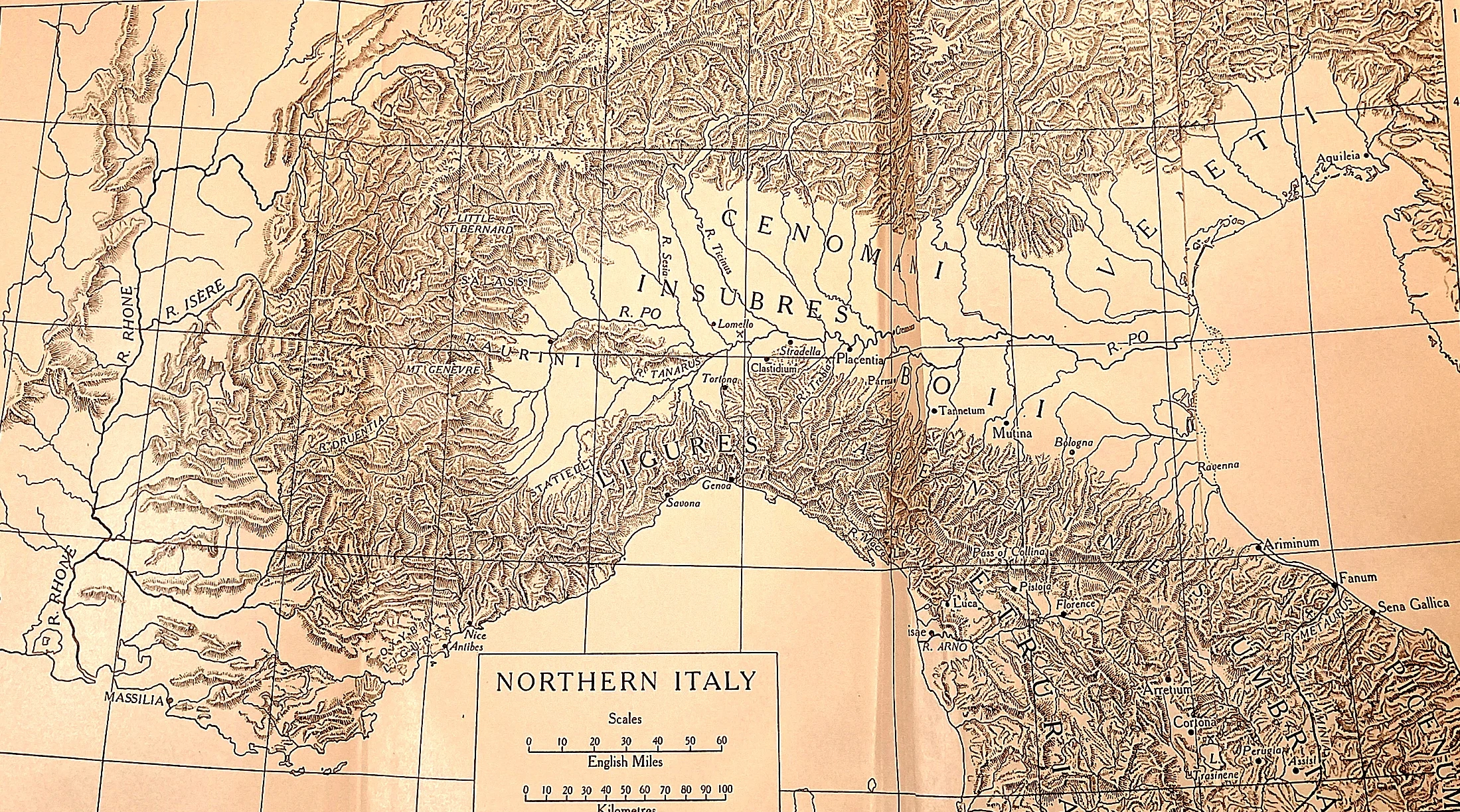
Where the war actually arrived. Hannibal came down off the Alps at the top left of this sheet into the country of the Insubres and Boii, Gallic peoples Rome had beaten only a few years before and who joined him at once.
 CAH plate
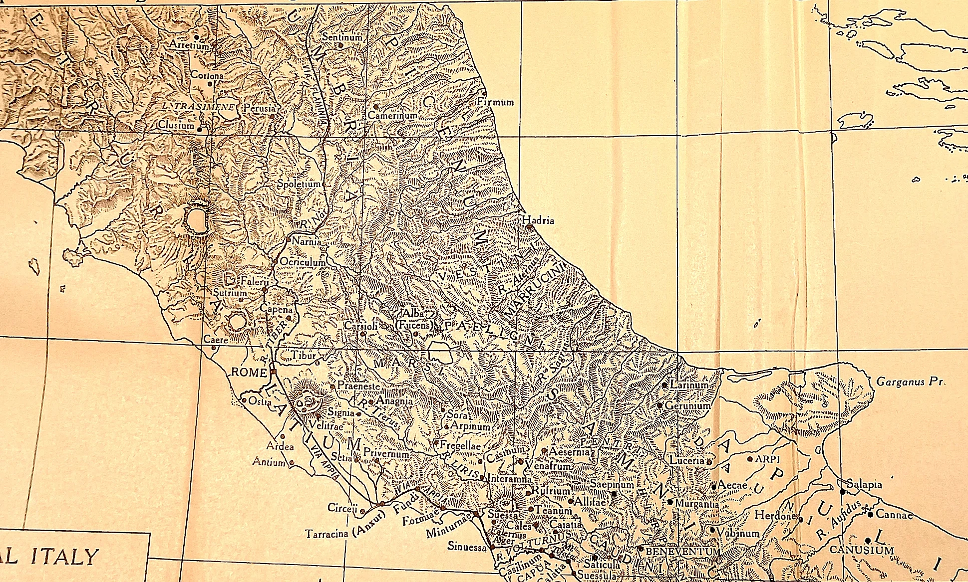
Where the war was lost and not lost.
 CAH plate
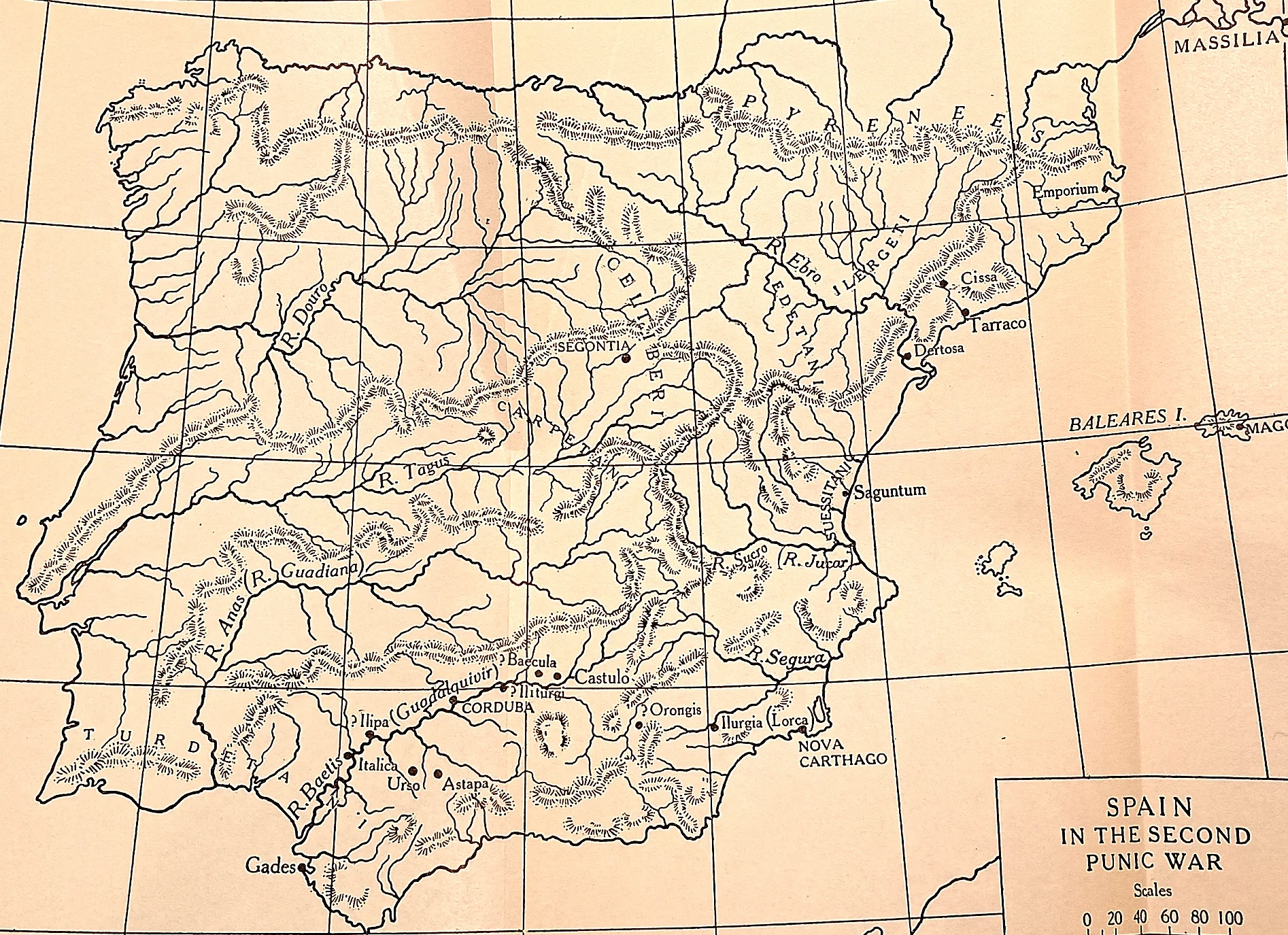
The theatre Scipio inherited. Emporium and Tarraco at the top, the Ebro crossing, then the long march south to Baecula, Ilipa and New Carthage. Rome had sent an army here in 218 B.C.
 CAH plate
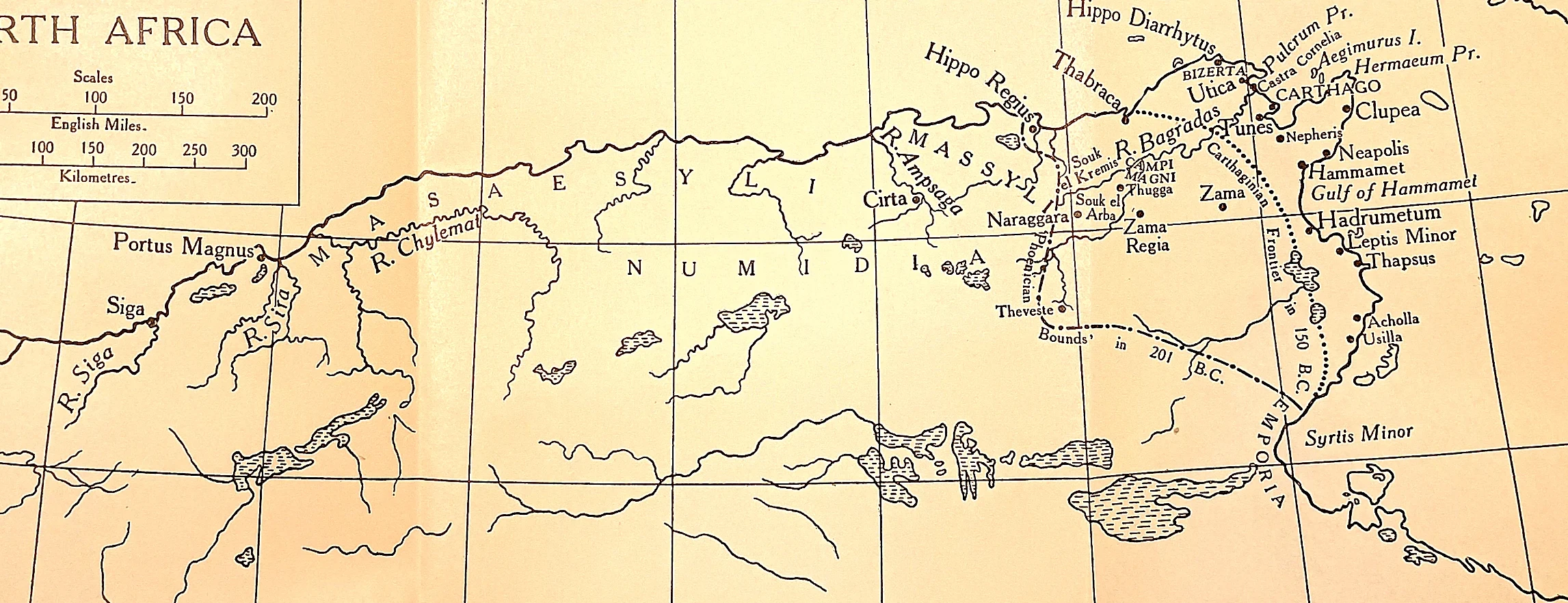
The cage of 201 B.C. The dotted line marks the boundary imposed on Carthage after Zama: she kept her city and her trade but might not make war outside it without Rome’s leave. Masinissa’s Numidia surrounds her.
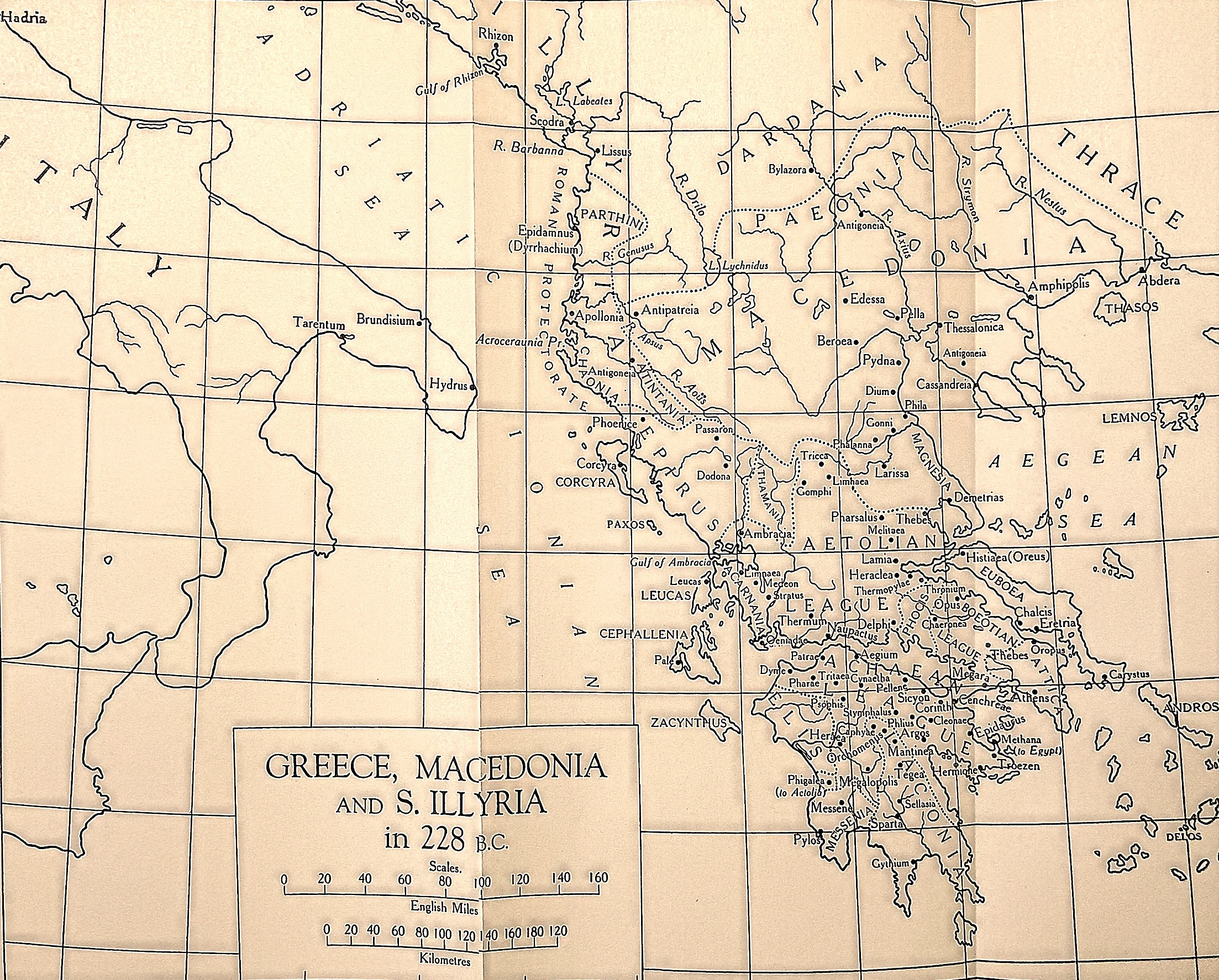 CAH plate
The world Rome was about to enter.
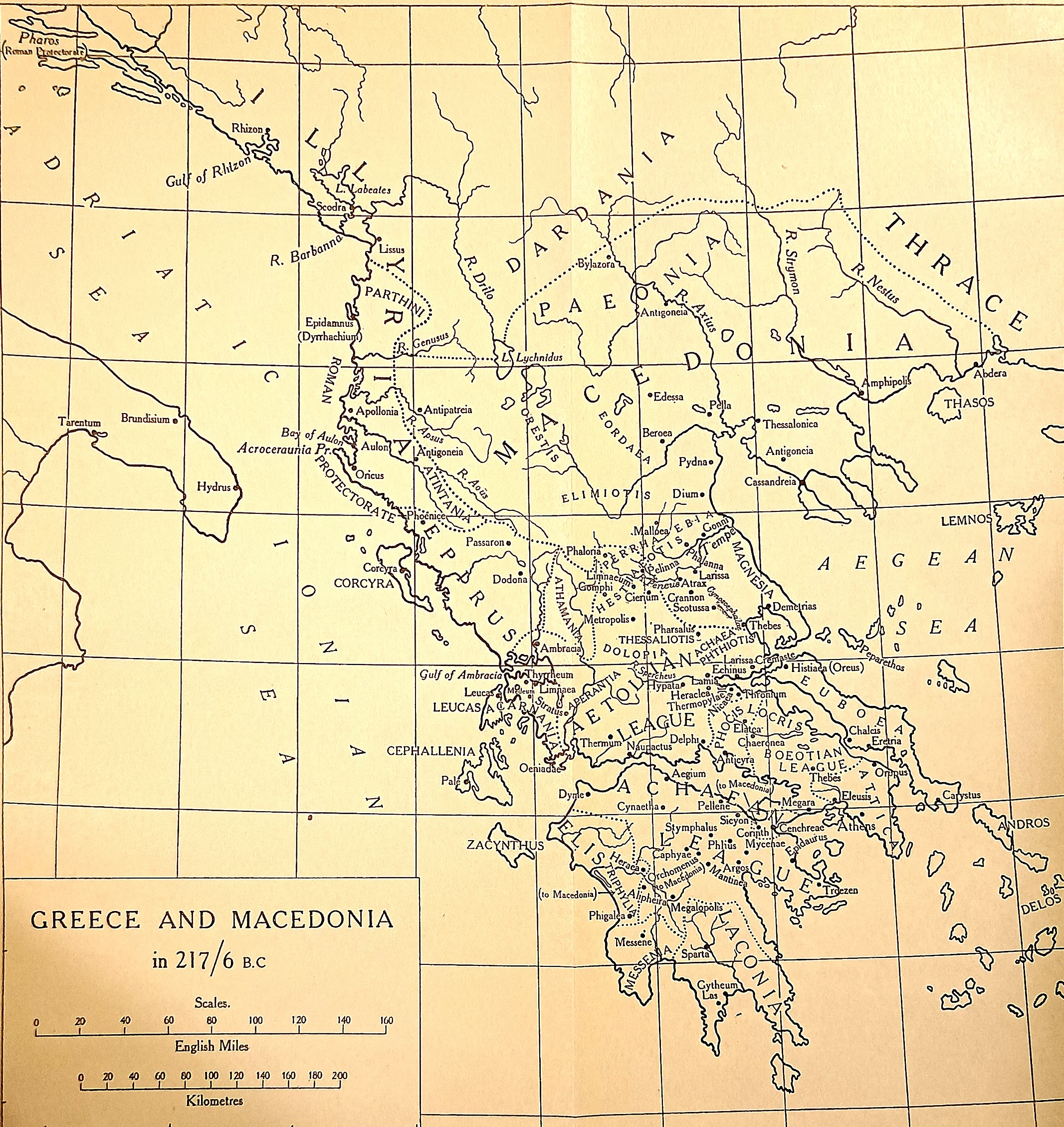 CAH plate
Philip’s Greece, on the eve. Thessaly, where Cynoscephalae was fought, sits in the middle of the sheet between the Macedonian kingdom and the leagues of the south.
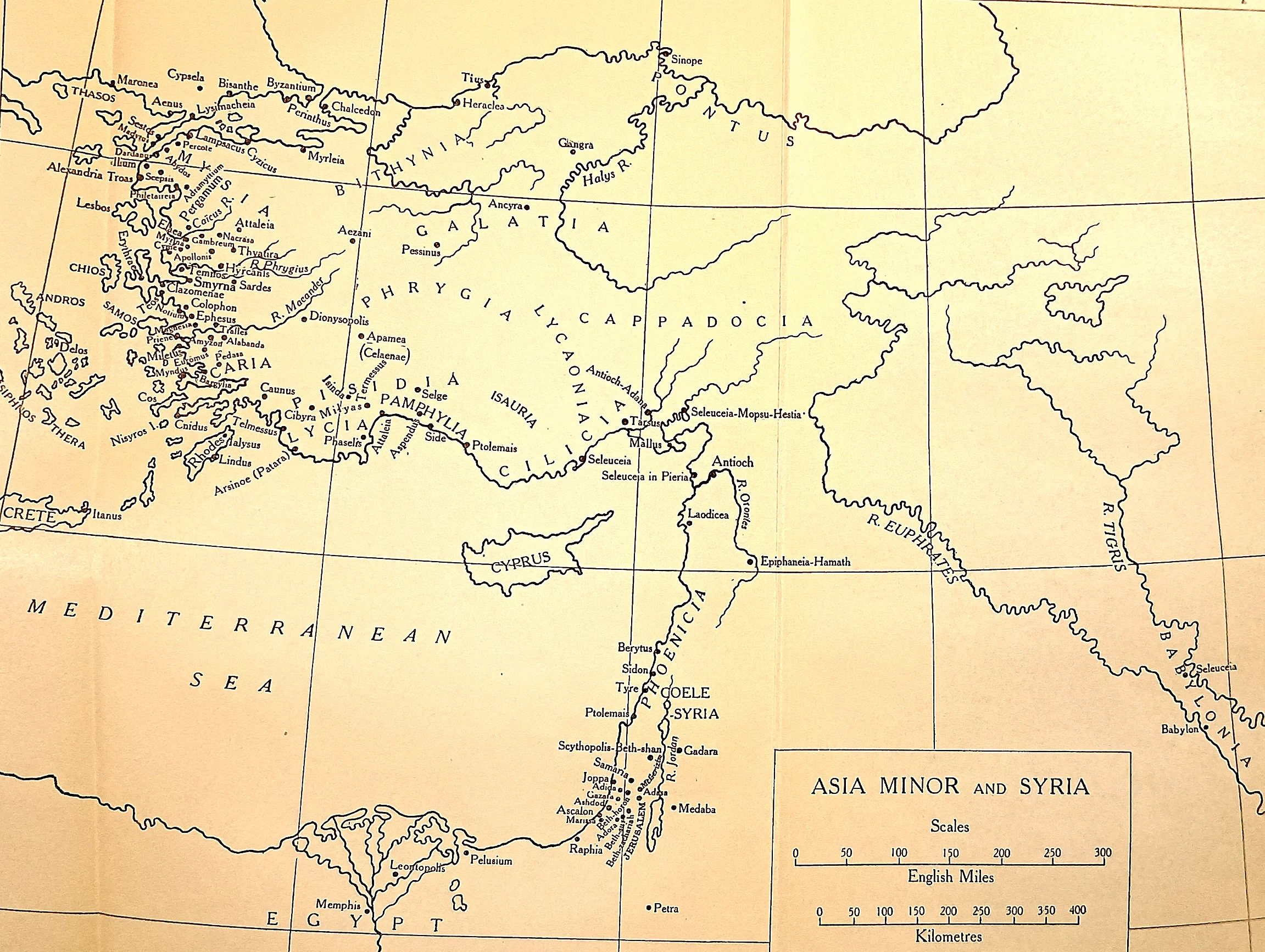 CAH plate
What Magnesia redistributed. The Seleucid west: Ionia and Caria on the Aegean, the Phrygian and Lycaonian plateau, the Cilician Gates, and Antioch beyond the Amanus. After 188 B.C.
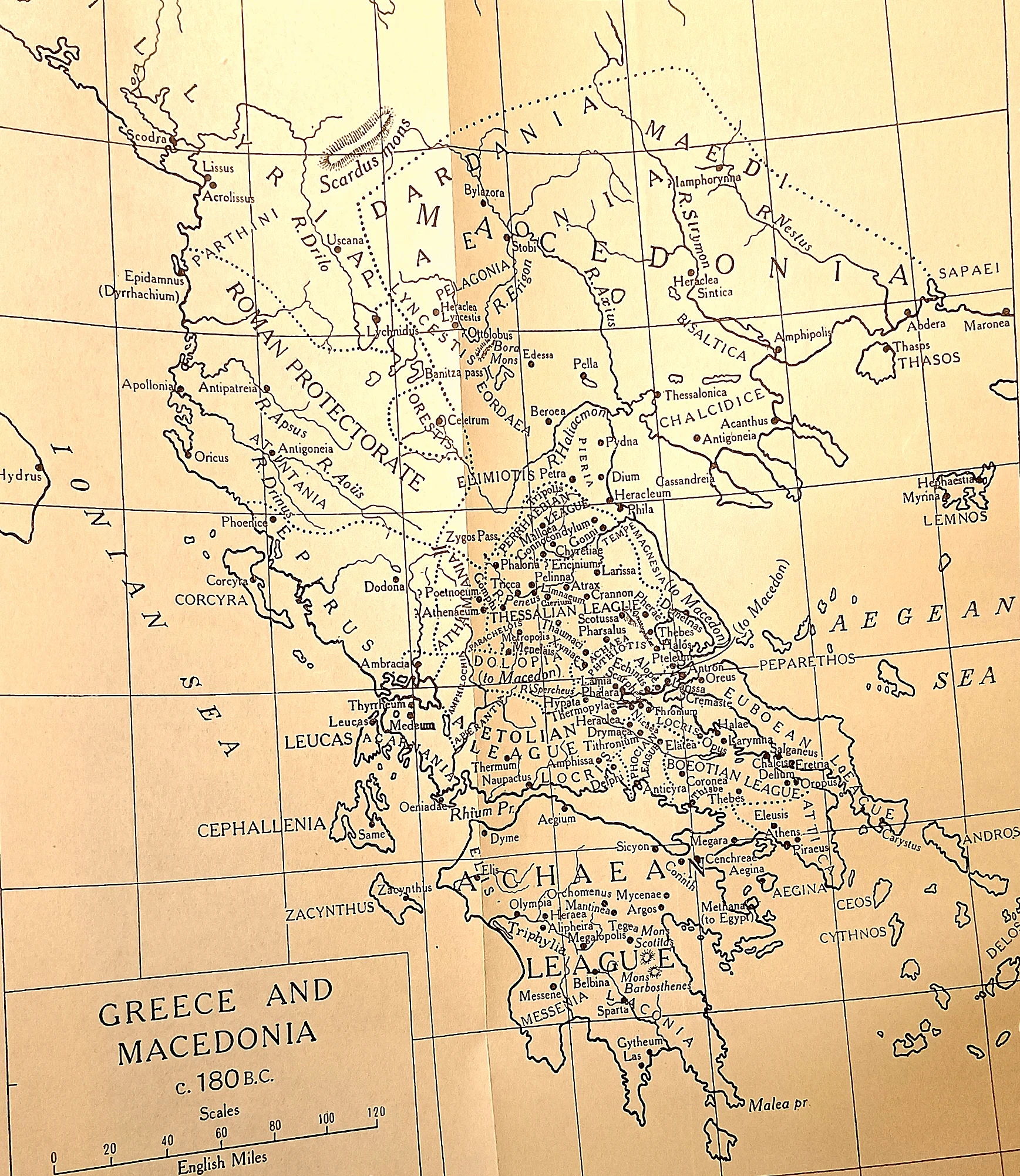 CAH plate
The kingdom Perseus inherited. Macedon still whole, the Roman protectorate on the Illyrian coast, the Thessalian, Aetolian, Boeotian and Achaean Leagues each with their own frontier. After Pydna in 168 B.C.
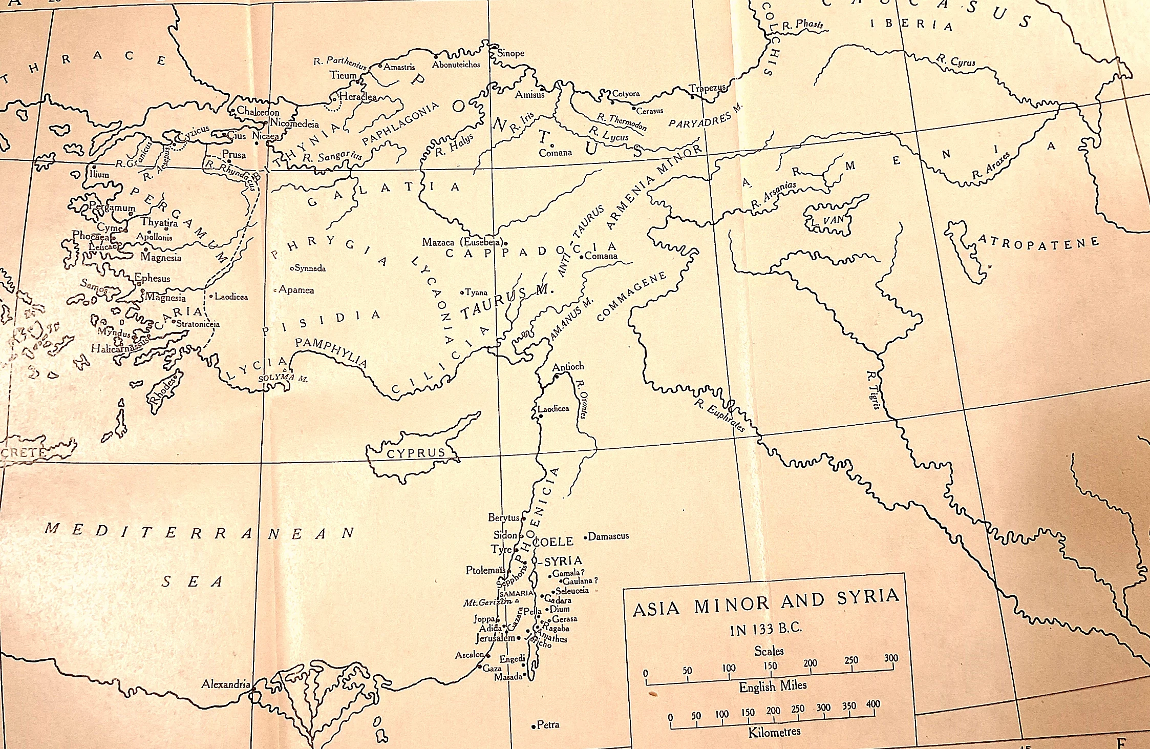 CAH plate
The legacy that opened the chapter. Pergamum sits on the Aegean coast at the left of the sheet. When Attalus III died in 133 B.C.
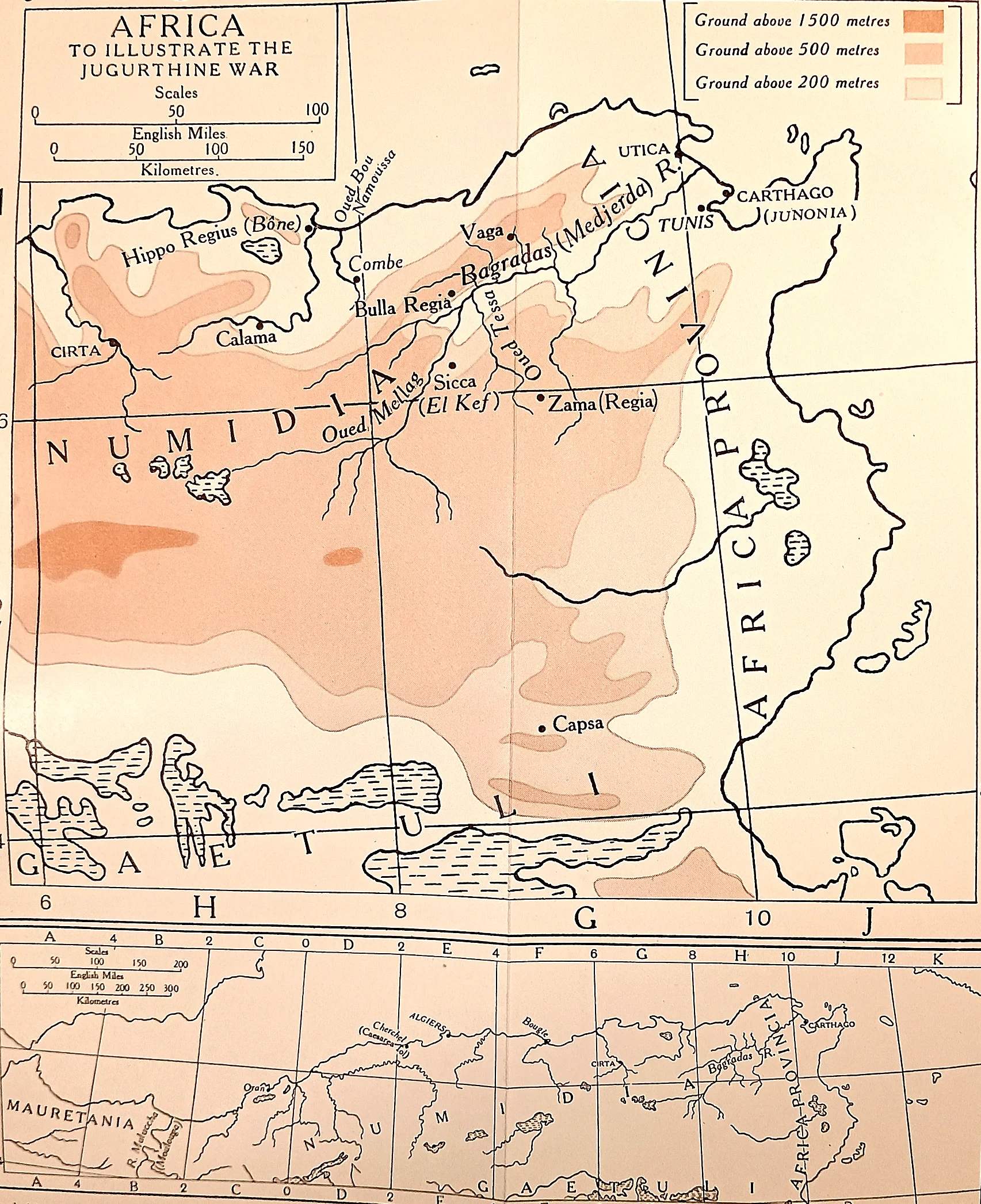 CAH plate
A war of marches, not battles. Cirta, where Jugurtha massacred the Italian traders; Zama and the Bagradas valley; Capsa deep in the south, which Marius took after crossing waterless country.
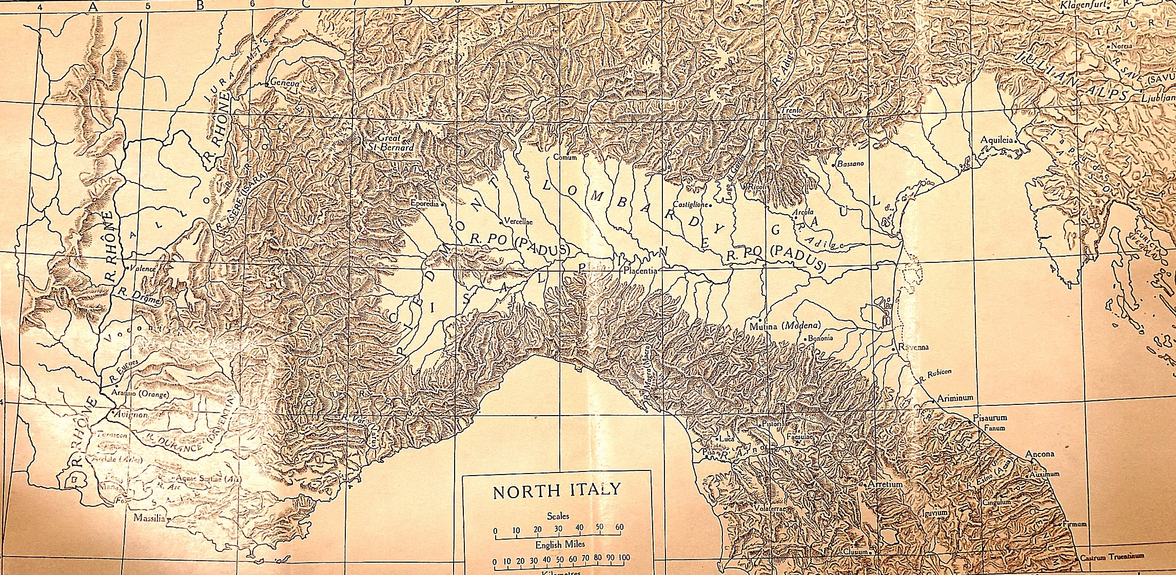 CAH plate
The road the Cimbri were taking. Every Alpine pass on this sheet leads down into the Po valley, and from the Po valley there is nothing between an invader and Rome.
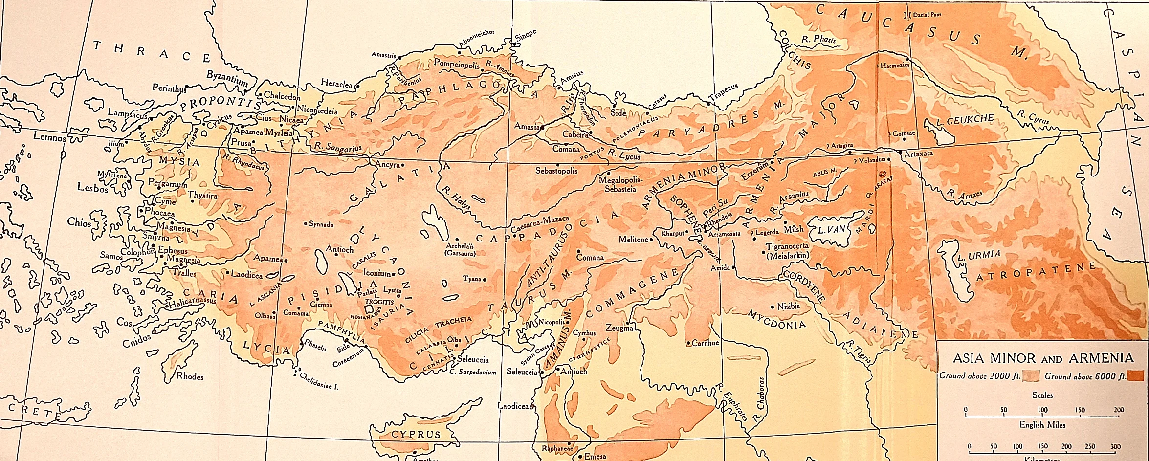 CAH plate
The kingdom behind the massacre. Pontus runs along the Black Sea coast at the top of the sheet; the Roman province of Asia lies on the Aegean at the left; between them the high plateau and the Taurus.
 CAH plate
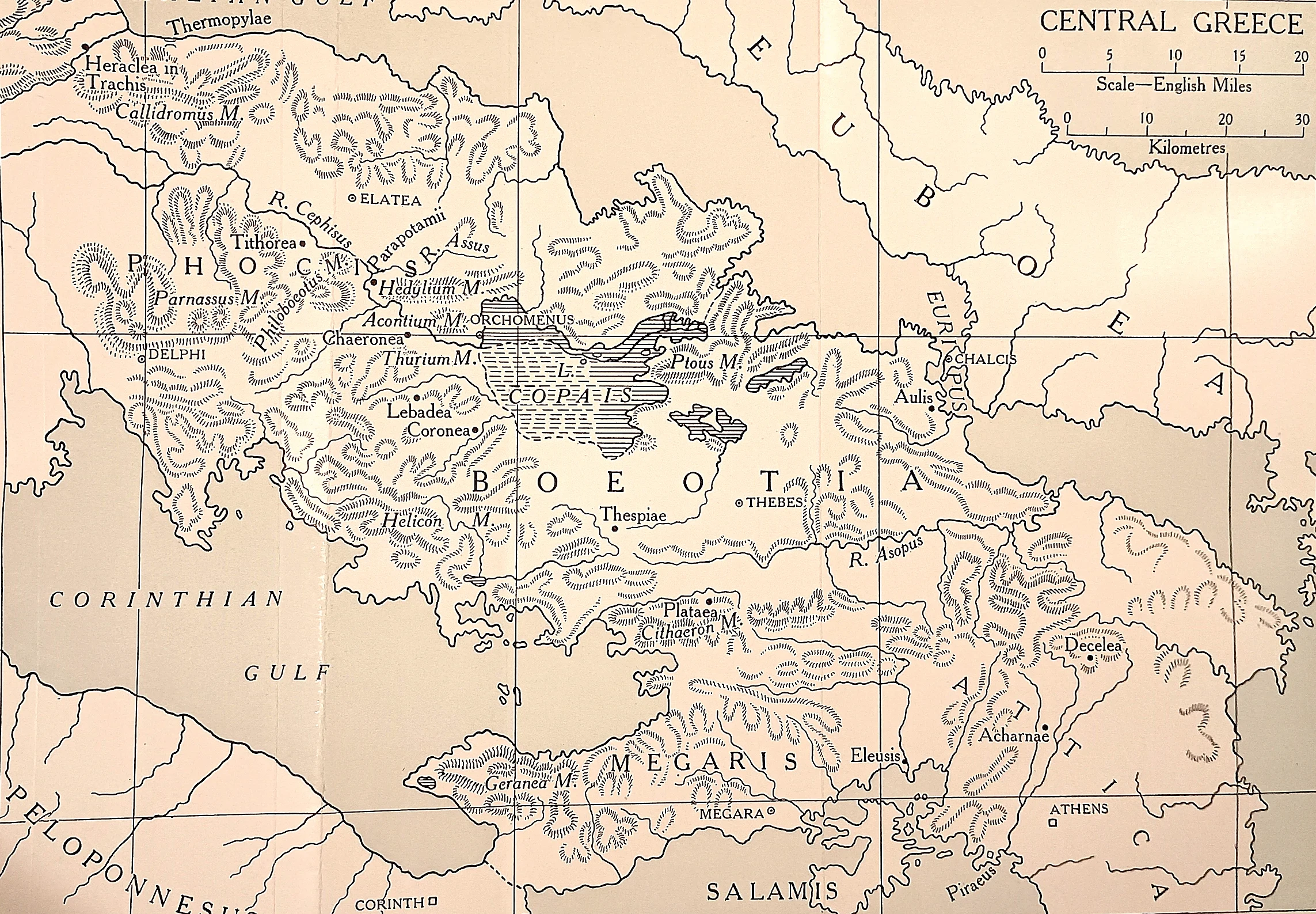
Where Sulla was while Rome burned. Chaeronea and Orchomenus sit beside Lake Copais in the middle of the sheet; Thermopylae guards the pass at the top, Athens and the Piraeus stand at the bottom right.
 CAH plate
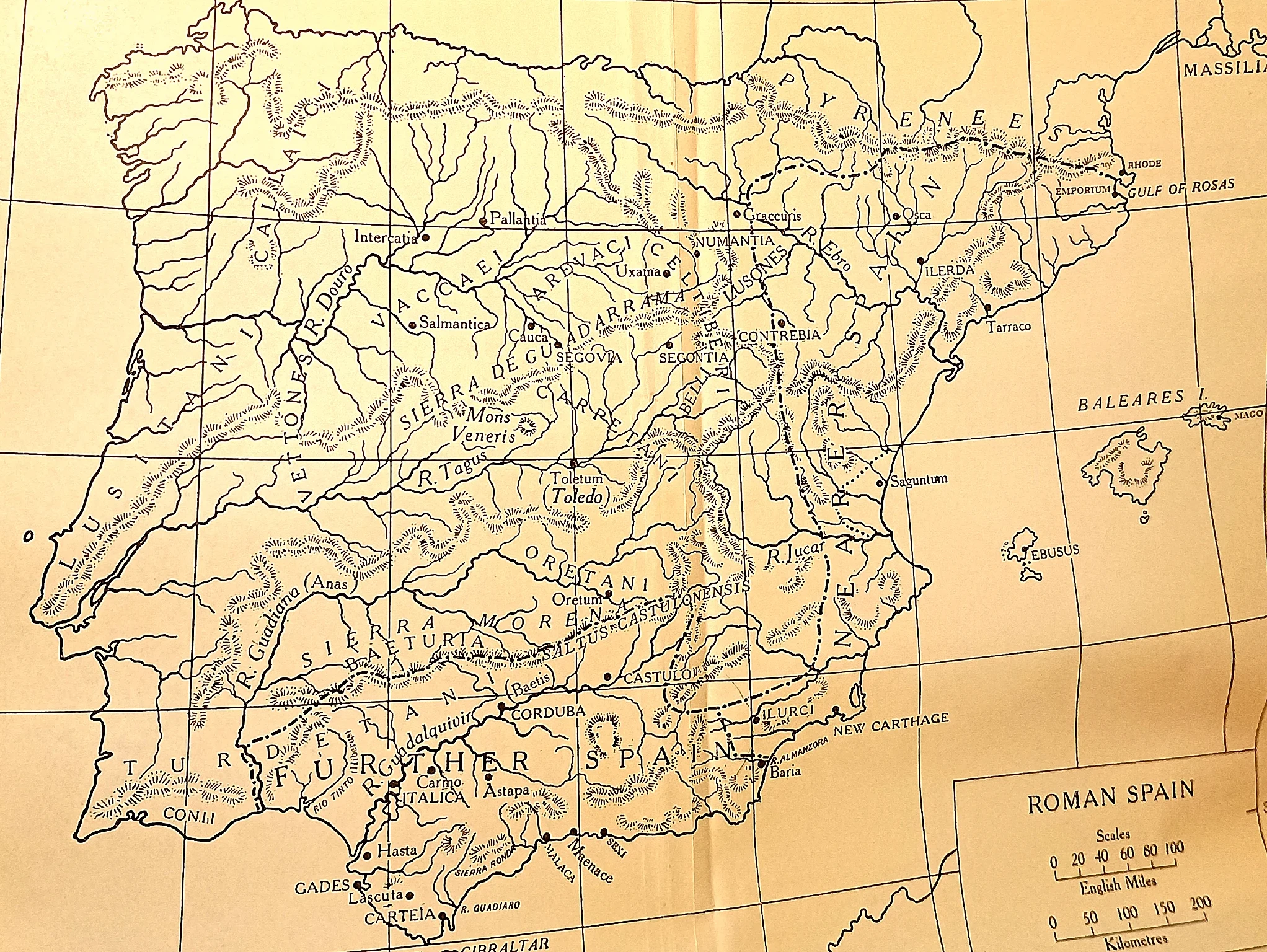
The province that never settled. Numantia, in the Celtiberian highlands at the centre of the sheet, held out for twenty years and was finally starved out in 133 B.C.
 CAH plate
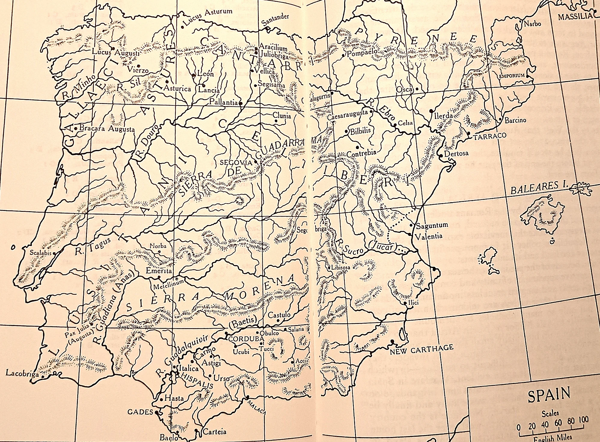
The country that made the war possible.
 CAH plate
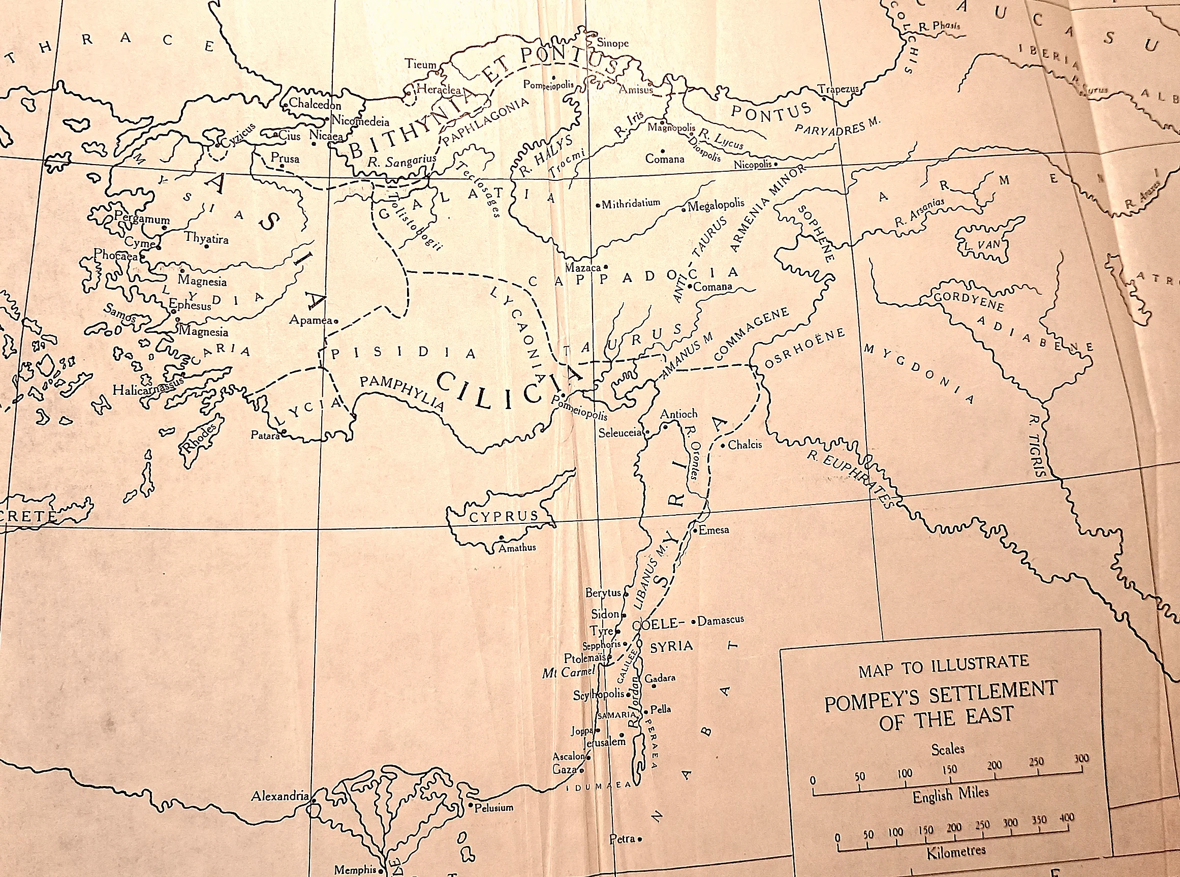
One man redraws the East. Bithynia and Pontus, Cilicia, and a new province of Syria out of the last Seleucid remnant; behind them a screen of client kings — Cappadocia, Commagene, Galatia, Judaea — left in place and bound to Rome.
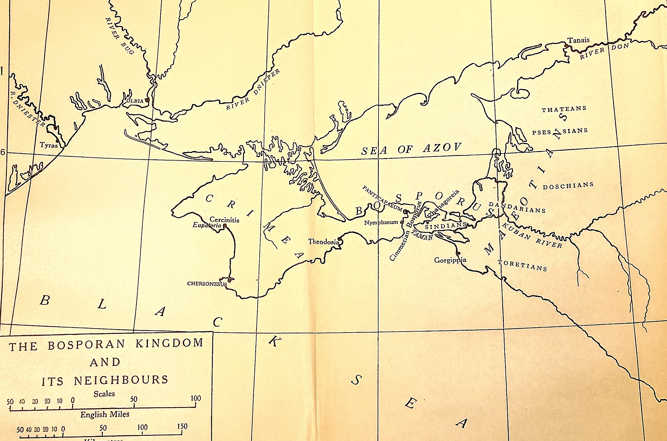 CAH plate
Where Mithridates ended. Driven out of Anatolia, the king crossed the Black Sea to the Bosporan kingdom his son Pharnaces governed from Panticapaeum. When Pharnaces revolted in 63 B.C.
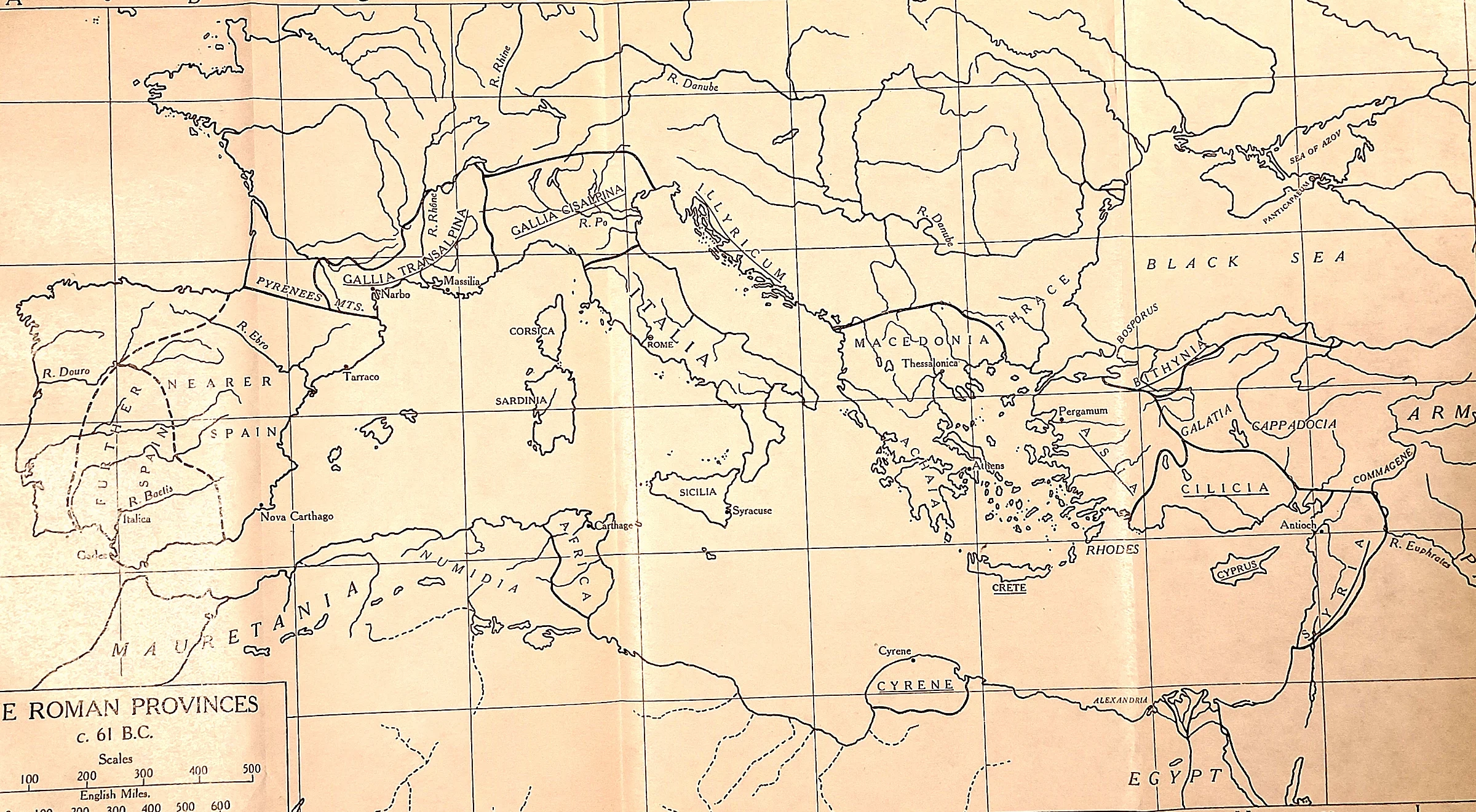 CAH plate
What the three men were dividing. The empire on the eve of the compact: Spain, Narbonese Gaul, Africa, Macedonia, Asia, Bithynia-Pontus, Cilicia, Syria, Cyrene, the islands.
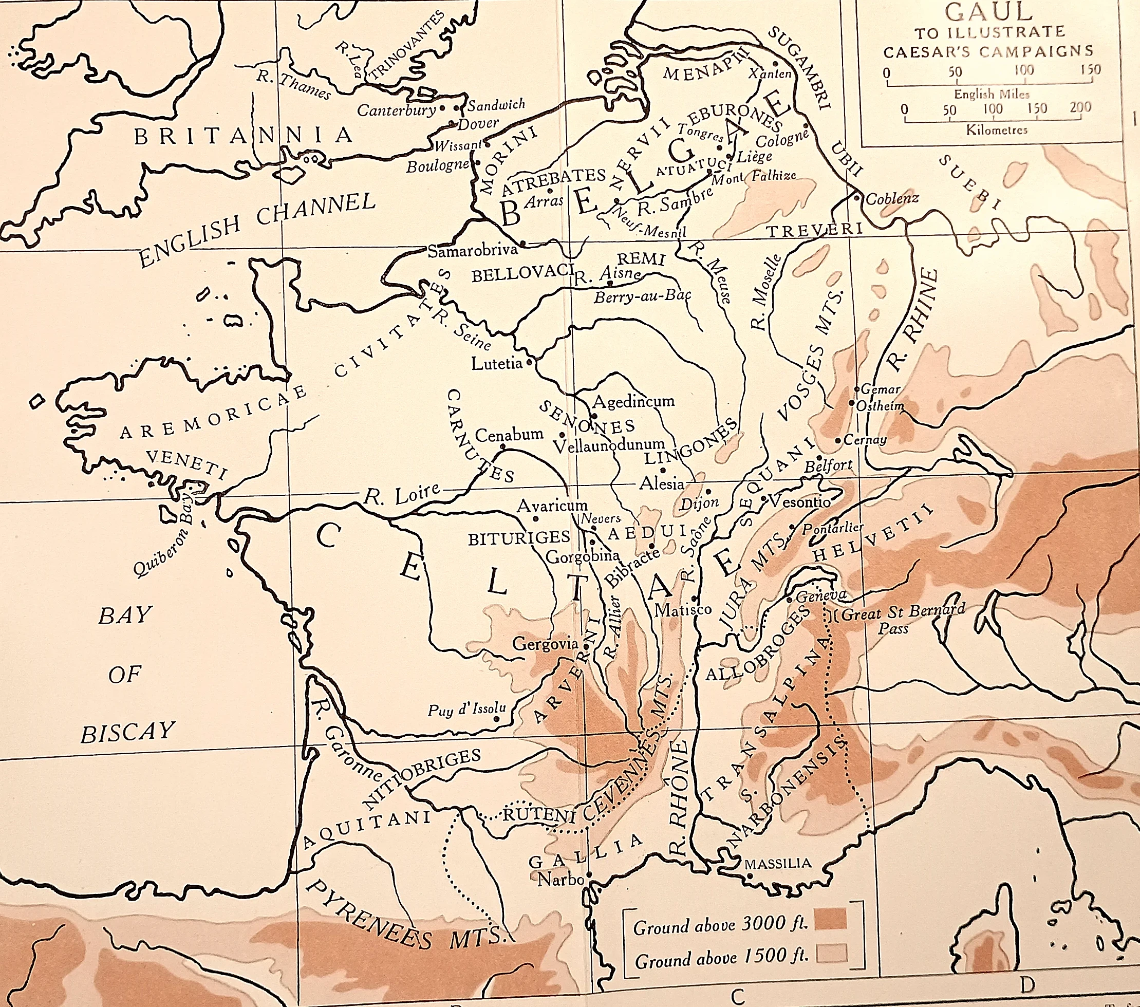 CAH plate
Eight seasons on one sheet.
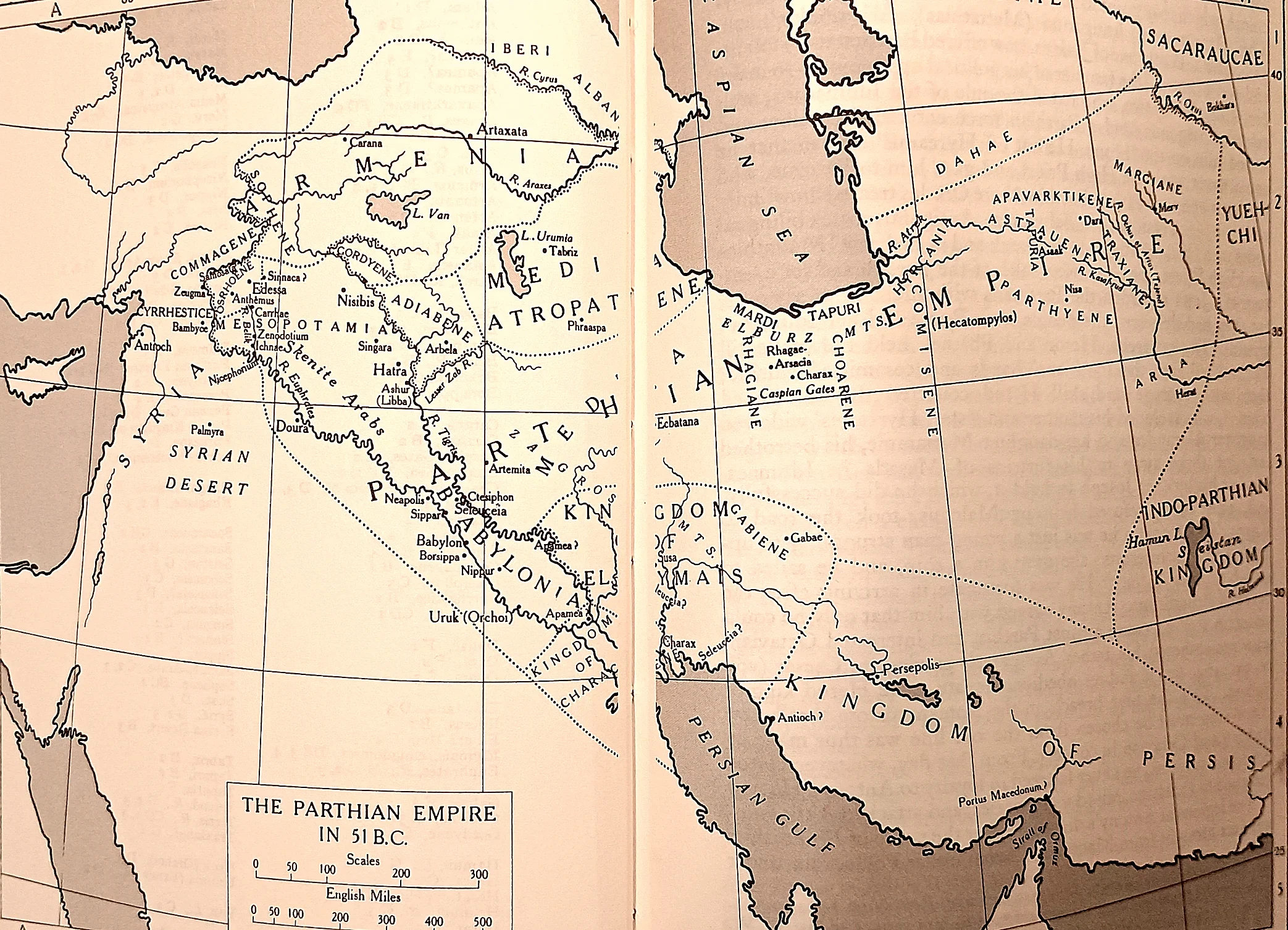 CAH plate
The empire that killed Crassus. Carrhae lies in the Mesopotamian steppe just south of the Euphrates crossing at Zeugma, on the left of the sheet.
 CAH plate
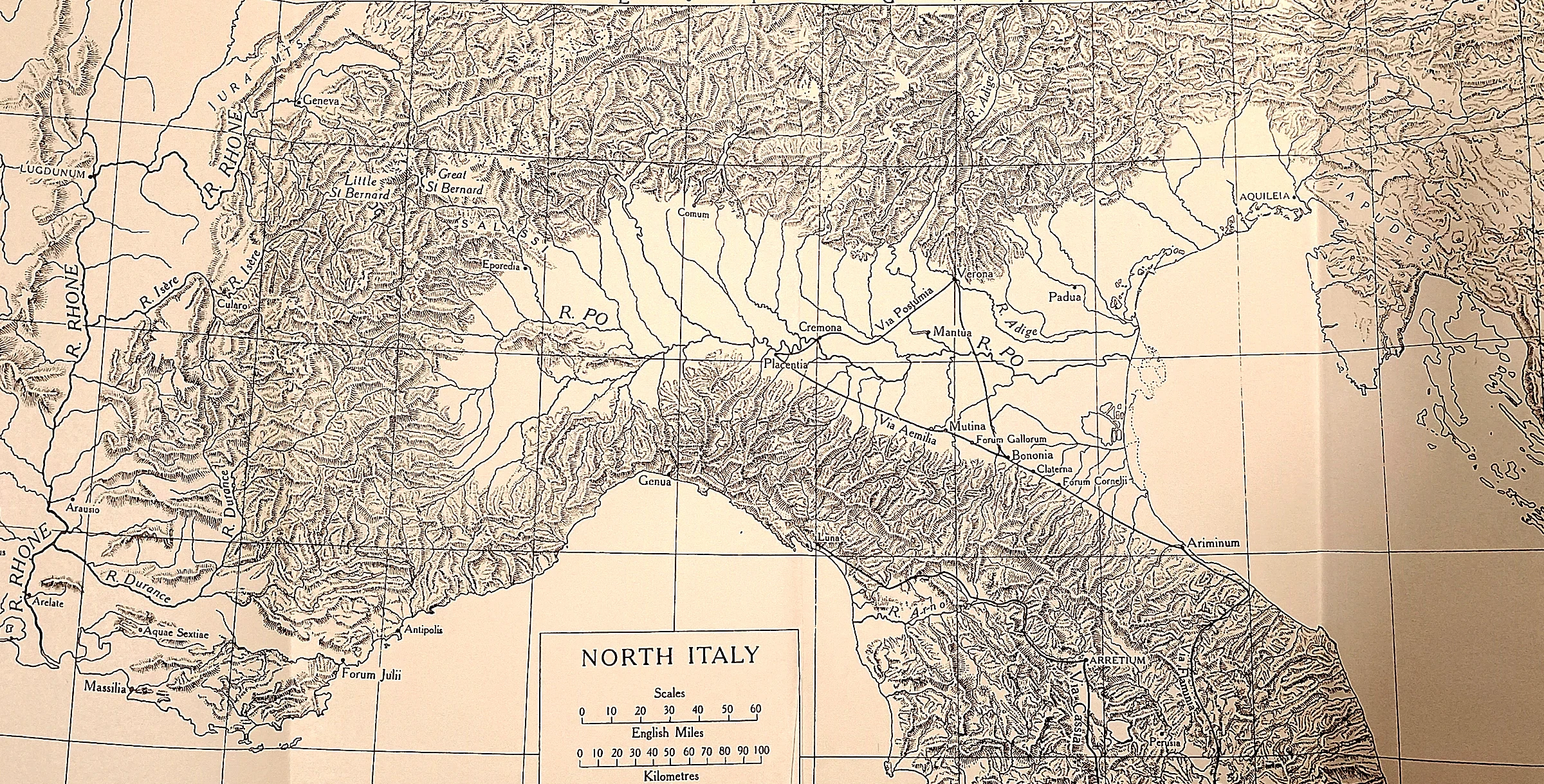
The province and the line. Caesar’s command included Cisalpine Gaul, which reaches down the Adriatic coast to the Rubicon, a stream too small to name on most sheets. South of it a proconsul with an army was an enemy of the Roman people.
 CAH plate
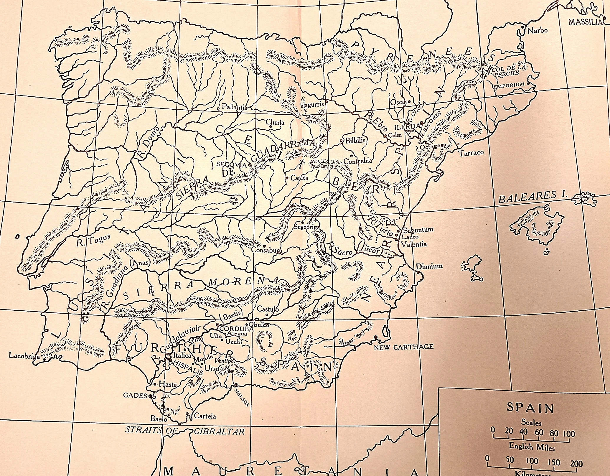
“I go to fight an army without a general.” Before following Pompey east, Caesar went west.
 CAH plate
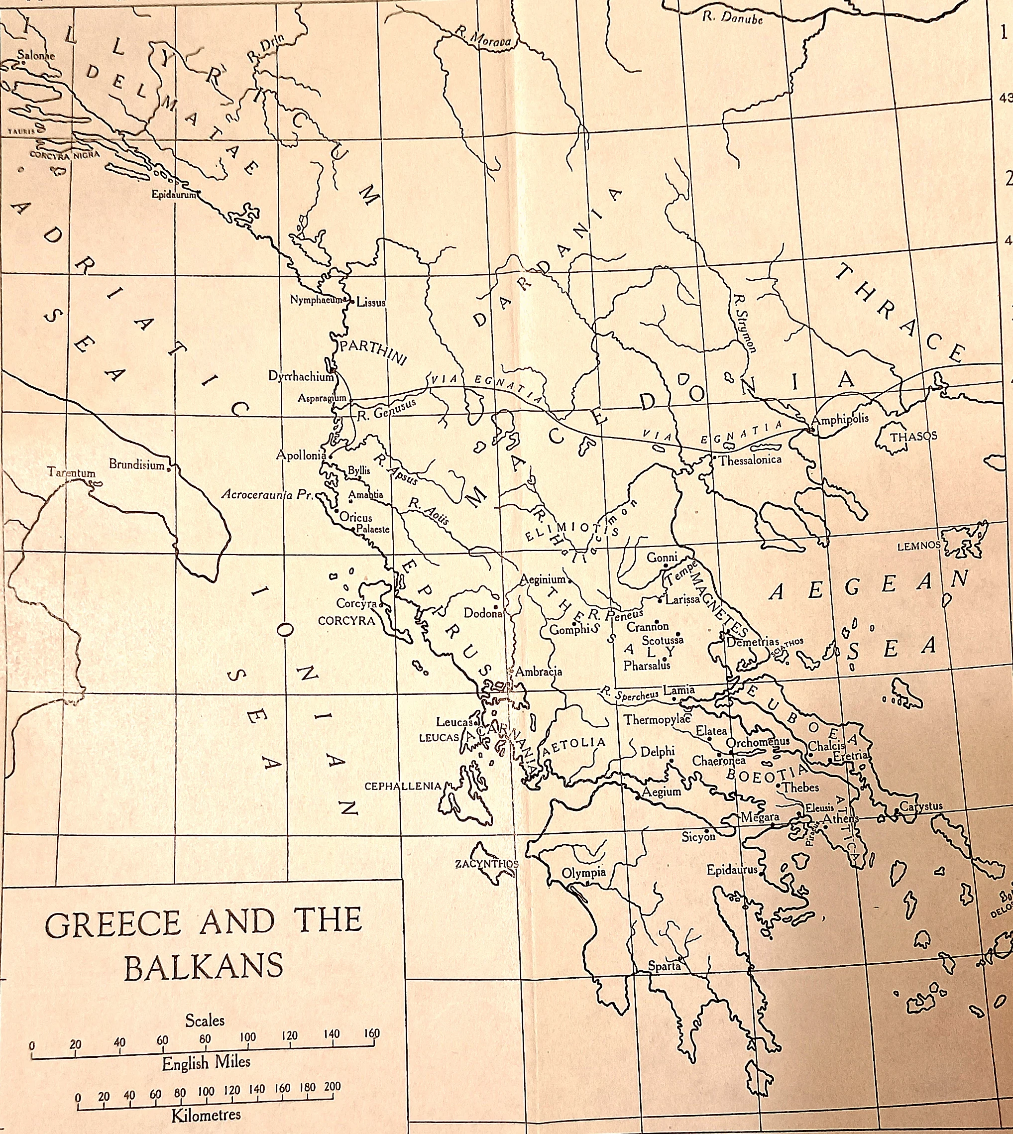
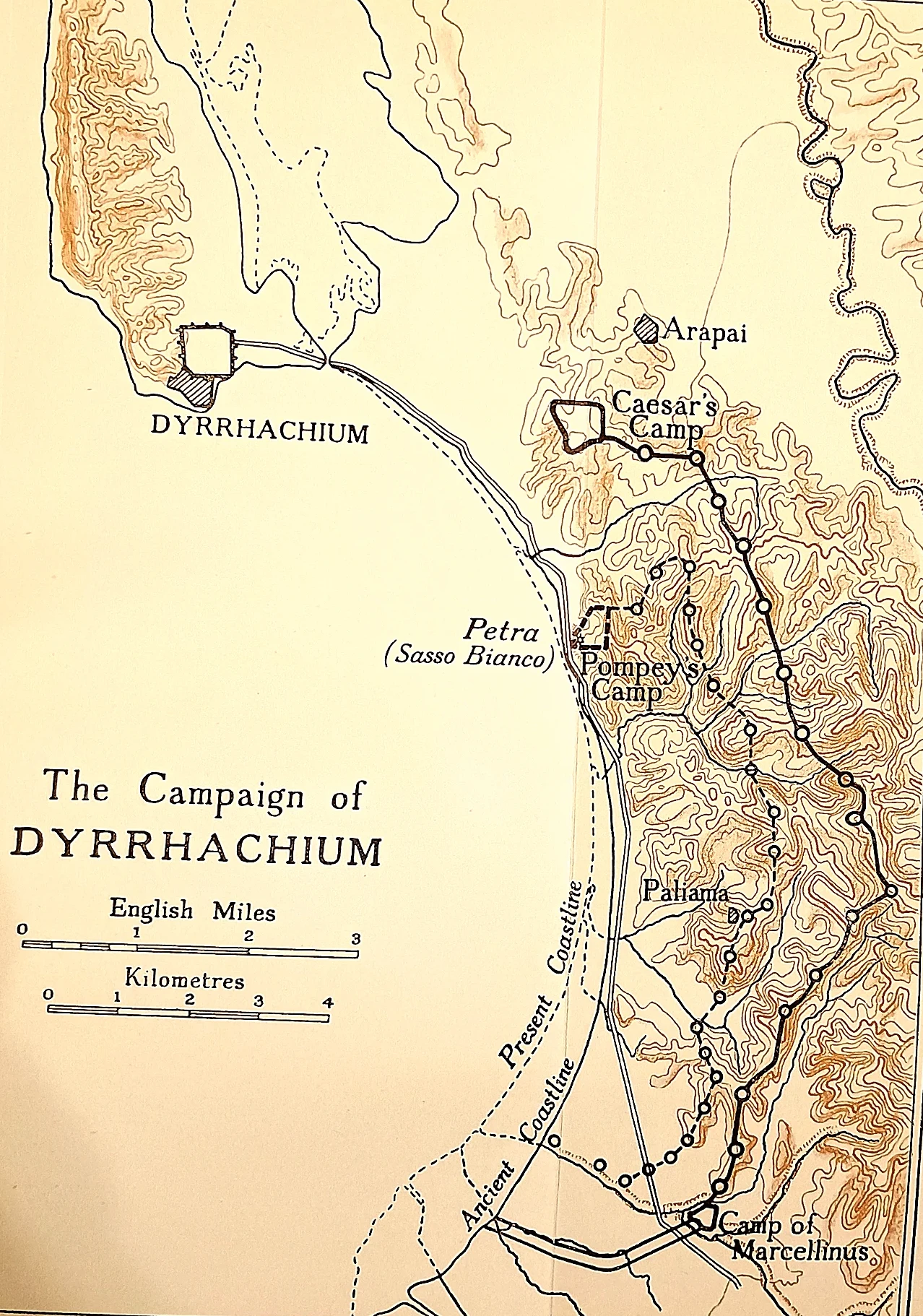
Dyrrhachium to Pharsalus. Caesar crossed to Dyrrhachium on the Illyrian coast at the left of the sheet, was beaten there in the siege lines, and broke inland along the Via Egnatia into Thessaly.
 CAH plate
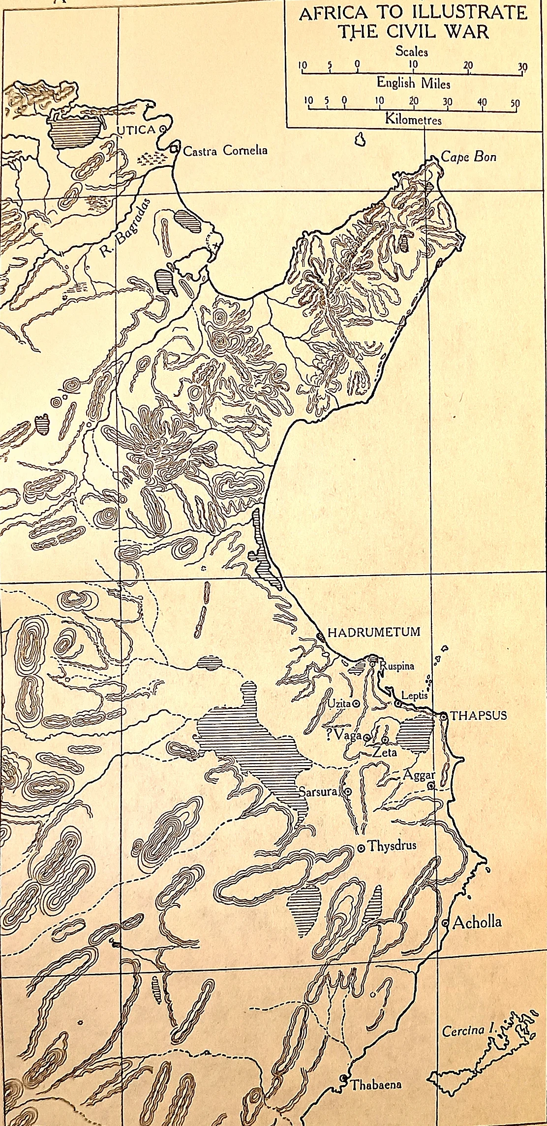
The African campaign, close up. Caesar landed near Hadrumetum with too few men, was pinned at Ruspina, and spent months building up before forcing the issue outside Thapsus in April 46 B.C.
 CAH plate
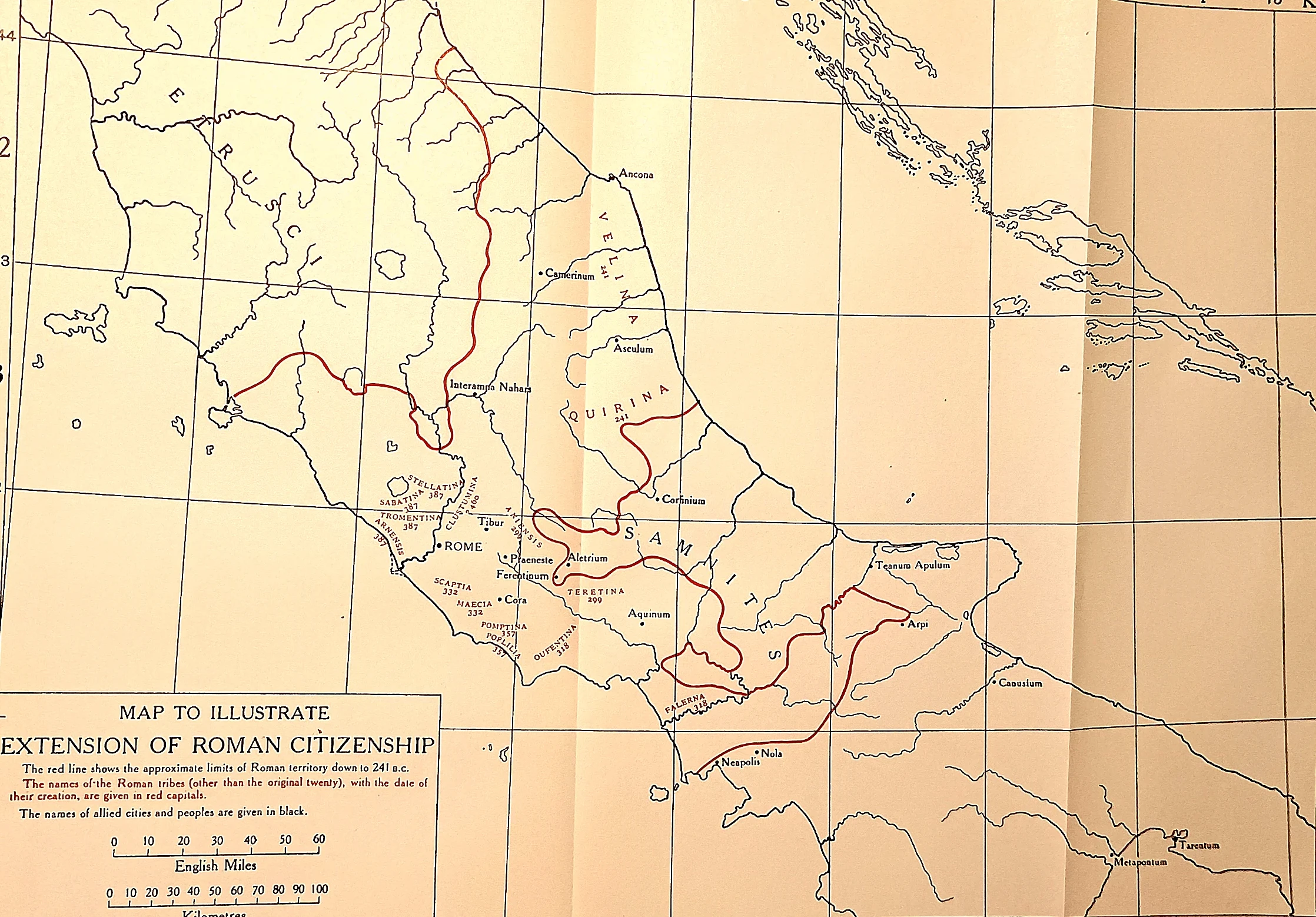
The rim cut, the spokes kept. The red line on the plate is the limit of Roman territory proper; inside it the names of the voting tribes, each with the date of its creation; outside it, in black, the allied cities and peoples.
 CAH plate
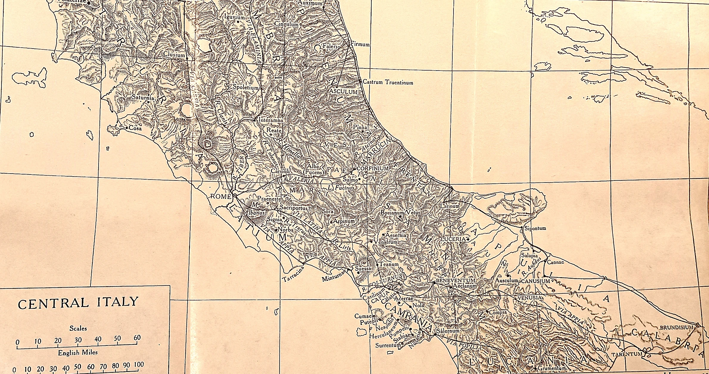
The Italy that took up arms. Asculum in Picenum, where the war began with a massacre; Corfinium in the Paelignian country, renamed Italica and made the rebels’ capital; and the Marsic, Vestine and Samnite highlands around them.
 CAH plate
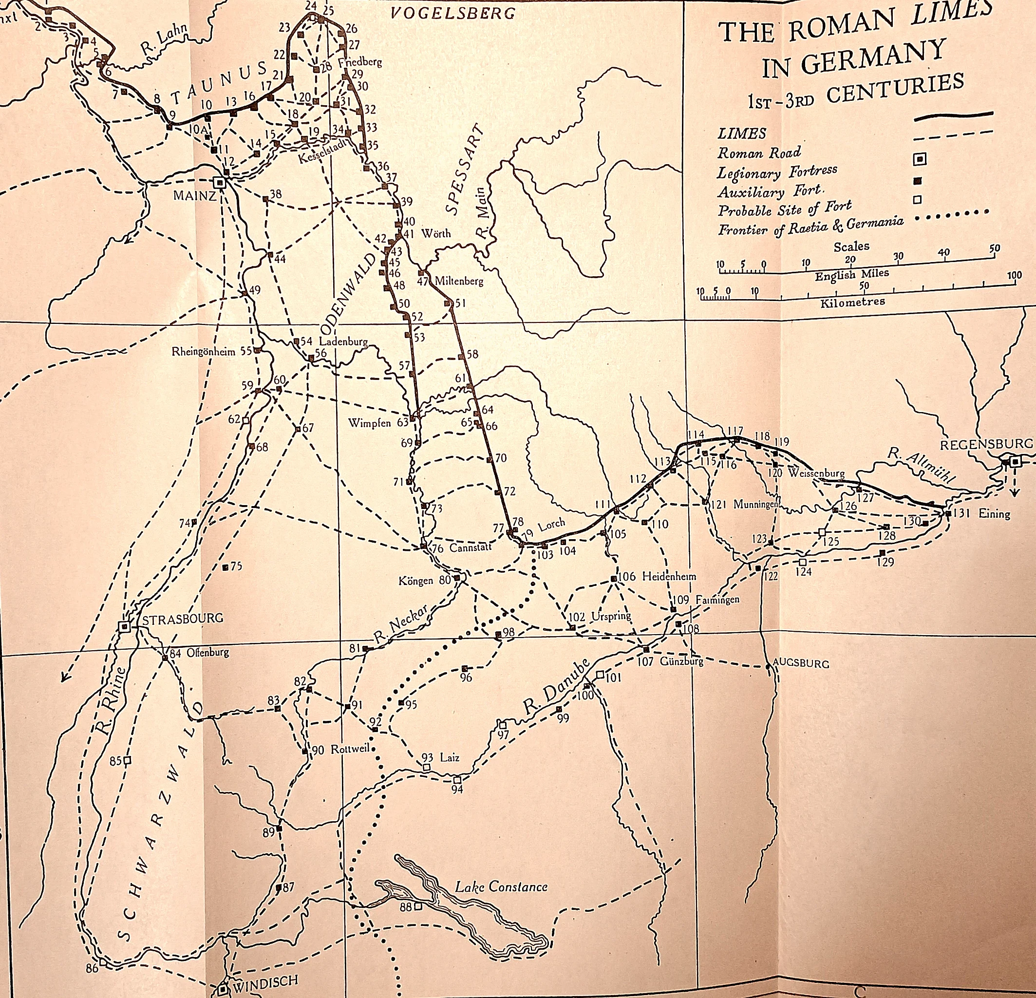
A frontier as a public work.
 CAH plate
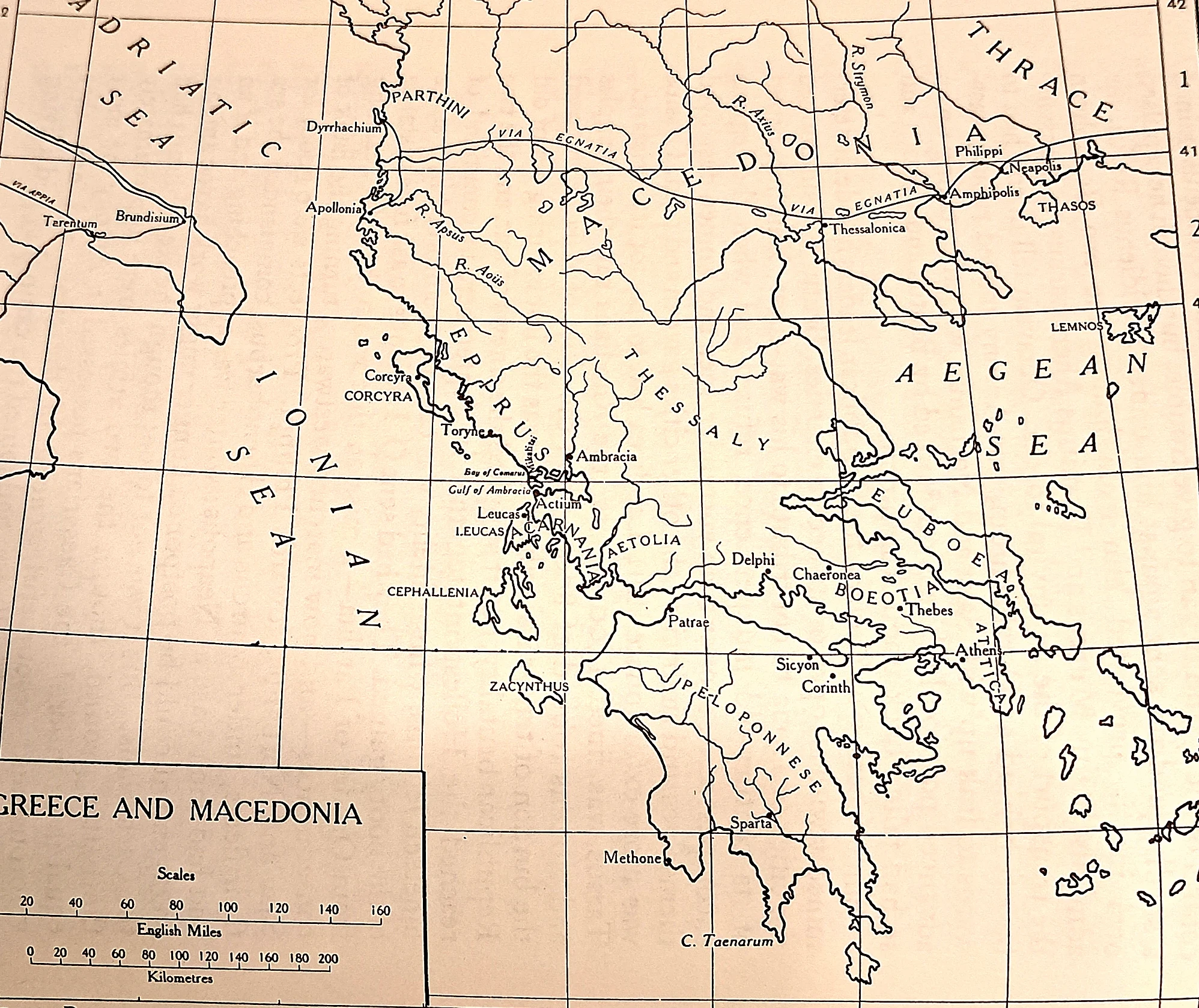
The road both wars were fought along. The Via Egnatia runs across the sheet from Dyrrhachium and Apollonia on the Adriatic to Thessalonica, Amphipolis and Philippi near the Aegean. Philippi in 42 B.C.
 CAH plate
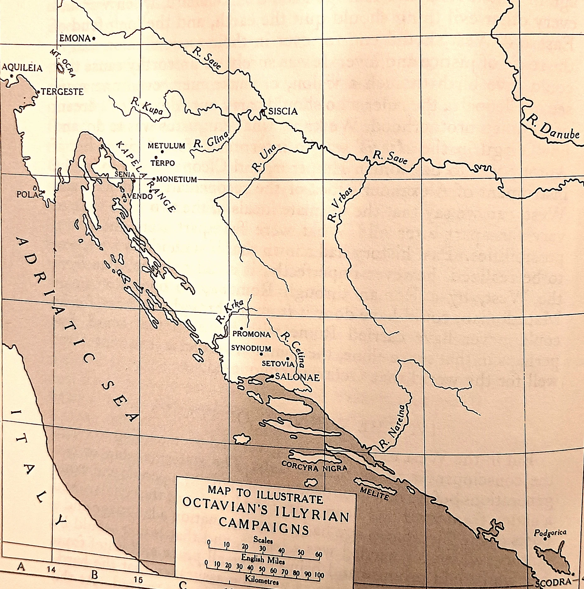
Where Octavian learned to be a general.
 CAH plate
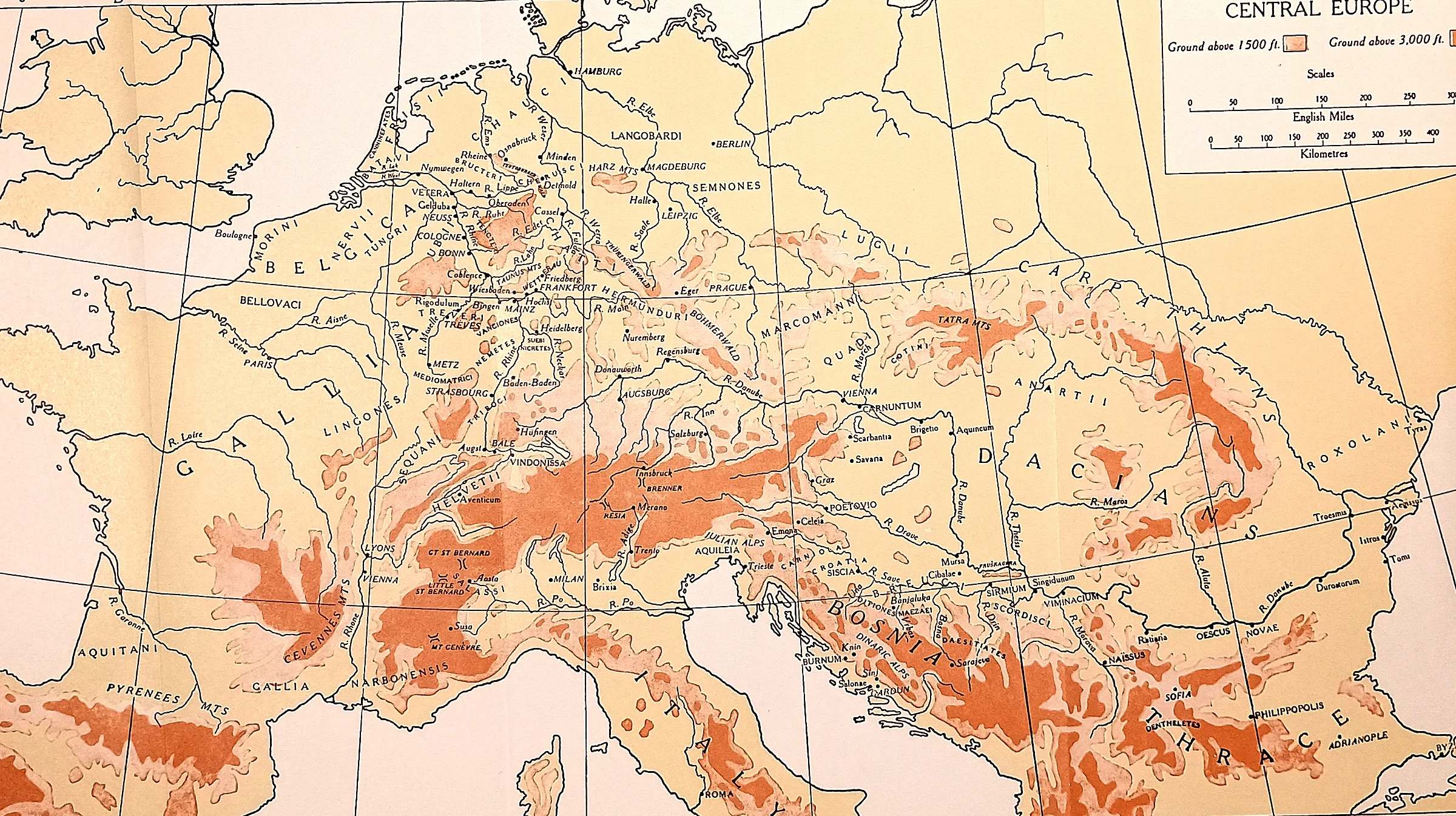
What the stepsons conquered. The relief explains the strategy.
 CAH plate
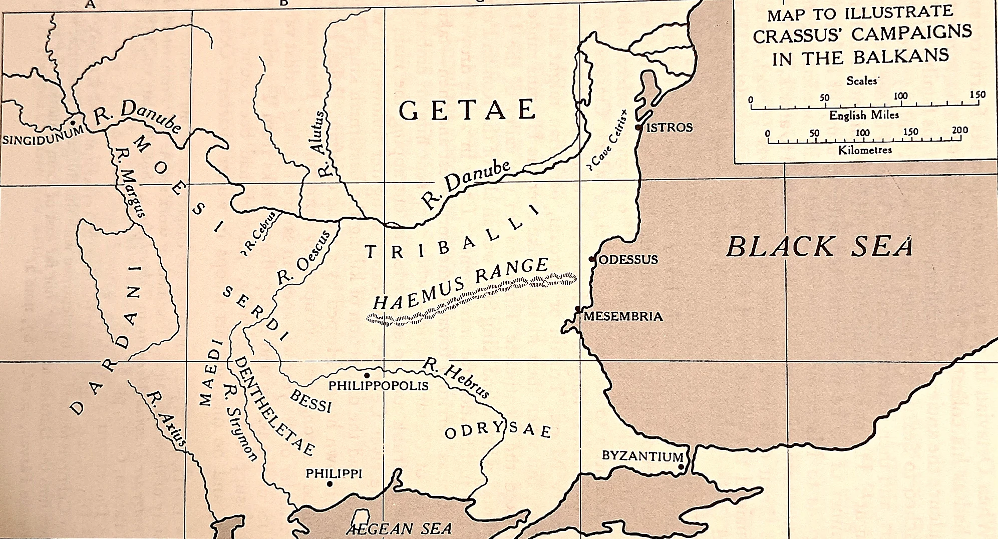
The first Roman push to the lower Danube. M. Licinius Crassus, grandson of the triumvir, campaigned against the Bastarnae, Moesi and Getae between the Haemus range and the Danube in 29–28 B.C.
 CAH plate
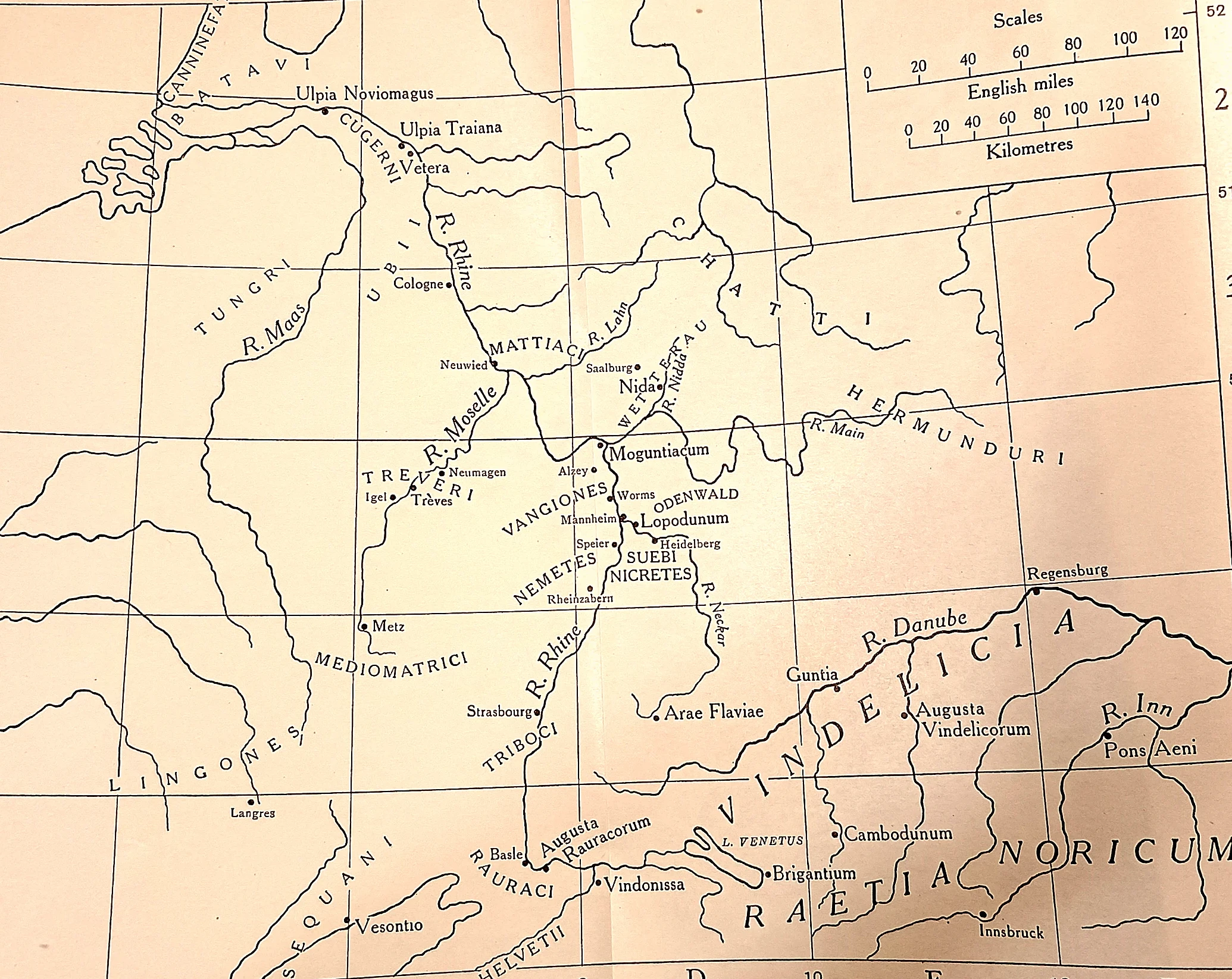
Eight legions on one river.
 CAH plate
The province Claudius made. Camulodunum, the Trinovantian capital taken in A.D.
 CAH plate
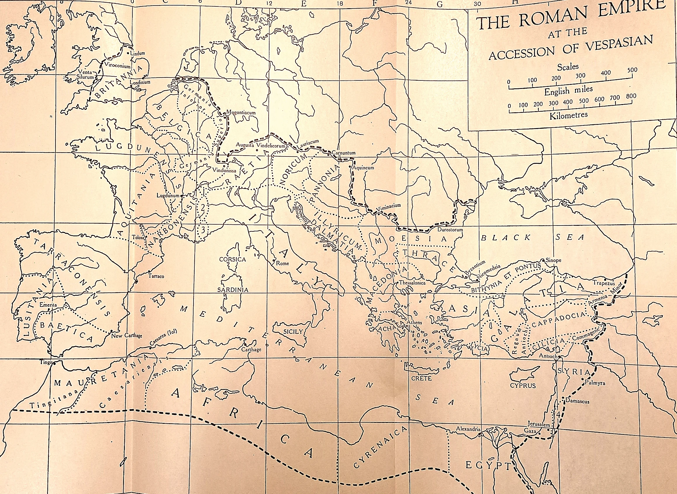
The whole of what was at stake. The provinces as Vespasian found them: Britain and the three Gauls, the Rhine and Danube commands, Spain and Africa, the eastern arc from Asia to Syria and Egypt.
 CAH plate
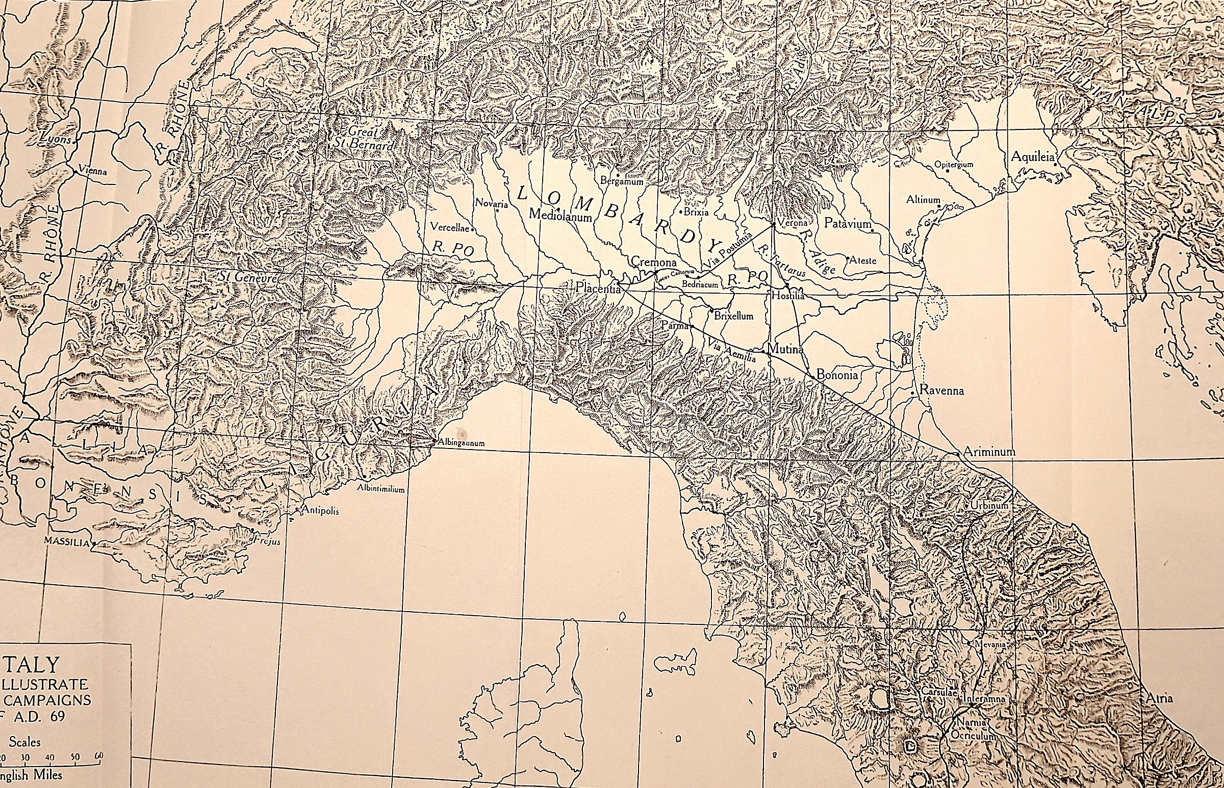
Where the four emperors were decided. Not in Rome: at Bedriacum, on the road between Cremona and Mantua in the middle of this sheet, twice in one year.
 CAH plate
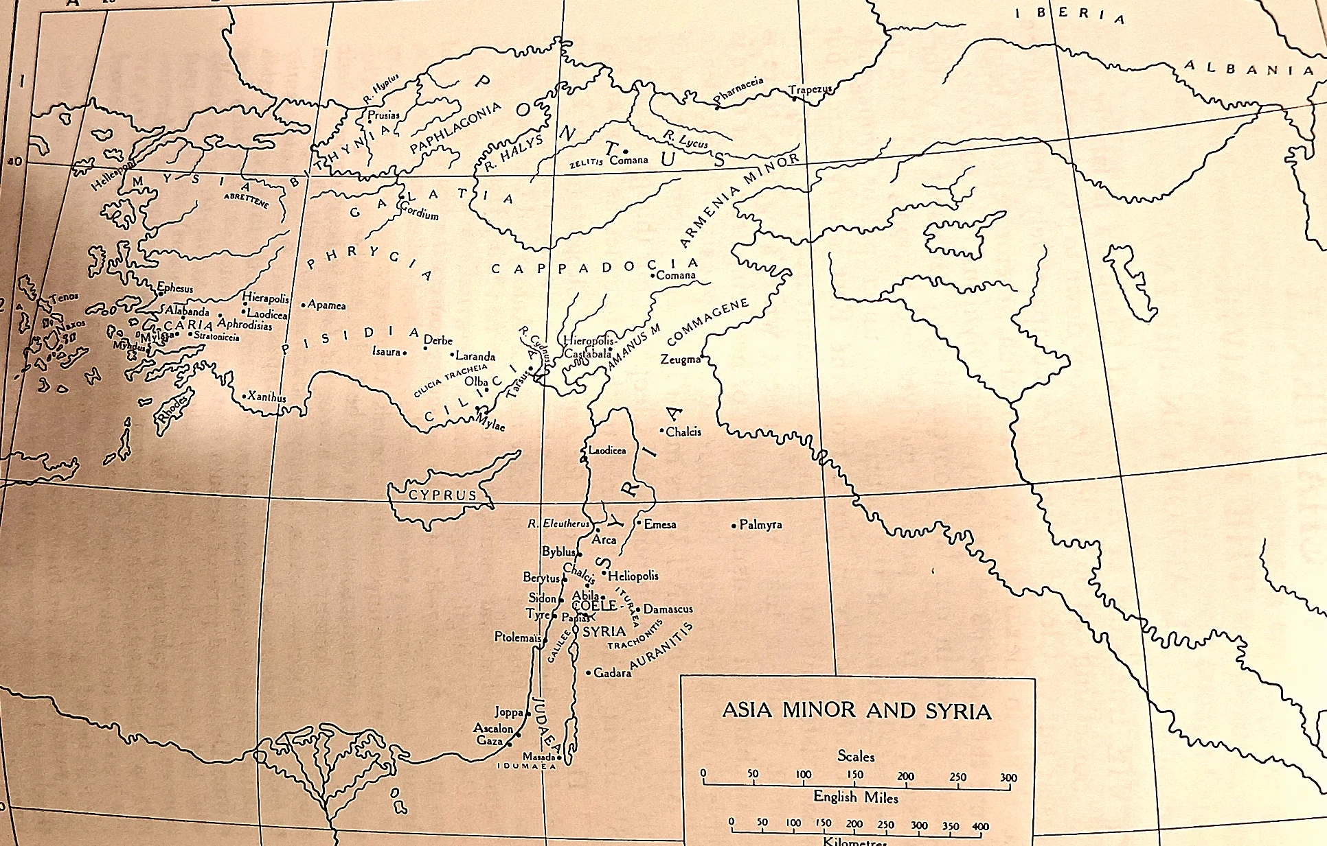
Judaea inside a larger settlement. Pompey was not campaigning in Judaea; he was reorganising the whole eastern seaboard from Cilicia to the Nabataean desert.
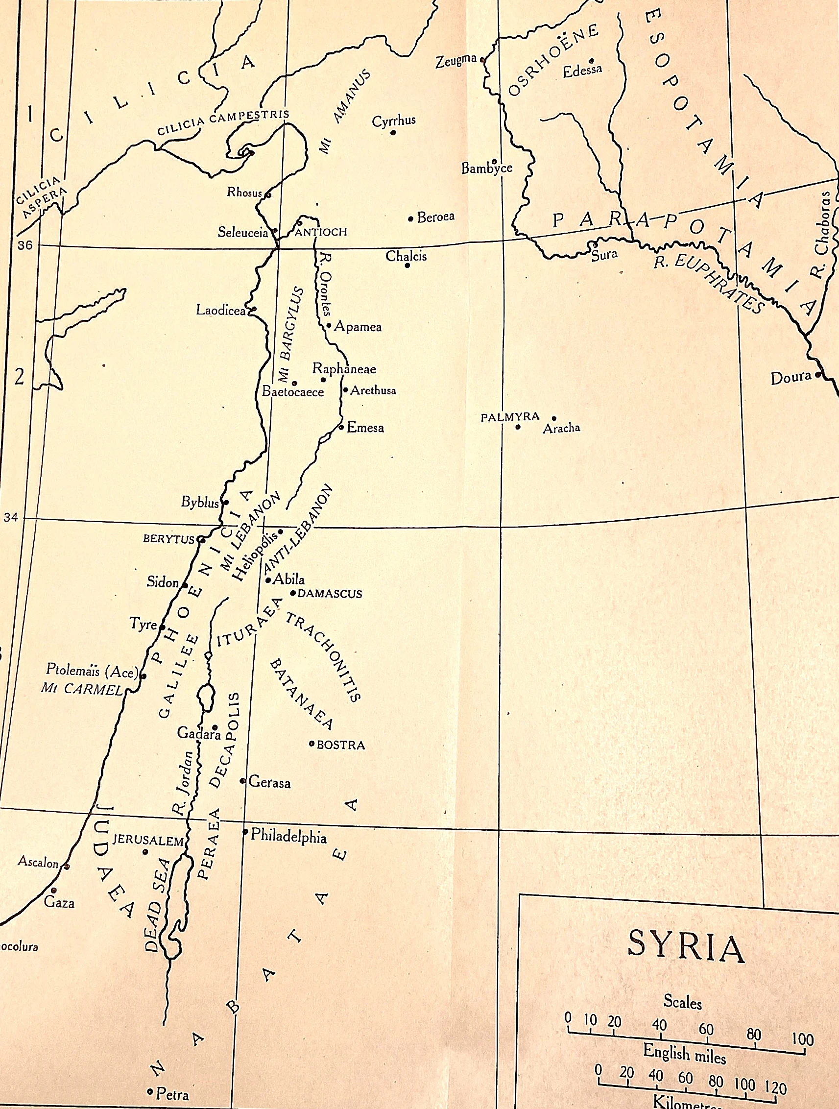 CAH plate
The neighbourhood of a client kingdom.
 CAH plate
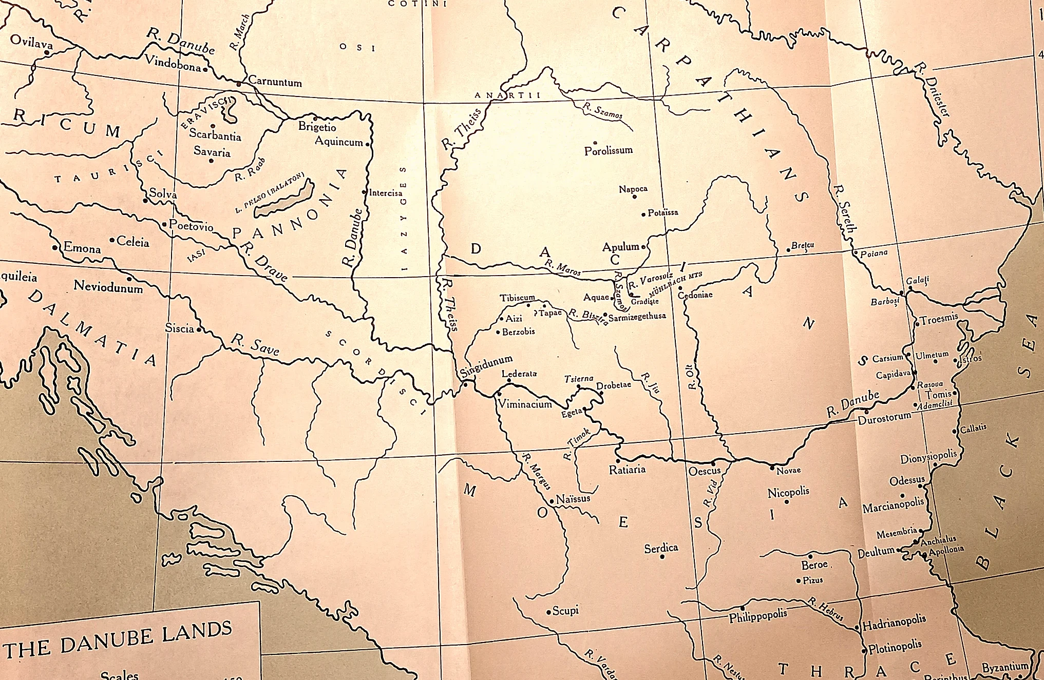
The whole Danube front. Carnuntum, Aquincum and Viminacium on the river at the left, the Iron Gates below them, and inside the Carpathian arc the Dacian heartland with Sarmizegethusa in the mountains.
 CAH plate
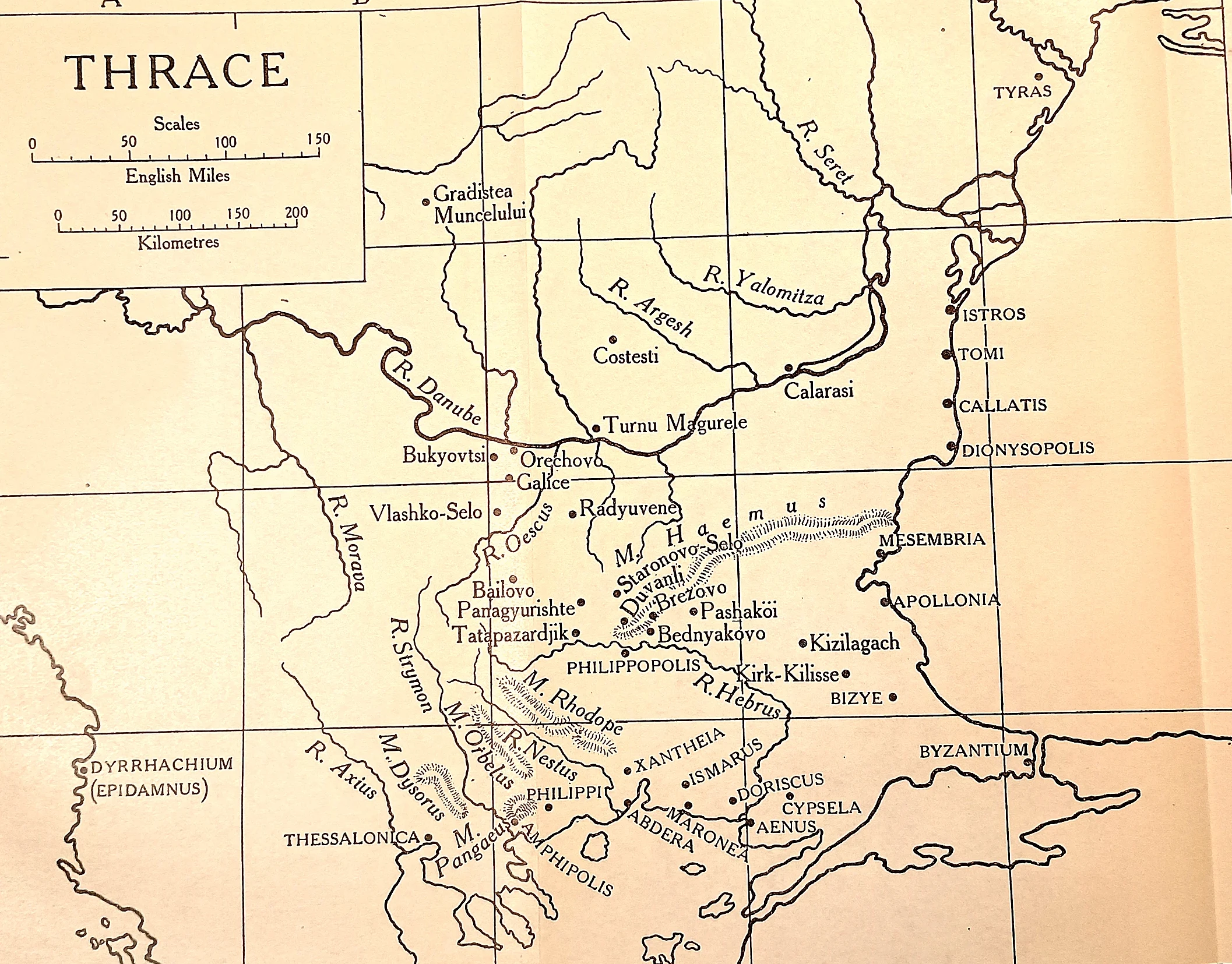
The whole of this episode on one sheet. The Greek colonies stand in capitals along the Black Sea coast — Istros, Tomi, Callatis, Apollonia, Mesambria — a rim of Hellenic settlement around an interior the Greeks described but did not hold.
 CAH plate
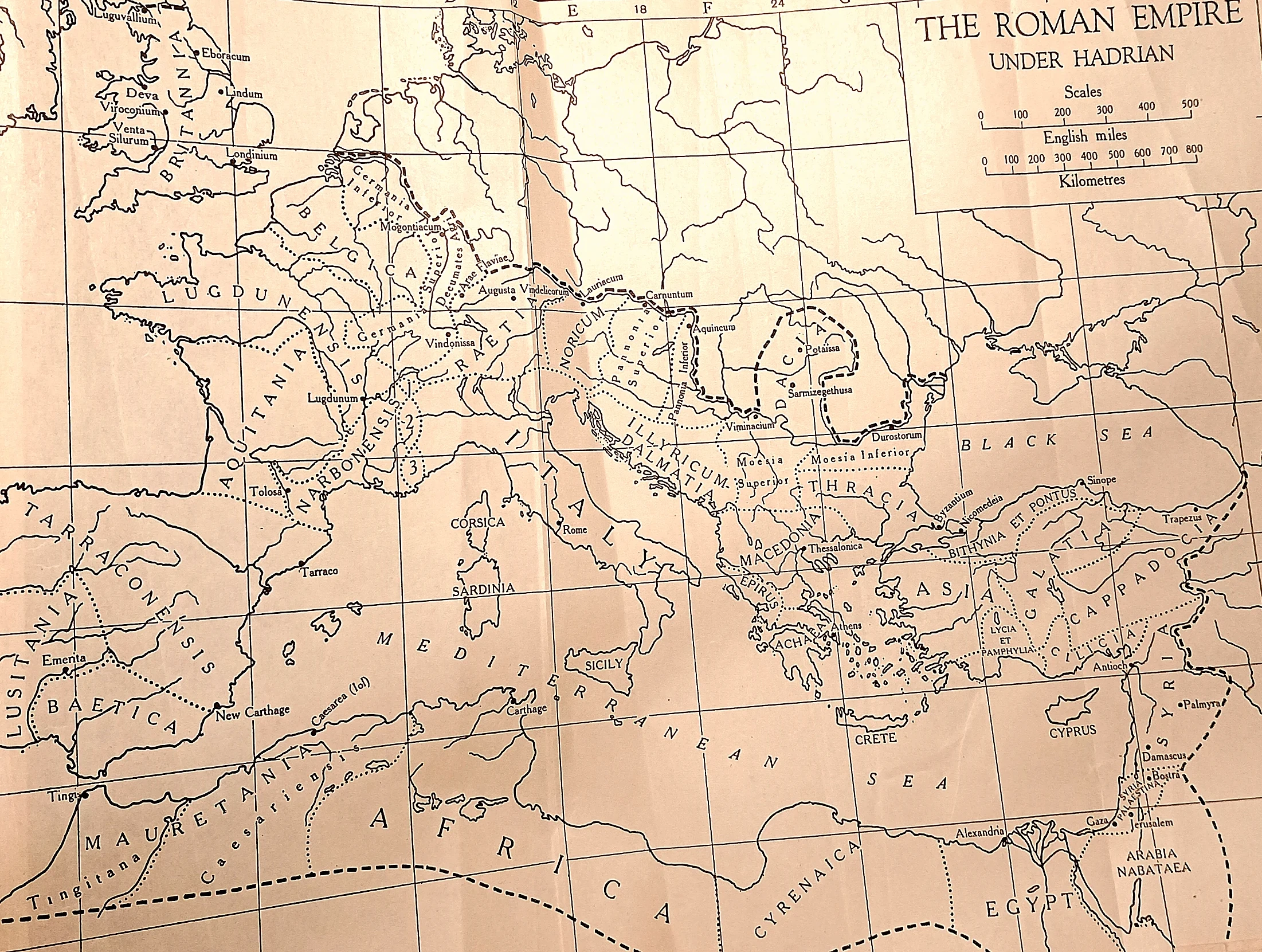
The inheritance Antoninus governed by letter. Hadrian’s settled empire: Britain behind its wall, the Rhine and Danube behind the limes, Dacia held out beyond the river, and in the east a frontier drawn back to the Euphrates.
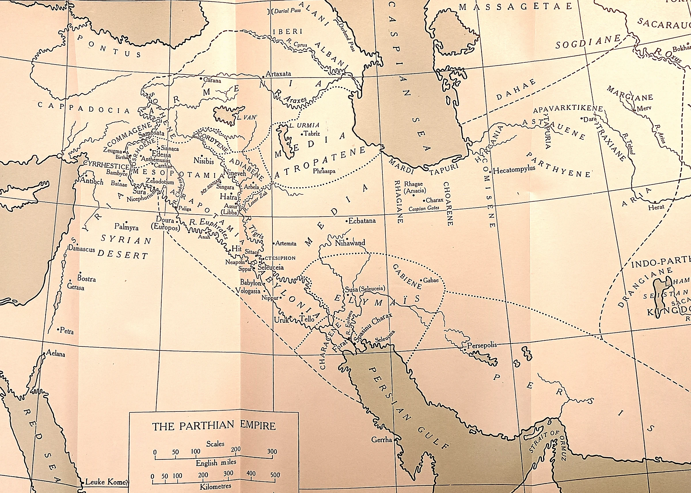 CAH plate
The war that brought home the plague. Armenia at the top left, where Vologases put his own king and a Roman legion was destroyed at Elegeia; then the Euphrates line down to Seleucia and Ctesiphon, which Avidius Cassius sacked in 165.
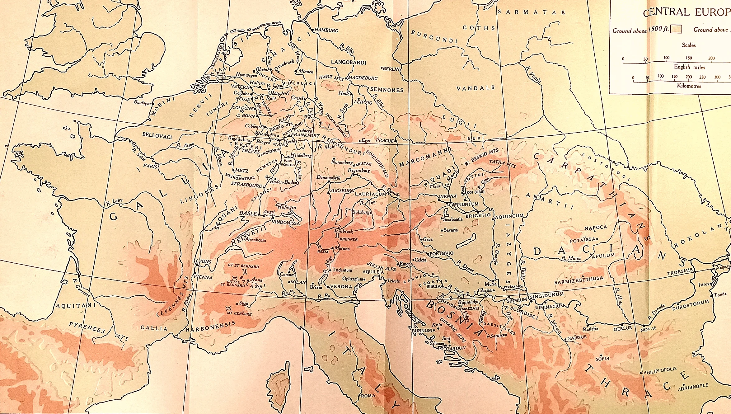 CAH plate
Bohemia, and the road to Aquileia.
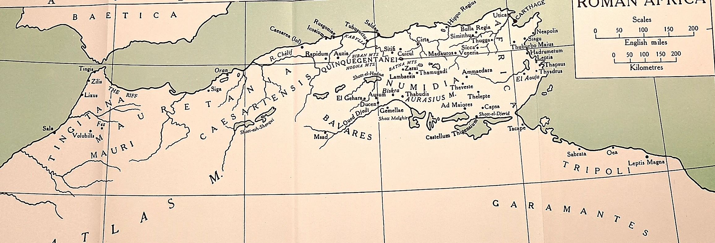 CAH plate
Where the new dynasty came from.
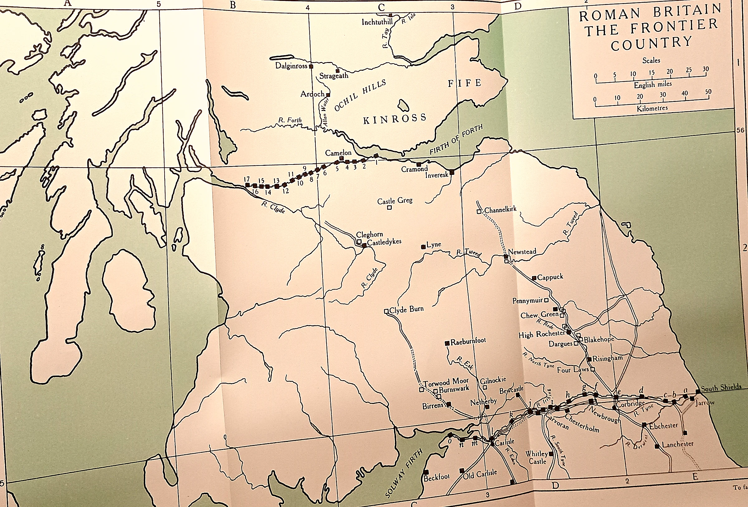 CAH plate
Two walls and the country between.
 CAH plate
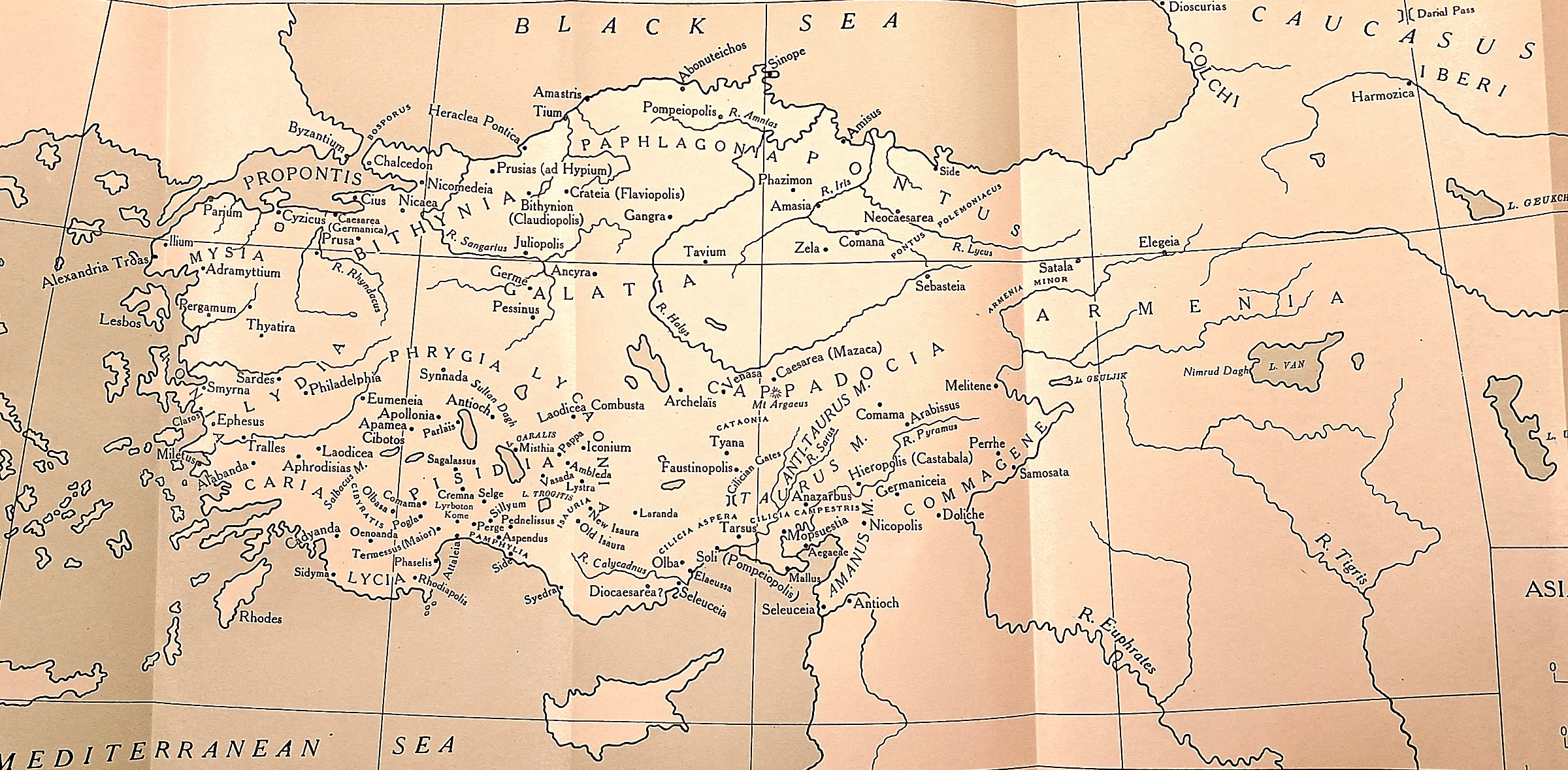
The country of the letters. Ephesus and the cities addressed in Revelation stood within the connected world of Roman Asia Minor; Colossae lay inland, and Tarsus beneath the Taurus.
 CAH plate
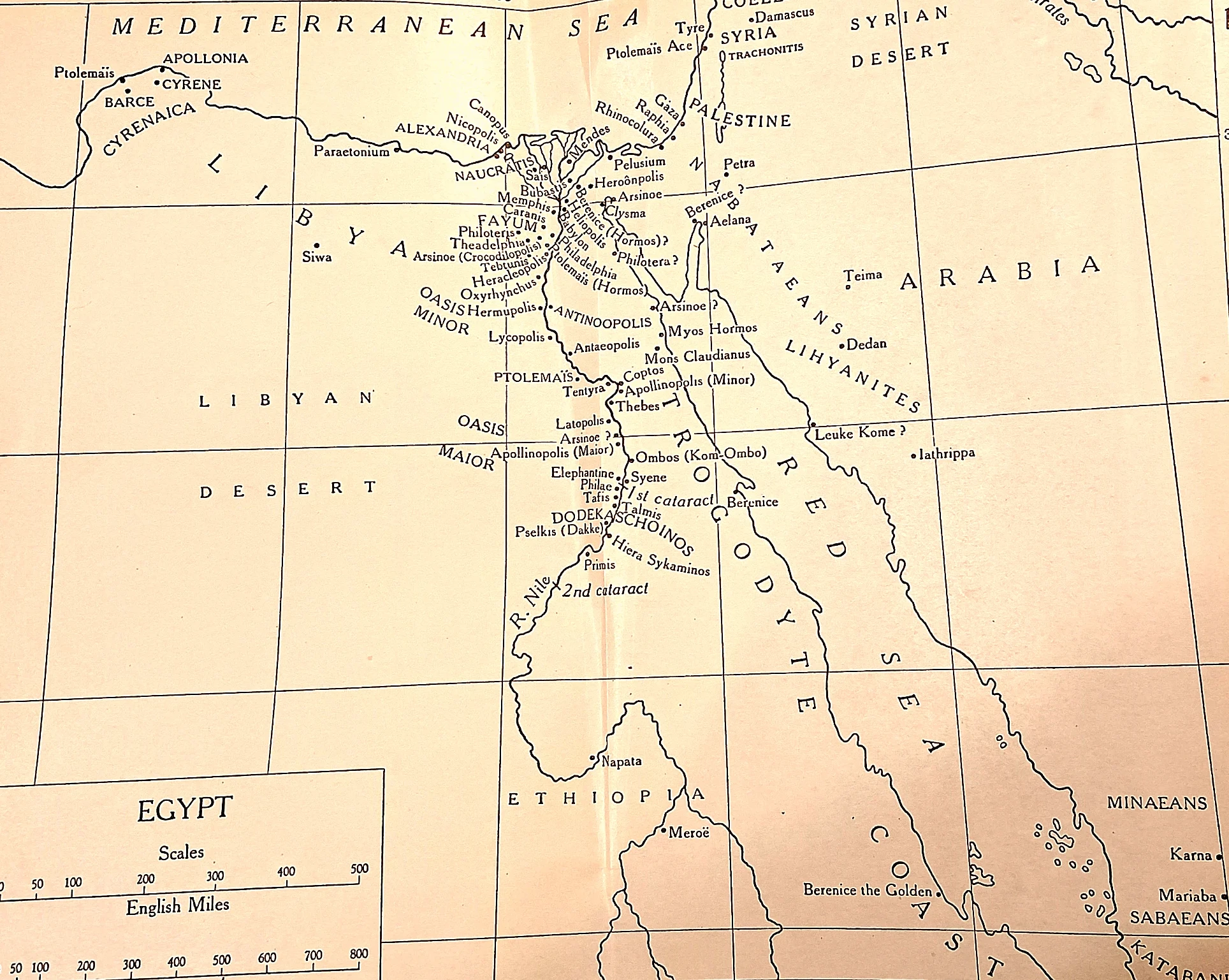
Alexandria and the river behind it.
 CAH plate
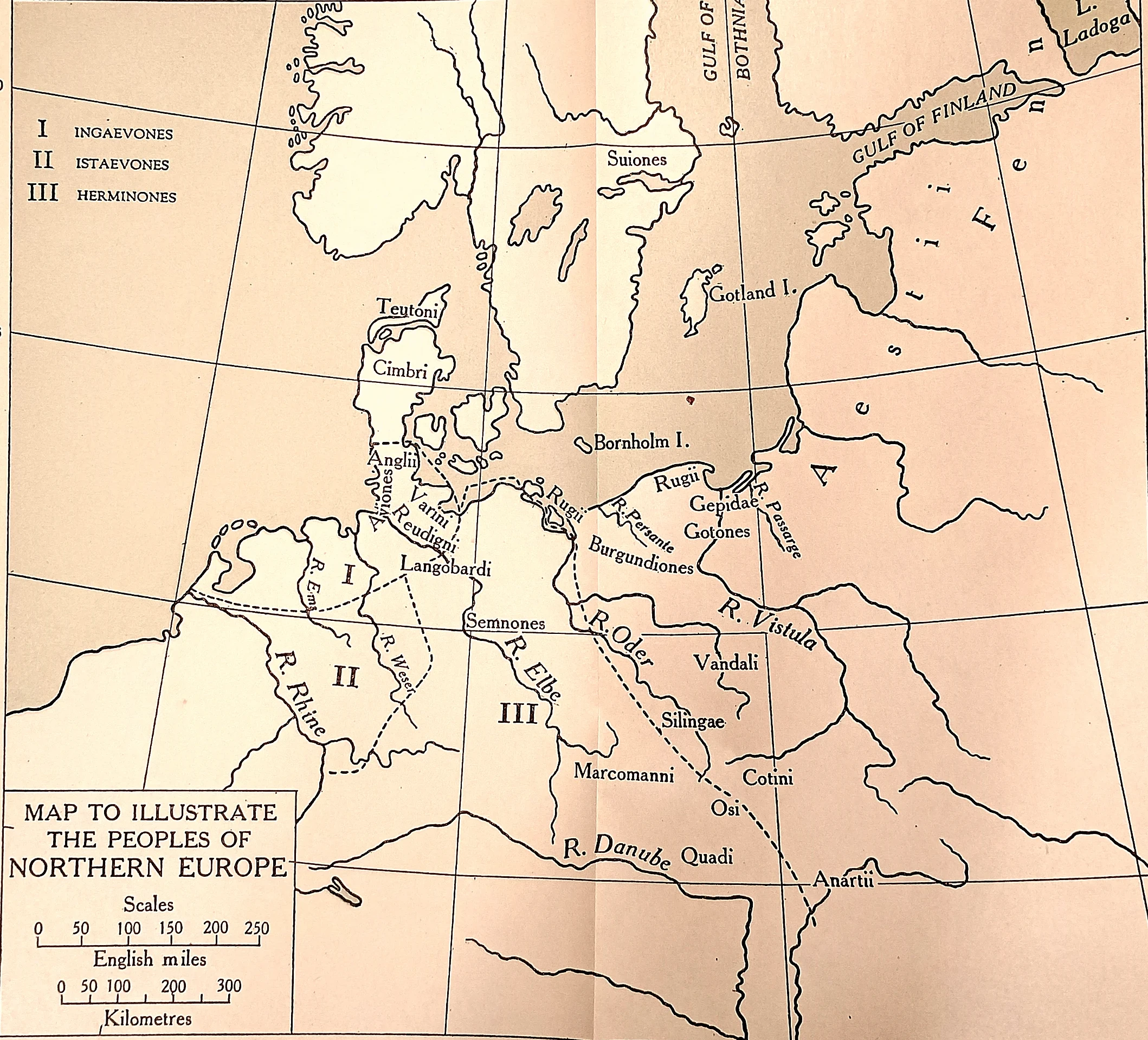
Who was on the other side.
 CAH plate
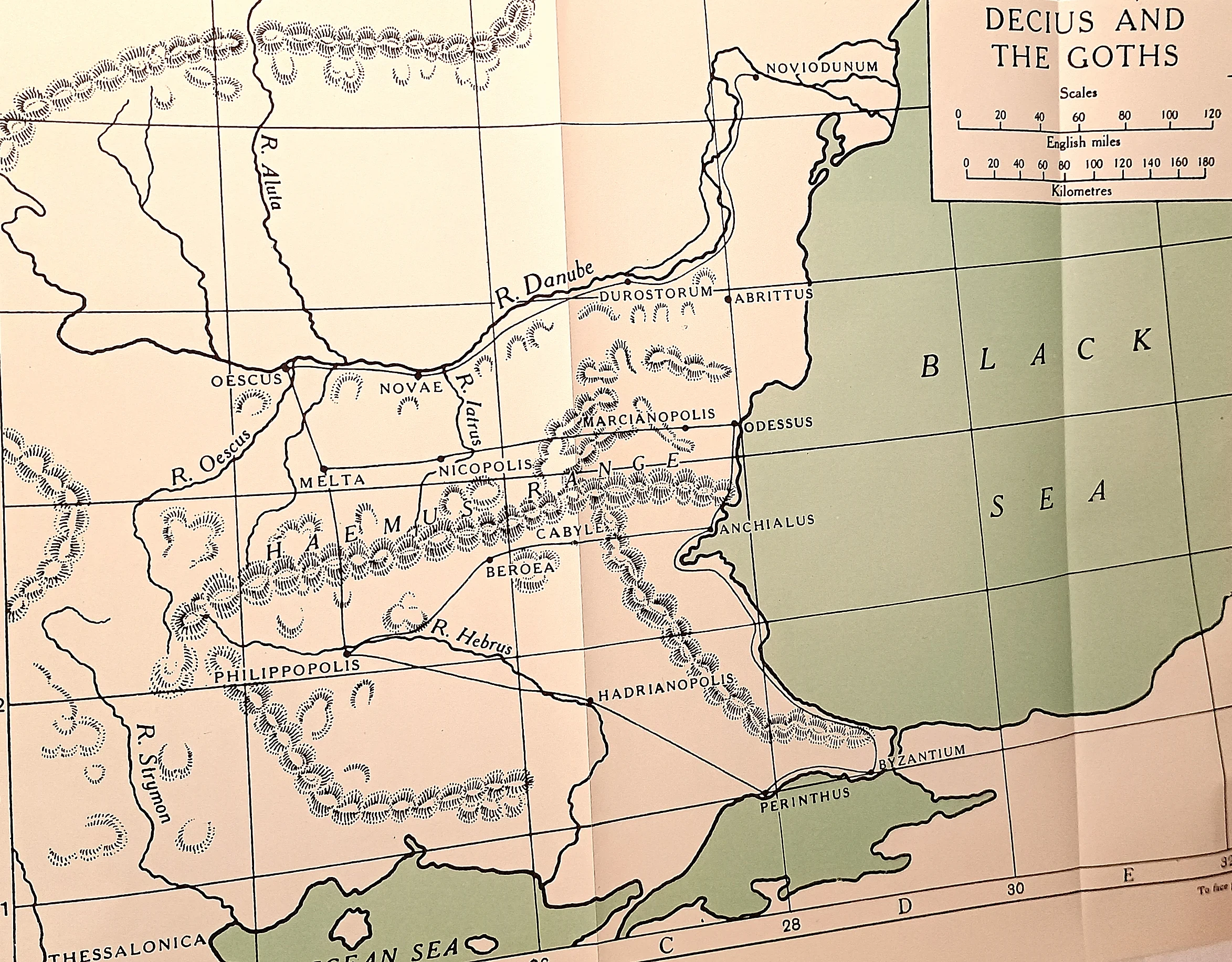
The ground of Abrittus. The Danube at the top, the Haemus range across the middle with its passes, and between them the Moesian and Thracian cities the Goths plundered.
 CAH plate
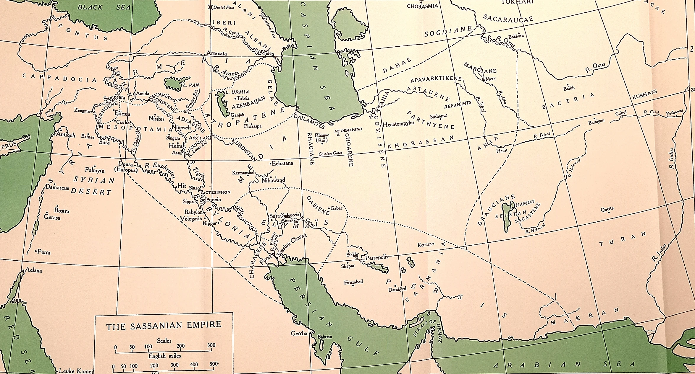
A different kind of enemy. Ardashir’s and Shapur’s Persia was not the loose Parthian confederation it replaced: a centralised court at Ctesiphon, a state religion, and a claim to everything the Achaemenids had held.
 CAH plate
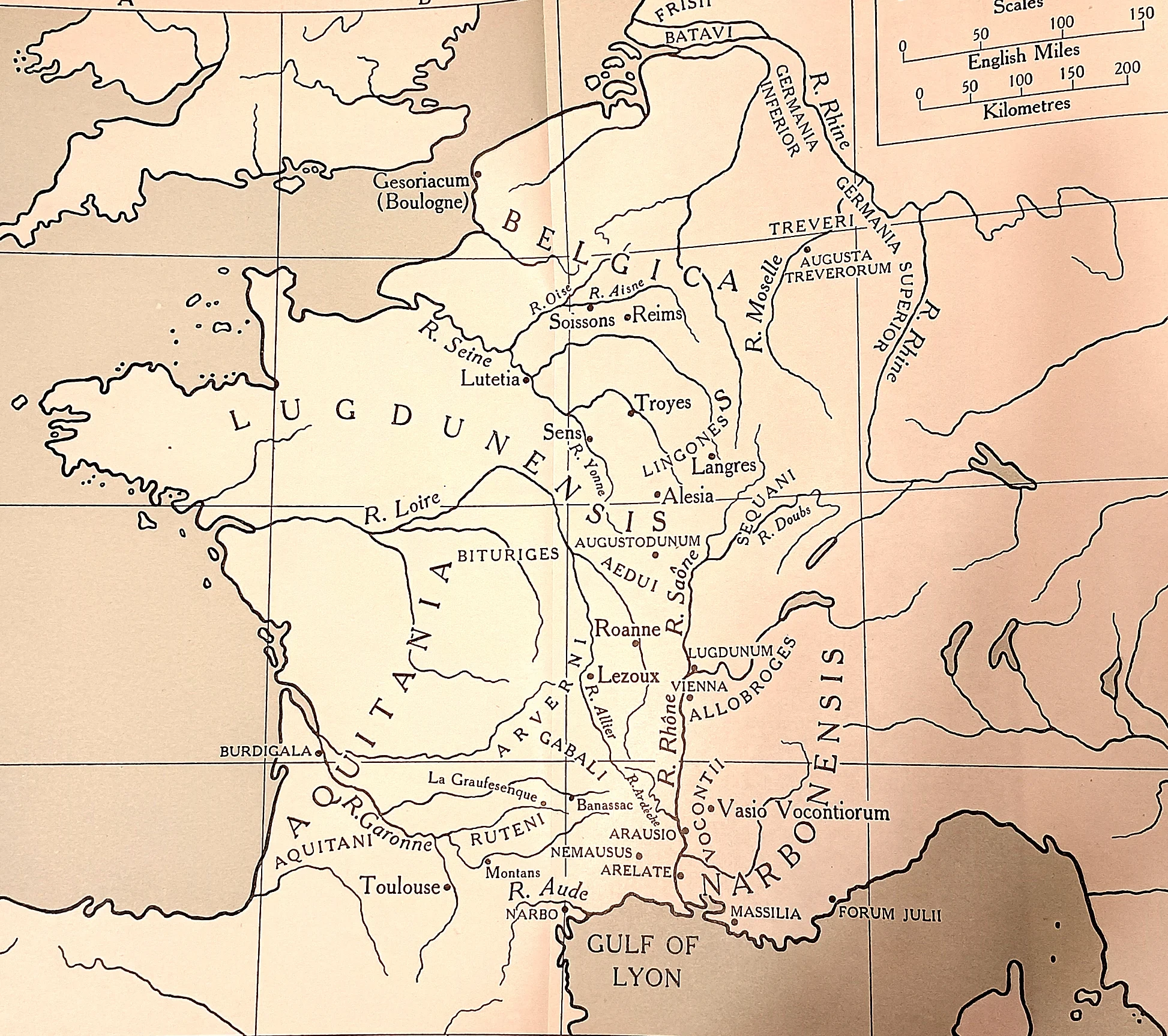
The empire that broke off in the west. Postumus ruled Gaul, the Germanies, Britain and for a time Spain for ten years, with his own consuls and coinage, from Colonia Agrippinensis and Augusta Treverorum on the right of this sheet.
 CAH plate
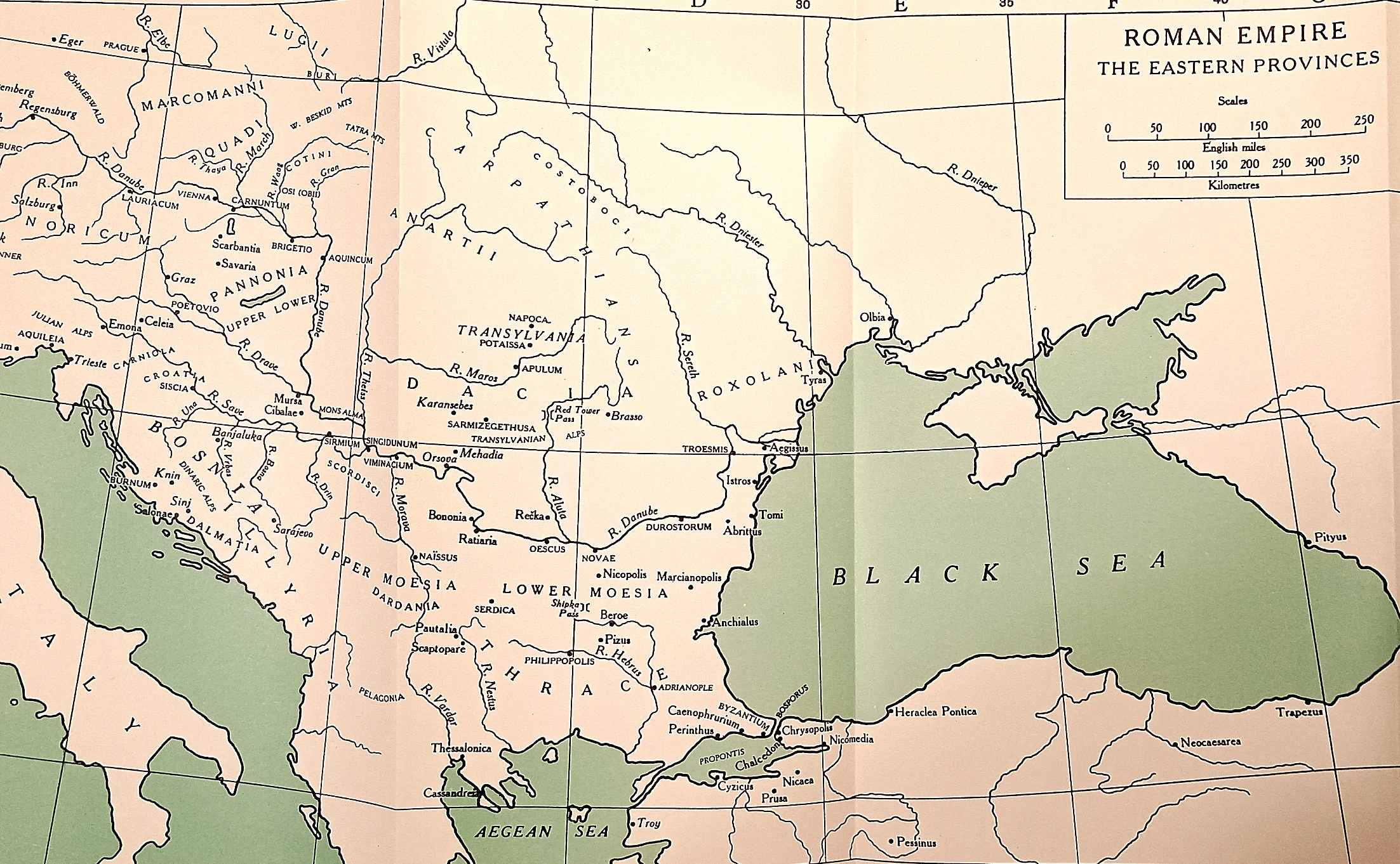
The Danube, and what came over it. Dacia beyond the river, the two Moesias and Thrace below it, and the Black Sea coast the Gothic sea-raids came down.
 CAH plate
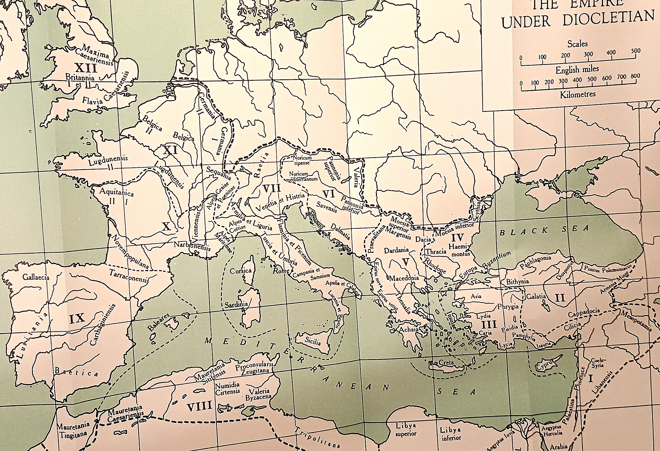
The new administrative map.
 CAH plate
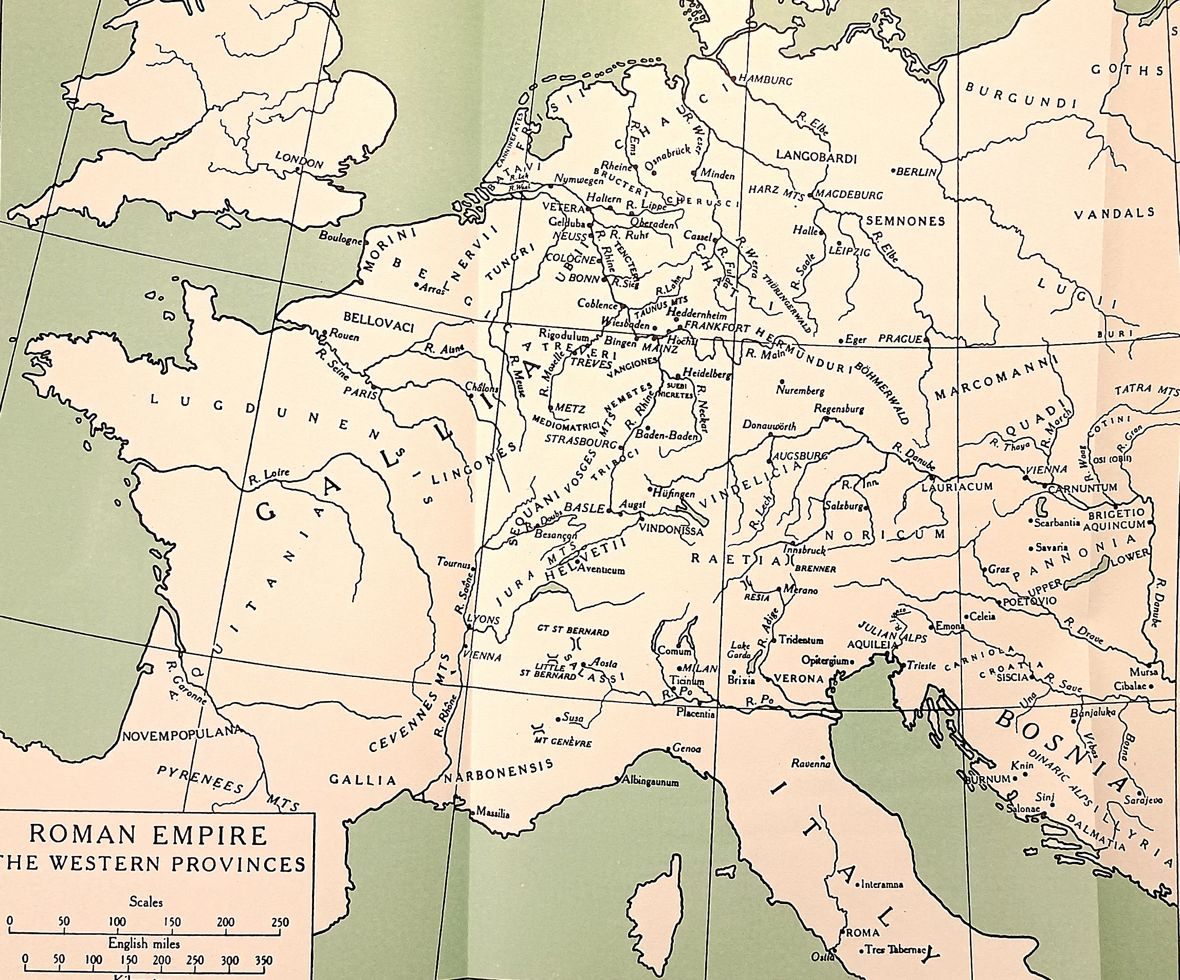
What was left to lose. Gaul, the Germanies, Raetia, Noricum, Pannonia and Italy, with the barbarian peoples named along the top of the sheet.
 CAH plate
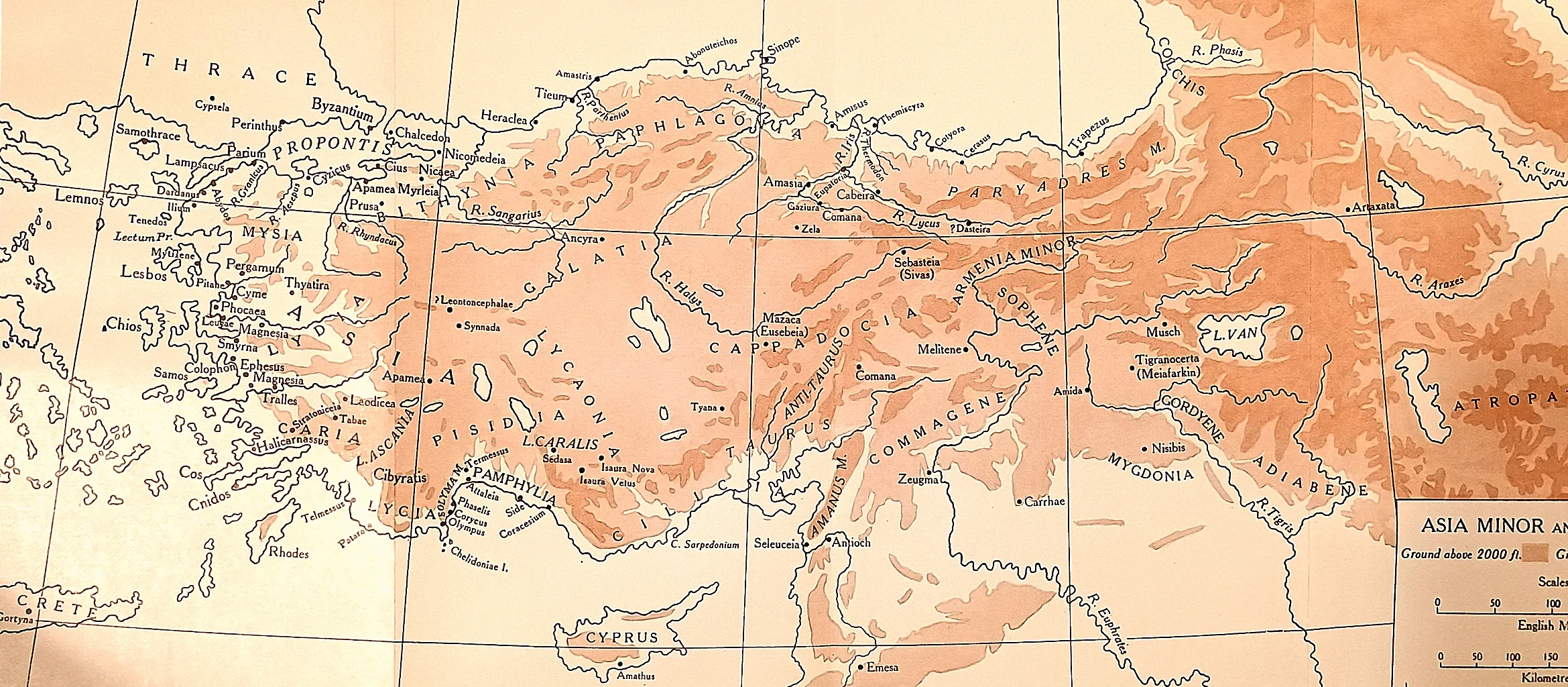
Relief plate of Anatolia with Pontus, Galatia and the Taurus.
 CAH plate
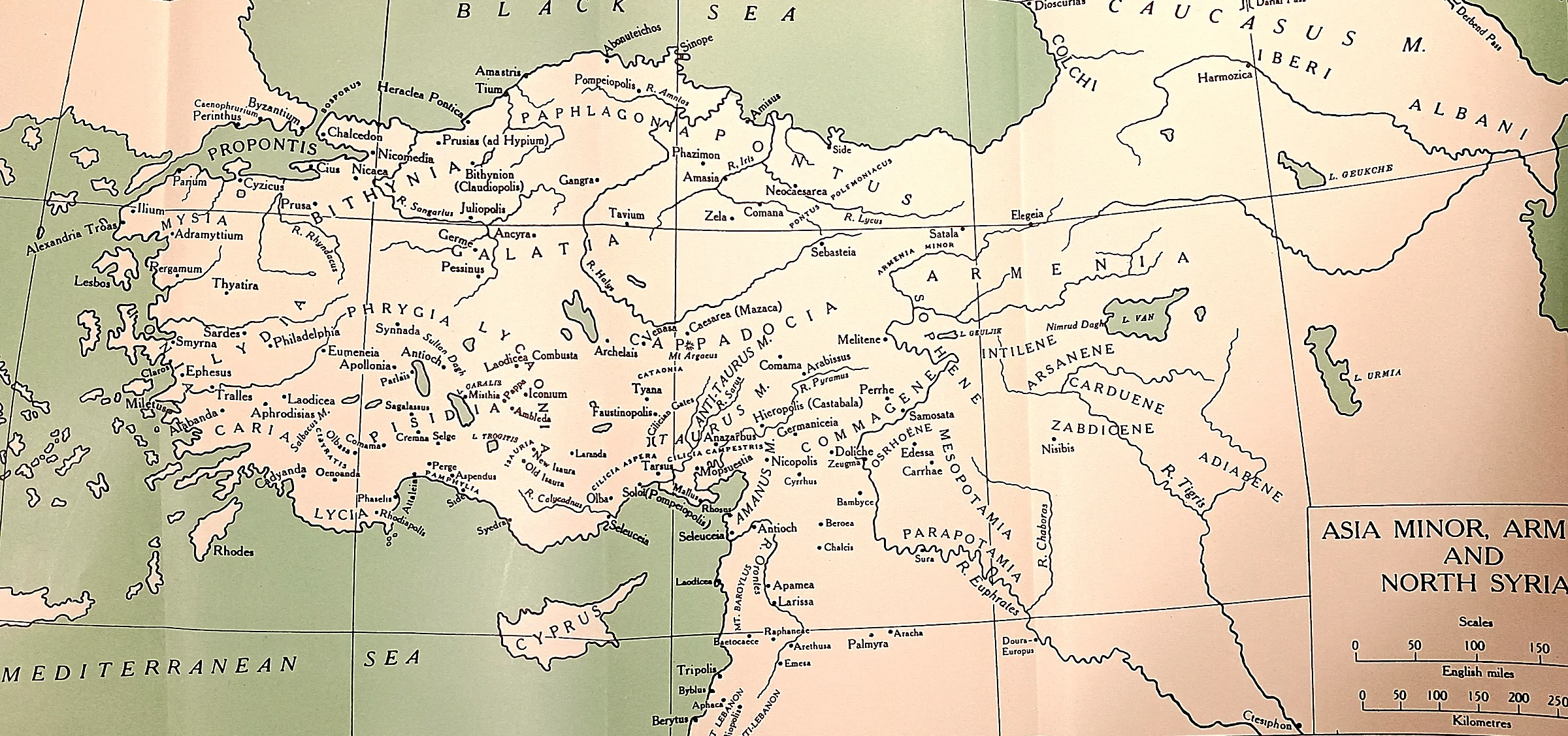
The eastern war zone from Cappadocia to Adiabene.
 CAH plate
Colour-restored version of the same plate.
 CAH plate
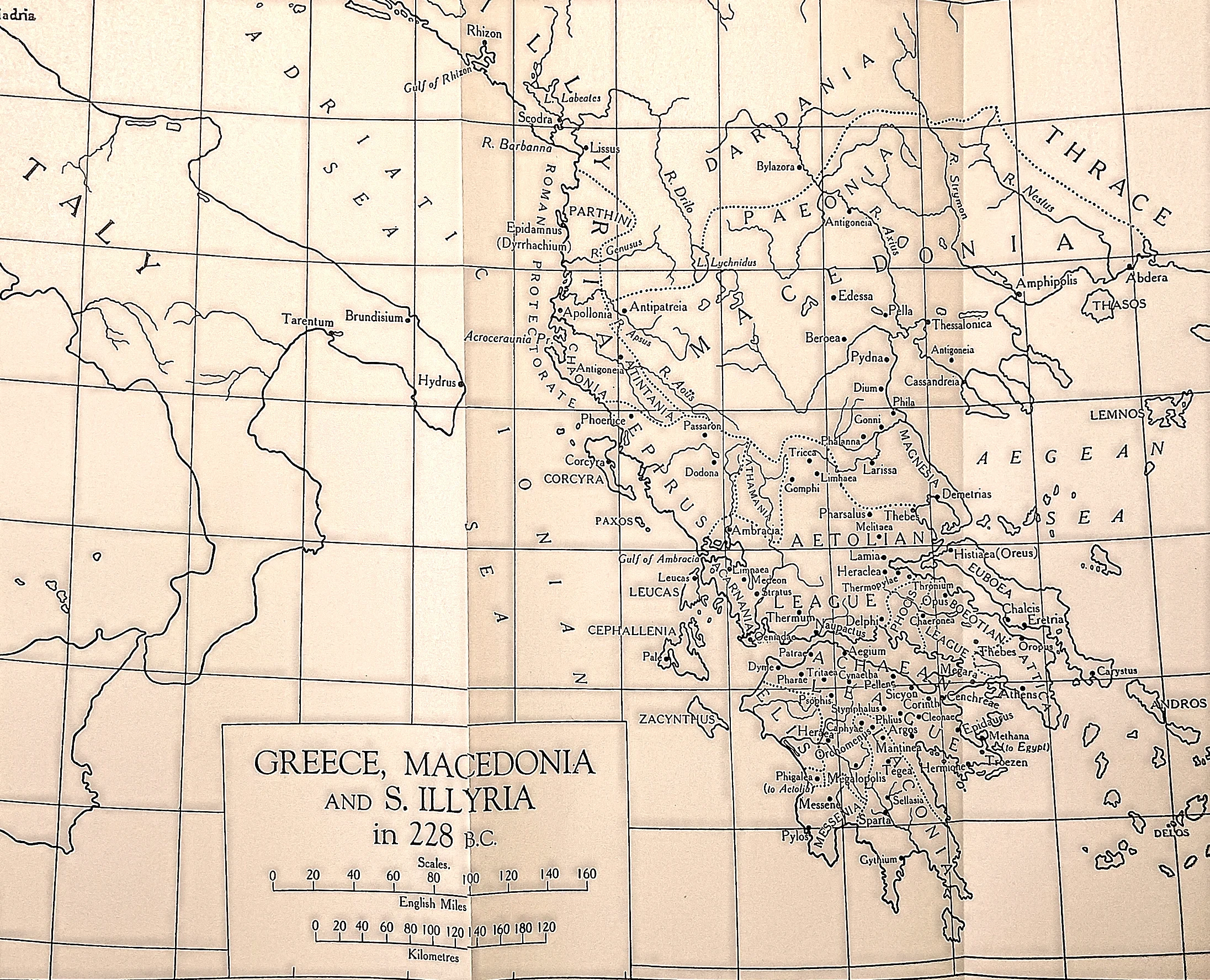
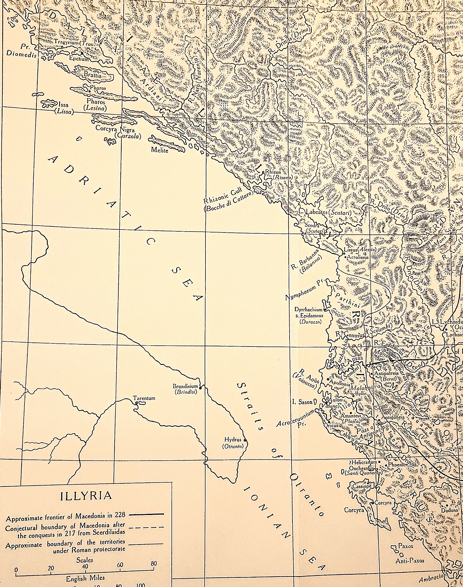
The Adriatic coast with Macedon's frontier and the Roman protectorate of 228 B.C.
 CAH plate
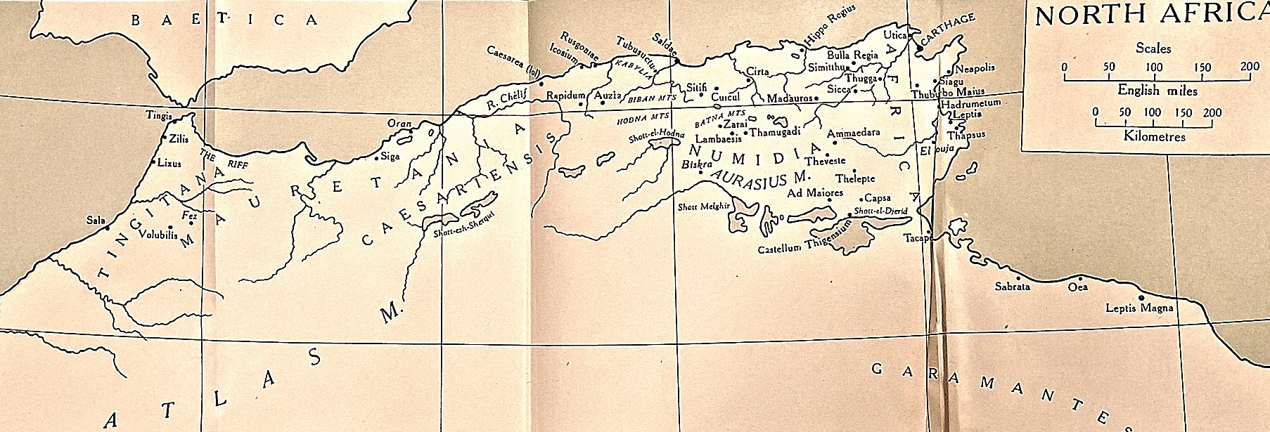
Africa Proconsularis, Numidia and the Mauretanias.
 CAH plate
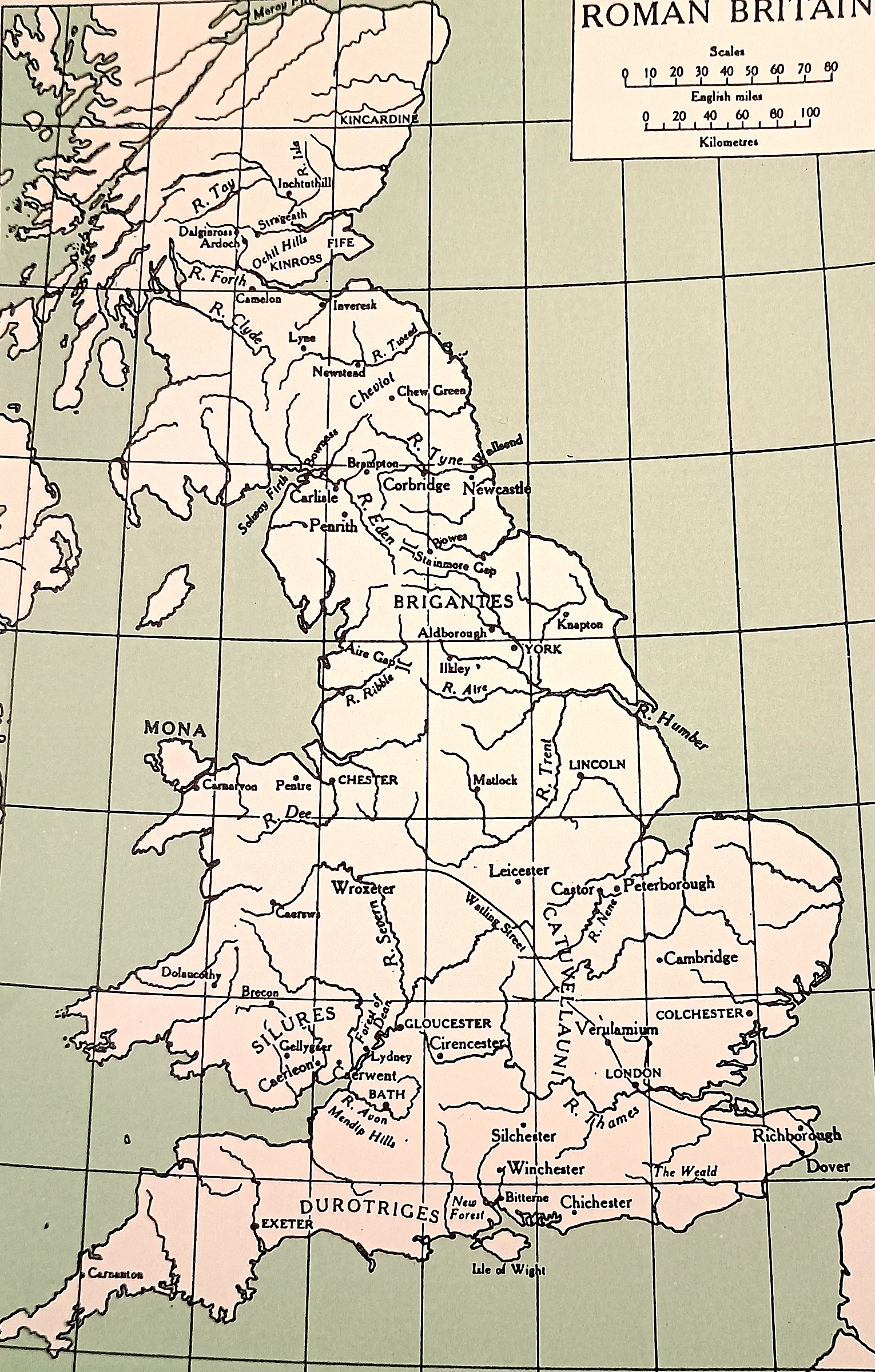
The province from the Channel to the Forth, with the tribal civitates.
 CAH plate
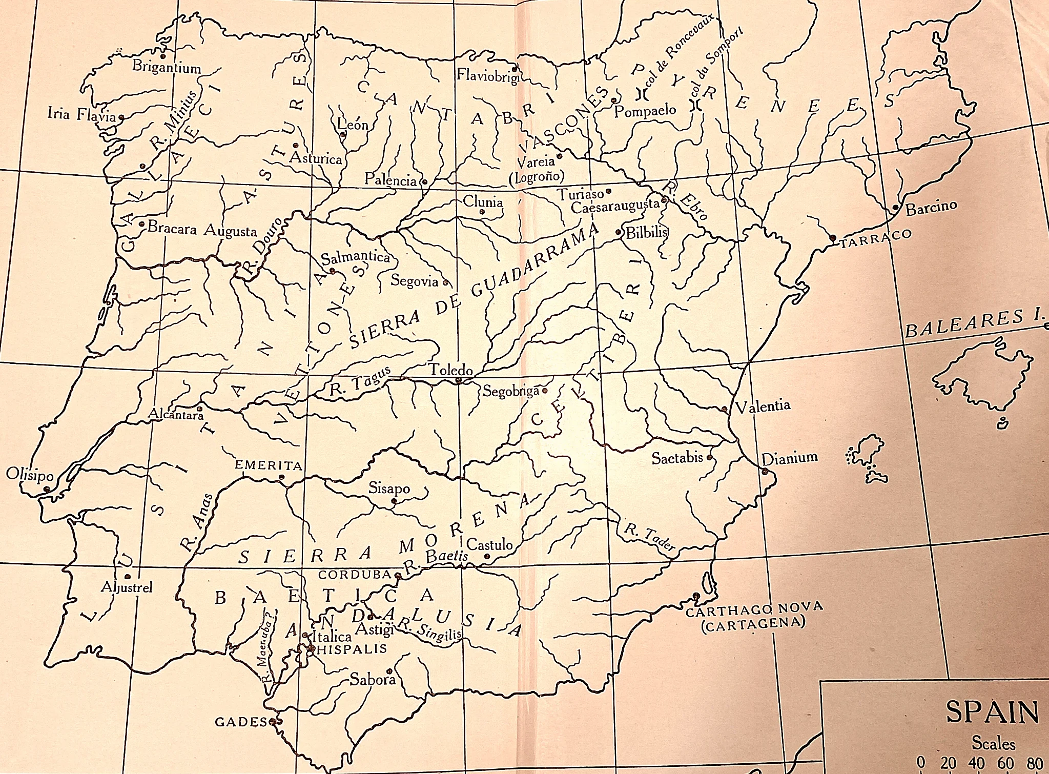
Imperial Spain: Baetica, Lusitania, Tarraconensis, with roads, mines and colonies.
 CAH plate
Contour plate of the lines of circumvallation, 48 B.C.
Try a different place, date, or period.