An atlas of peoples and languages · c. 3300 B.C.–A.D. 476
Peoples and tongues
From the first cities at Uruk to the last emperor in the west.
Who lived where, and what they probably spoke.
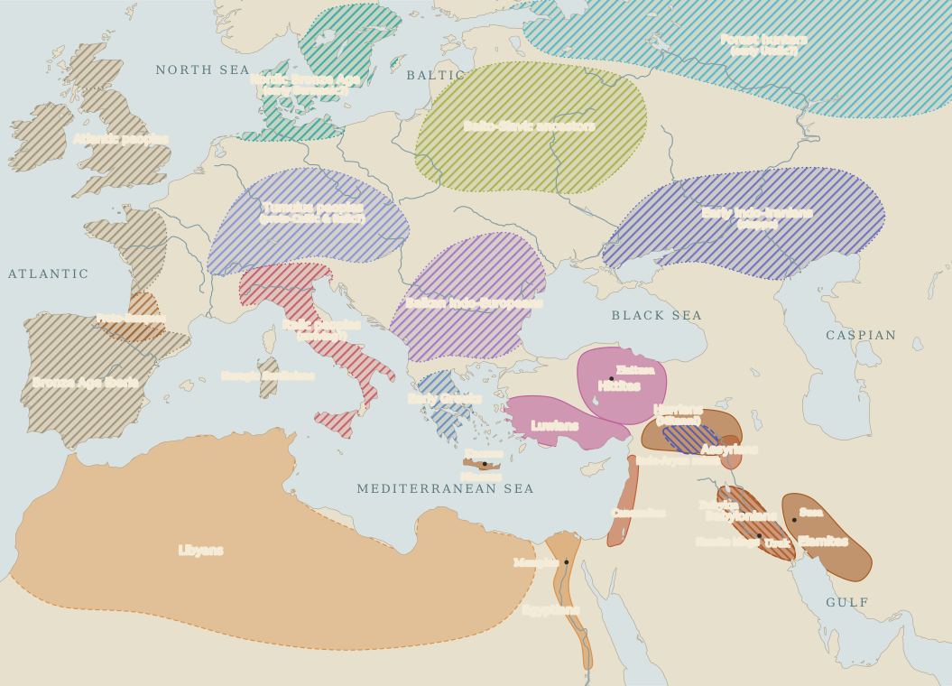
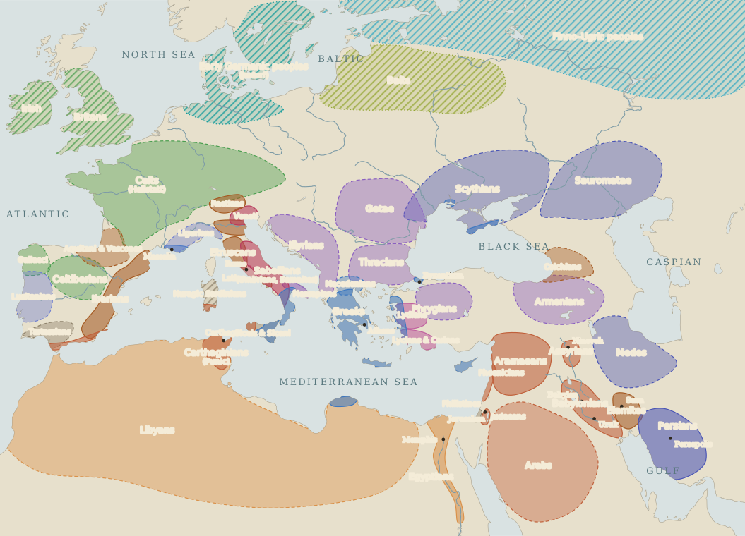
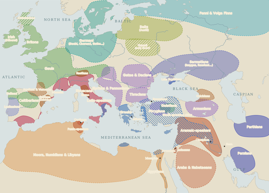
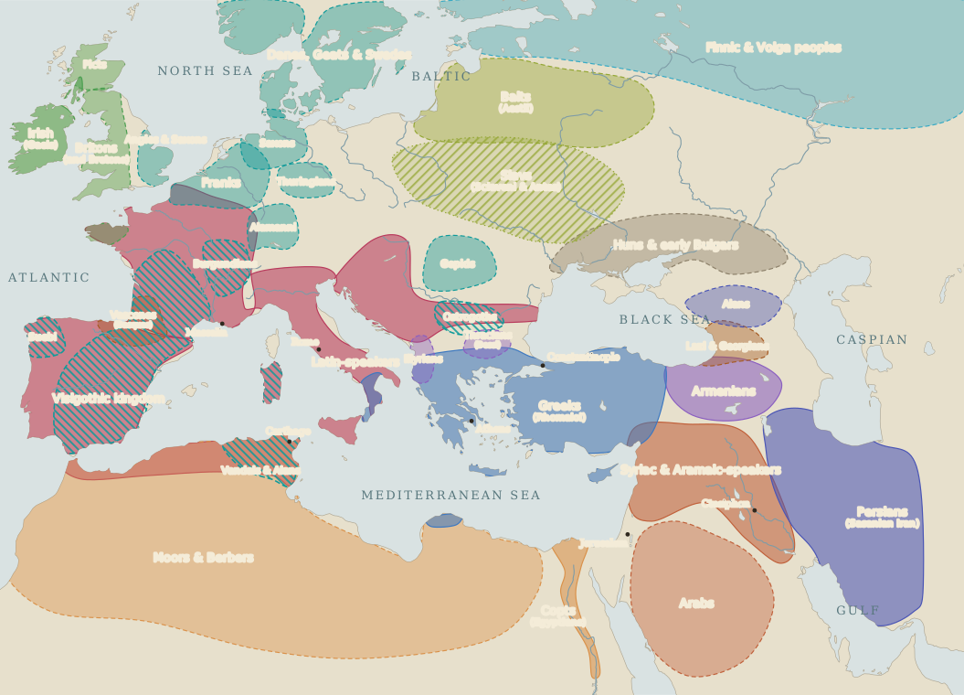
Loose areas drawn around each people’s heartland, not borders. Blank land means only that no people is named there. Select a family above to pick out its speakers.
How to read this map
Colour shows the language family, not ancestry. A people could change its language without moving: the Gauls became Latin-speakers in a few centuries, and most Assyrians ended by speaking Aramaic. Solid colour means the language survives in its own writing; pale colour with a dashed edge means neighbours, or Greek and Roman writers, named the people; hatching means the evidence is archaeological, and the language is a reasoned guess.
Fine diagonal hatching laid over another colour marks a ruling group: the Kassite kings of Babylon, the Greek courts of the Hellenistic east, the Gothic kings of the west. Their subjects went on speaking their own tongues.
Sources and the limits of this map
Every shape is an editorial approximation, drawn by hand around the core of a people’s settlement and clipped to modern coastlines. Frontiers were rarely lines; languages mixed in towns and valleys; many small peoples are left out. The dates fall roughly three hundred years apart, with A.D. 476 as the end point.
Before about 1500 B.C., most names north of the Mediterranean are modern labels for archaeological cultures. Linking such cultures with languages is still disputed, above all the question of where the Indo-European languages began. The steppe origin shown here is the most widely held view, not a settled fact.
Static plates: c. 1500 B.C. · c. 600 B.C. · c. A.D. 1 · A.D. 476.