An atlas of peoples and languages · A.D. 476–1870
Peoples and nations
From the last emperor in the west to the nation-states of 1870.
Who lived where, and what they had come to speak.
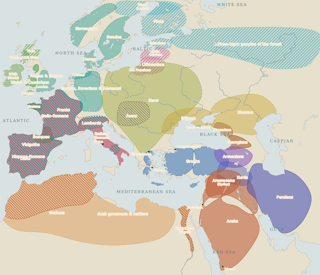
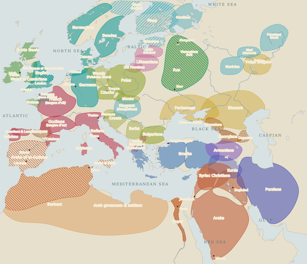
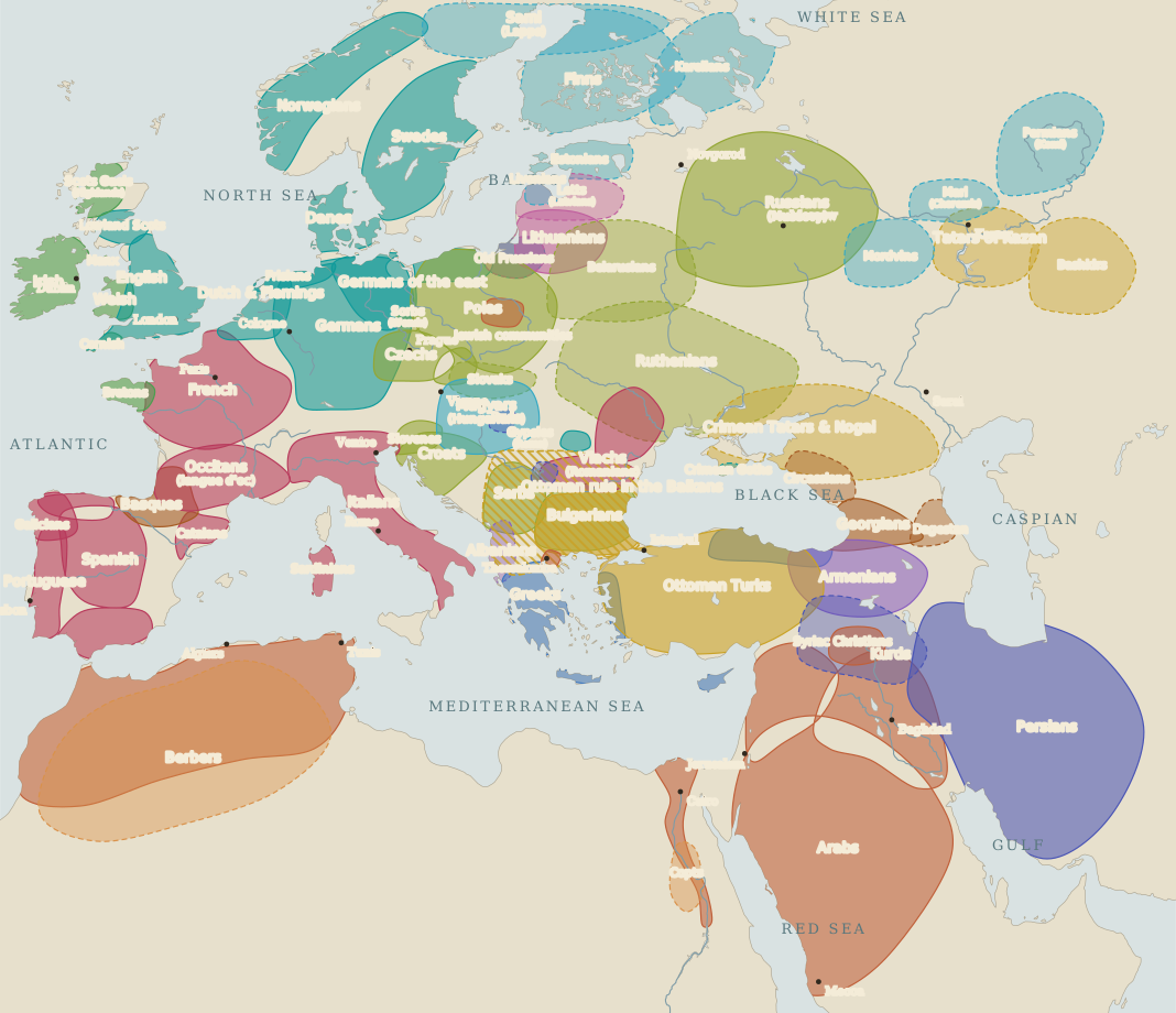
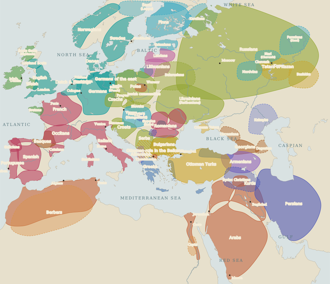
Loose areas drawn around each people’s heartland, not borders. Blank land means only that no people is named there. Select a family above to pick out its speakers.
How to read this map
This atlas begins where Peoples and tongues ends, on the day in A.D. 476 when Odoacer sent the western regalia to Constantinople, and it runs to 1870, the year Italy and Germany finished making themselves into states. Colour shows the language family, not ancestry. Almost every change on these fourteen maps happened to populations that largely stayed where they were: the Gauls had already become Latin-speakers, the Egyptians went over to Arabic, the Greeks of Anatolia to Turkish, and the Slavs of the Peloponnese back to Greek. Conquest moved the language far more often than it moved the people.
Fine diagonal hatching laid over another colour marks a ruling group speaking something other than its subjects: the Franks over Gallo-Romans, the Normans over the English, the Arab governors over Copts and Berbers, the Mongol khans over the Rus, the Ottoman askeri over the Balkans. Most such layers dissolved within a few generations — the Franks, the Normans and the Bulgars each ended by speaking the language of the people they had conquered.
Sources and the limits of this map
Every shape is an editorial approximation, drawn by hand around the core of a people’s settlement and clipped to modern coastlines. Frontiers were rarely lines; languages mixed in towns, valleys and market days; many small peoples are left out. The dates are unevenly spaced, close together where the map changes fastest — three times in the two centuries after 476, once a century thereafter.
The evidence improves as the atlas runs. In 476 the Slavs are an inference from archaeology and a few Greek notices; by 1500 nearly every people on the map has printed books in its own tongue, and the last two plates rest on census and philology rather than on chronicles. Where a shape is drawn pale and dashed — the early Slavs, the Vlachs, the steppe confederations — it means neighbours named the people but left little of its speech.
Three hard cases are drawn deliberately, not fudged. The Vlachs appear as a scatter because where Romanian survived between the Roman evacuation of Dacia and the twelfth century is genuinely unsettled. The Jewish communities are shown as small marks on towns rather than as territory, because they had none. And Crimean Gothic is shown surviving to 1600 on the strength of a single word-list taken down by an ambassador in the 1550s.
Static plates: c. A.D. 650 · c. 1000 · c. 1500 · 1870.